
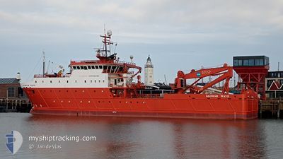
GLOMAR WAVE
Other Type D
Aktuelle Reise
SUBSEA OPS CPA 0.5 N
| Bisherige Reisezeit | 8 Tage |
|---|---|
| Verbleibende Reisezeit | --- |
| Zurückgelegte Distanz | 150.74 nm |
| Verbleibende Distanz | --- |
| Durchschnittliche Geschwindigkeit | 4.6 Knoten |
| Maximale Geschwindigkeit | 8.6 Knoten |
| Durchschnittliche Windgeschwindigkeit | 9.5 Knoten |
| Maximale Windgeschwindigkeit | 22 Knoten |
| Minimale Temperatur | 10.6°C / 51.08°F |
| Maximale Temperatur | 16.1°C / 60.98°F |
| Tiefgang | 5 m |
| Position erhalten | 1 m alt |
Aktuelle Position
| Länge | --- |
|---|---|
| Breite | --- |
| Zustand | Restricted manoeuverability |
| Geschwindigkeit | 0.1 Knoten |
| Kurs | 214° |
| Gebiet | North Sea |
| Station | T-AIS |
| Position erhalten | 1 m alt |
Schiffsdetails
Information
Die GLOMAR WAVE befindet sich derzeit in North Sea mit den Koordinaten 52.05043° / 1.59002°, Diese Position wurde am 2024-10-31 23:09 von unserer Schiffsverfolgungs-App über AIS erfasst. Das Schiff fährt momentan mit einer Geschwindigkeit von 0.1 Knoten
Das Schiff GLOMAR WAVE (IMO: 9682617, MMSI: 356301000) ist Other Type D und fährt unter der Flagge von [PA] Panama.
Auf dieser Seite erhalten Sie Informationen zur aktuellen Position des Schiffes, zu den letzten bekannten Hafenanläufen und zu den aktuellen Reiseinformationen. Sollte das Schiff nicht durch AIS abgedeckt sein, wird die zuletzt erfasste Position angezeigt.
Die GLOMAR WAVE wird durch unsere AIS-Empfänger ermittelt. Wir übernehmen keine Gewähr für die Richtigkeit der Daten. Die letzte Position wurde von unseren AIS-Empfängern aufgezeichnet, während das Schiff in Reichweite war.
Der aktuelle Entwurf von GLOMAR WAVE, wie von AIS gemeldet, betragt 5 meter
Wetter
| Temperatur | 12.5°C / 54.5°F |
|---|---|
| Windgeschwindigkeit | 6 Knoten |
| Windrichtung | 247° WSW |
| Luftdruck | 1024.7 hPa |
| Luftfeuchtigkeit | 87.2 % |
| Wolken | 5 % |
Featured Company
Letzte Hafenanläufe
| Hafen | Ankunft | Abfahrt | Time In Port |
|---|---|---|---|
| 2024-10-22 17:05 | 2024-10-23 13:15 | 20 h | |
| 2024-09-29 17:49 | 2024-10-01 11:18 | 1 d | |
| 2024-09-26 15:54 | 2024-09-27 22:28 | 1 d | |
| 2024-09-11 04:08 | 2024-09-11 10:32 | 6 h | |
| 2024-08-28 17:58 | 2024-08-29 20:08 | 1 d | |
| 2024-08-01 20:34 | 2024-08-02 19:12 | 22 h |
Meistbesuchte Häfen (Letztes Jahr)
| Hafen | Ankünfte | |
|---|---|---|
| 20 | ||
| 3 | ||
| 3 | ||
| 2 | ||
| 1 | ||
| 1 |
Letzte Reisen
| Herkunft | Abfahrt | Ziel | Ankunft | Distanz | |
|---|---|---|---|---|---|
| 2024-10-01 12:18 | 2024-10-22 18:05 | 439.28 nm | |||
| 2024-09-27 23:28 | 2024-09-29 18:49 | 89.25 nm | |||
| 2024-09-11 11:32 | 2024-09-26 16:54 | 406.26 nm | |||
| 2024-08-29 21:08 | 2024-09-11 05:08 | 318.18 nm | |||
| 2024-08-02 20:12 | 2024-08-28 18:58 | 435.04 nm | |||
| 2024-07-22 20:01 | 2024-08-01 21:34 | 255.24 nm |
Events
| Zeit | Ereignis | Details | Position / Ziel | Information |
|---|---|---|---|---|
| 2024-10-31 17:12 | STOP Bewegung | 12.02 nm, North East of FELIXSTOWE |
52.04978 / 1.58842
SUBSEA OPS CPA 0.5 N
|
Geschwindigkeit: 0.3 kn Kurs: 215° |
| 2024-10-31 16:59 | START Bewegung | 12.7 nm, North East of FELIXSTOWE |
52.05975 / 1.60060
SUBSEA OPS CPA 0.5 N
|
Geschwindigkeit: 3.7 kn Kurs: 218° |
| 2024-10-31 16:56 | STOP Bewegung | 12.8 nm, North East of FELIXSTOWE |
52.06115 / 1.60252
SUBSEA OPS CPA 0.5 N
|
Geschwindigkeit: 0.2 kn Kurs: 218° |
| 2024-10-31 16:45 | START Bewegung | 12.17 nm, North East of FELIXSTOWE |
52.05205 / 1.59112
SUBSEA OPS CPA 0.5 N
|
Geschwindigkeit: 3.6 kn Kurs: 211° |
| 2024-10-31 12:03 | STOP Bewegung | 12.07 nm, North East of FELIXSTOWE |
52.05072 / 1.58905
SUBSEA OPS CPA 0.5 N
|
Geschwindigkeit: 0.3 kn Kurs: 221° |
| 2024-10-31 11:53 | START Bewegung | 11.42 nm, North East of FELIXSTOWE |
52.04188 / 1.57663
SUBSEA OPS CPA 0.5 N
|
Geschwindigkeit: 4.3 kn Kurs: 207° |
| 2024-10-31 11:37 | STOP Bewegung | 11.32 nm, North East of FELIXSTOWE |
52.04055 / 1.57458
SUBSEA OPS CPA 0.5 N
|
Geschwindigkeit: 0.2 kn Kurs: 225° |
| 2024-10-31 11:31 | START Bewegung | 11.63 nm, North East of FELIXSTOWE |
52.04458 / 1.58070
SUBSEA OPS CPA 0.5 N
|
Geschwindigkeit: 3.6 kn Kurs: 218° |
| 2024-10-31 07:07 | STOP Bewegung | 11.72 nm, North East of FELIXSTOWE |
52.04622 / 1.58235
SUBSEA OPS CPA 0.5 N
|
Geschwindigkeit: 0.2 kn Kurs: 221° |
| 2024-10-31 07:02 | START Bewegung | 11.82 nm, North East of FELIXSTOWE |
52.04742 / 1.58428
SUBSEA OPS CPA 0.5 N
|
Geschwindigkeit: 3.1 kn Kurs: 243° |