
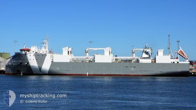
GLOUCESTER EXPRESS
Cargo
Current Trip
| Time Travelled | 3 days |
|---|---|
| Remaining Time | --- |
| Distance Travelled | 1282.63 nm |
| Remaining Distance | 2530.42 nm |
| AVG Speed | 14.1 Knots |
| MAX Speed | 18.4 Knots |
| AVG Wind | 19.9 knots |
| MAX Wind | 26 knots |
| MIN Temp | 20.9°C / 69.62°F |
| MAX Temp | 27.9°C / 82.22°F |
| Draught | 6.9 m |
| Position Received | 3 d ago |
Current Position
| Longitude | 145.73160° |
|---|---|
| Latitude | -16.59087° |
| Status | Under way using engine |
| Speed | 14.6 Knots |
| Course | 321.8° |
| Area | Coral Sea |
| Station | T-AIS |
| Position Received | 3 d ago |
Info
Information
The current position of GLOUCESTER EXPRESS is in Coral Sea with coordinates -16.59087° / 145.73160° as reported on 2024-05-26 00:01 by AIS to our vessel tracker app. The vessel's current speed is 14.6 Knots and is heading at the port of HAI PHONG. The estimated time of arrival as calculated by vessel tracking app is 2024-06-05 07:00 LT
The vessel GLOUCESTER EXPRESS (IMO: 9733765, MMSI: 255915565) is a Cargo It's sailing under the flag of [PT] Portugal.
In this page you can find informations about the vessels current position, last detected port calls, and current voyage information. If the vessels is not in coverage by AIS you will find the latest position.
The current position of GLOUCESTER EXPRESS is detected by our AIS receivers and we are not responsible for the reliability of the data. The last position was recorded while the vessel was in Coverage by the Ais receivers of our vessel tracking app.
The current draught of GLOUCESTER EXPRESS as reported by AIS is 6.9 meters
Weather
| Temperature | 27.9°C / 82.22°F |
|---|---|
| Wind Speed | 13 knots |
| Direction | 98° E |
| Pressure | 1010.6 hPa |
| Humidity | 83.3 % |
| Cloud Coverage | 14 % |
Featured Company
Last Port Calls
| Port | Arrival | Departure | Time In Port |
|---|---|---|---|
| 2024-05-24 20:57 | 2024-05-25 11:07 | 14 h | |
| 2024-05-16 02:11 | 2024-05-16 02:23 | 12 m | |
| 2024-05-15 05:39 | 2024-05-15 05:59 | 19 m | |
| 2024-05-09 19:19 | 2024-05-10 16:27 | 21 h | |
| 2024-05-02 22:51 | 2024-05-04 16:43 | 1 d | |
| 2024-04-23 19:55 | 2024-04-24 12:11 | 16 h | |
| 2024-04-12 02:49 | 2024-04-13 07:21 | 1 d | |
| 2024-04-06 20:56 | 2024-04-07 16:47 | 19 h | |
| 2024-04-01 20:46 | 2024-04-01 20:59 | 12 m | |
| 2024-03-31 22:44 | 2024-03-31 23:04 | 20 m |
Most Visited Ports (Last year)
| Port | Arrivals | |
|---|---|---|
| 6 | ||
| 4 | ||
| 3 | ||
| 2 | ||
| 2 | ||
| 2 |
Last Trips
| Origin | Departure | Destination | Arrival | Distance | |
|---|---|---|---|---|---|
| 2024-05-16 09:23 | 2024-05-25 06:57 | 2885.14 nm | |||
| 2024-05-15 12:59 | 2024-05-16 09:11 | 1.51 nm | |||
| 2024-05-11 01:57 | 2024-05-15 12:39 | 1613.37 nm | |||
| 2024-05-04 23:43 | 2024-05-10 04:49 | 1524.71 nm | |||
| 2024-04-24 22:11 | 2024-05-03 05:51 | 2784.30 nm | |||
| 2024-04-13 14:21 | 2024-04-24 05:55 | 2804.33 nm | |||
| 2024-04-08 02:17 | 2024-04-12 09:49 | 1517.93 nm | |||
| 2024-04-02 03:59 | 2024-04-07 06:26 | 1615.23 nm | |||
| 2024-04-01 06:04 | 2024-04-02 03:46 | 2.01 nm | |||
| 2024-03-23 22:07 | 2024-04-01 05:44 | 2874.37 nm |
Events
| Time | Event | Details | Position / Dest | Info |
|---|---|---|---|---|
| 2024-05-26 00:08 | Status Changed | Default Under way using engine |
-16.56854 / 145.71521
VN HPH
|
Speed: 14.6 kn Course: 321.8° |
| 2024-05-26 00:01 | Status Changed | Under way using engine Default |
-16.59087 / 145.73160
VN HPH
|
Speed: 14.6 kn Course: 322° |
| 2024-05-26 00:01 | OUT of Coverage |
-16.59087 / 145.73160
Coral Sea
VN HPH
|
Speed: 14.6 kn Course: 321.8° |
|
| 2024-05-26 00:00 | Status Changed | Default Under way using engine |
-16.59505 / 145.73498
VN HPH
|
Speed: 14.6 kn Course: 321.8° |
| 2024-05-25 19:25 | Status Changed | Under way using engine Default |
-17.46970 / 146.21023
VN HPH
|
Speed: 14.6 kn Course: 344° |
| 2024-05-25 19:04 | Status Changed | Default Under way using engine |
-17.55332 / 146.23636
VN HPH
|
Speed: 14.7 kn Course: 343° |
| 2024-05-25 18:53 | Status Changed | Under way using engine Default |
-17.59694 / 146.25051
VN HPH
|
Speed: 14.7 kn Course: 343° |
| 2024-05-25 18:43 | Status Changed | Default Under way using engine |
-17.63251 / 146.26189
VN HPH
|
Speed: 14.7 kn Course: 344.4° |
| 2024-05-25 18:36 | Status Changed | Under way using engine Default |
-17.66243 / 146.27140
VN HPH
|
Speed: 14.6 kn Course: 346° |
| 2024-05-25 18:20 | IN Coverage |
-17.66243 / 146.27140
Coral Sea
VN HPH
|
Speed: 14.7 kn Course: 344.4° |