
GLOVIS SAFETY
Cargo
Current Trip
| Time Travelled | 4 days |
|---|---|
| Remaining Time | --- |
| Distance Travelled | 2023.02 nm |
| Remaining Distance | --- |
| AVG Speed | 18 Knots |
| MAX Speed | 20.8 Knots |
| AVG Wind | 10 knots |
| MAX Wind | 17.3 knots |
| MIN Temp | 22.2°C / 71.96°F |
| MAX Temp | 30°C / 86°F |
| Draught | 9.3 m |
| Position Received | 4 d ago |
Current Position
| Longitude | 128.84676° |
|---|---|
| Latitude | 34.79662° |
| Status | Under way using engine |
| Speed | 17.1 Knots |
| Course | 178.5° |
| Area | Japan Sea |
| Station | T-AIS |
| Position Received | 4 d ago |
Info
Information
The current position of GLOVIS SAFETY is in Japan Sea with coordinates 34.79662° / 128.84676° as reported on 2024-06-16 01:01 by AIS to our vessel tracker app. The vessel's current speed is 17.1 Knots and is heading at the port of BRISBANE. The estimated time of arrival as calculated by vessel tracking app is 2024-06-25 19:00 LT
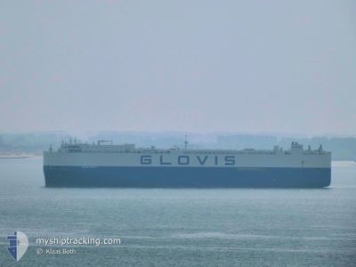
The vessel GLOVIS SAFETY (IMO: 9798399, MMSI: 538007438) is a Cargo It's sailing under the flag of [MH] Marshall Is.
In this page you can find informations about the vessels current position, last detected port calls, and current voyage information. If the vessels is not in coverage by AIS you will find the latest position.
The current position of GLOVIS SAFETY is detected by our AIS receivers and we are not responsible for the reliability of the data. The last position was recorded while the vessel was in Coverage by the Ais receivers of our vessel tracking app.
The current draught of GLOVIS SAFETY as reported by AIS is 9.3 meters
Weather
| Temperature | 28.7°C / 83.66°F |
|---|---|
| Wind Speed | 5 knots |
| Direction | 70° ENE |
| Pressure | 1009.7 hPa |
| Humidity | 73.5 % |
| Cloud Coverage | 100 % |
Featured Company
Last Port Calls
| Port | Arrival | Departure | Time In Port |
|---|---|---|---|
| 2024-06-14 21:31 | 2024-06-15 23:11 | 1 d | |
| 2024-06-14 02:48 | 2024-06-14 14:41 | 11 h | |
| 2024-06-10 02:56 | 2024-06-12 11:34 | 2 d | |
| 2024-06-07 21:37 | 2024-06-09 00:57 | 1 d | |
| 2024-04-29 05:00 | 2024-04-29 16:18 | 11 h | |
| 2024-04-24 03:32 | 2024-04-26 23:08 | 2 d | |
| 2024-04-21 16:24 | 2024-04-23 03:51 | 1 d | |
| 2024-04-19 06:30 | 2024-04-20 10:56 | 1 d | |
| 2024-04-19 05:27 | 2024-04-19 06:22 | 54 m | |
| 2024-04-16 20:28 | 2024-04-18 20:35 | 2 d |
Most Visited Ports (Last year)
| Port | Arrivals | |
|---|---|---|
| 6 | ||
| 5 | ||
| 4 | ||
| 3 | ||
| 3 | ||
| 3 |
Last Trips
| Origin | Departure | Destination | Arrival | Distance | |
|---|---|---|---|---|---|
| 2024-06-14 23:41 | 2024-06-15 06:31 | 82.17 nm | |||
| 2024-06-12 20:34 | 2024-06-14 11:48 | 560.80 nm | |||
| 2024-06-09 08:57 | 2024-06-10 11:56 | 451.45 nm | |||
| 2024-04-29 17:18 | 2024-06-08 05:37 | 14681.16 nm | |||
| 2024-04-27 01:08 | 2024-04-29 06:00 | 538.41 nm | |||
| 2024-04-23 04:51 | 2024-04-24 05:32 | 337.33 nm | |||
| 2024-04-20 12:56 | 2024-04-21 17:24 | 256.73 nm | |||
| 2024-04-19 08:22 | 2024-04-19 08:30 | 0.33 nm | |||
| 2024-04-18 22:35 | 2024-04-19 07:27 | 119.45 nm | |||
| 2024-04-16 06:36 | 2024-04-16 22:28 | 181.45 nm |
Events
| Time | Event | Details | Position / Dest | Info |
|---|---|---|---|---|
| 2024-06-16 01:08 | Status Changed | Default Under way using engine |
34.76143 / 128.84737
AUBNE
|
Speed: 17.1 kn Course: 178.5° |
| 2024-06-16 01:01 | OUT of Coverage |
34.79662 / 128.84676
Japan Sea
AUBNE
|
Speed: 17.1 kn Course: 178.5° |
|
| 2024-06-16 00:58 | Status Changed | Under way using engine Default |
34.80986 / 128.84646
AUBNE
|
Speed: 16.5 kn Course: 181° |
| 2024-06-16 00:56 | Status Changed | Default Under way using engine |
34.82102 / 128.84616
AUBNE
|
Speed: 16.8 kn Course: 180.6° |
| 2024-06-16 00:28 | Destination Changed | AUBNE KR MAS |
34.94408 / 128.82067
AUBNE
|
Speed: 16.5 kn Course: 146.7° |
| 2024-06-16 00:28 | ETA Changed | 2024/06/25 19:00 2024/06/14 20:00 |
34.94408 / 128.82067
AUBNE
|
Speed: 16.5 kn Course: 146.7° |
| 2024-06-16 00:13 | Status Changed | Under way using engine Default |
35.00693 / 128.79190
KR MAS
|
Speed: 8.2 kn Course: 120° |
| 2024-06-16 00:03 | IN Coverage |
35.00512 / 128.79265
Japan Sea
|
Speed: 14.8 kn Course: 161.1° |
|
| 2024-06-15 23:19 | START Moving | 3.07 nm, South of MASAN |
35.14027 / 128.60216
KR MAS
|
Speed: 15.6 kn Course: 167° |
| 2024-06-15 23:11 | PORT DEPARTURE |
|
35.14027 / 128.60216
KR MAS
|
Speed: 1.1 kn Course: 154° |