
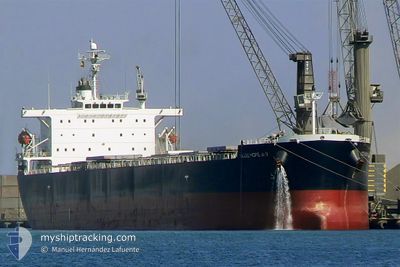
GOOD HOPE MAX
Bulk Carrier
Current Trip
| Time Travelled | 23 days |
|---|---|
| Remaining Time | 1 day |
| Distance Travelled | 5561.39 nm |
| Remaining Distance | 536.48 nm |
| AVG Speed | 10 Knots |
| MAX Speed | 10 Knots |
| AVG Wind | 14.9 knots |
| MAX Wind | 29.5 knots |
| MIN Temp | 13.7°C / 56.66°F |
| MAX Temp | 24.6°C / 76.28°F |
| Draught | 9.1 m |
| Position Received | 7 d ago |
Current Position
| Longitude | -26.54957° |
|---|---|
| Latitude | 36.26119° |
| Status | Under way using engine |
| Speed | 11.7 Knots |
| Course | 269.7° |
| Area | North Atlantic Ocean |
| Station | T-AIS |
| Position Received | 7 d ago |
Info
Information
The current position of GOOD HOPE MAX is in North Atlantic Ocean with coordinates 36.26119° / -26.54957° as reported on 2024-05-21 10:01 by AIS to our vessel tracker app. The vessel's current speed is 11.7 Knots and is heading at the port of BALTIMORE. The estimated time of arrival as calculated by vessel tracking app is 2024-05-30 17:38 LT
The vessel GOOD HOPE MAX (IMO: 9304241, MMSI: 232752000) is a Bulk Carrier that was built in 2005 ( 19 years old ). It's sailing under the flag of [GB] United Kingdom.
In this page you can find informations about the vessels current position, last detected port calls, and current voyage information. If the vessels is not in coverage by AIS you will find the latest position.
The current position of GOOD HOPE MAX is detected by our AIS receivers and we are not responsible for the reliability of the data. The last position was recorded while the vessel was in Coverage by the Ais receivers of our vessel tracking app.
The current draught of GOOD HOPE MAX as reported by AIS is 9.1 meters
Weather
| Temperature | 23.8°C / 74.84°F |
|---|---|
| Wind Speed | 18 knots |
| Direction | 249° WSW |
| Pressure | 1013.7 hPa |
| Humidity | 83.8 % |
| Cloud Coverage | 100 % |
Featured Company
Last Port Calls
| Port | Arrival | Departure | Time In Port |
|---|---|---|---|
| 2024-05-01 23:18 | 2024-05-05 15:57 | 3 d | |
| 2024-03-24 16:27 |
Last Trips
| Origin | Departure | Destination | Arrival | Distance | |
|---|---|---|---|---|---|
| 2024-03-24 12:27 | 2024-05-02 02:18 | 4372.83 nm |
Events
| Time | Event | Details | Position / Dest | Info |
|---|---|---|---|---|
| 2024-05-21 10:03 | Status Changed | Default Under way using engine |
36.26116 / -26.55691
BALTIMORE
|
Speed: 11.7 kn Course: 269.7° |
| 2024-05-21 10:01 | Status Changed | Under way using engine Default |
36.26119 / -26.54957
BALTIMORE
|
Speed: 11.6 kn Course: 272° |
| 2024-05-21 10:01 | OUT of Coverage |
36.26119 / -26.54957
North Atlantic Ocean
BALTIMORE
|
Speed: 11.7 kn Course: 269.7° |
|
| 2024-05-21 09:57 | Status Changed | Default Under way using engine |
36.26116 / -26.53226
BALTIMORE
|
Speed: 11.7 kn Course: 270.9° |
| 2024-05-21 09:37 | Status Changed | Under way using engine Default |
36.26101 / -26.45310
BALTIMORE
|
Speed: 11.7 kn Course: 271° |
| 2024-05-21 09:29 | IN Coverage |
36.26101 / -26.45310
North Atlantic Ocean
BALTIMORE
|
Speed: 11.7 kn Course: 271.2° |
|
| 2024-05-21 07:09 | Status Changed | Default Under way using engine |
36.25648 / -25.86074
BALTIMORE
|
Speed: 11.5 kn Course: 274.2° |
| 2024-05-21 06:58 | OUT of Coverage |
36.25423 / -25.81648
North Atlantic Ocean
BALTIMORE
|
Speed: 11.5 kn Course: 274.2° |
|
| 2024-05-21 01:14 | Draught Changed | 9.1 7.3 |
36.21960 / -24.44399
BALTIMORE
|
Speed: 11.1 kn Course: 270.2° |
| 2024-05-21 01:14 | ETA Changed | 2024/05/30 06:00 2024/05/30 12:00 |
36.21960 / -24.44399
BALTIMORE
|
Speed: 11.1 kn Course: 270.2° |