
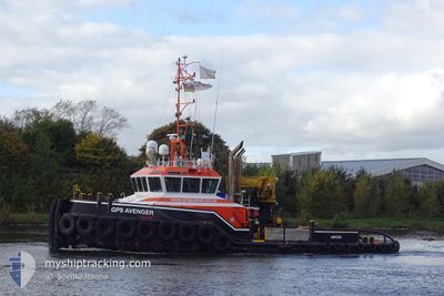
GPS AVENGER
Tug
Current Trip
SWALECLIFF
| Time Travelled | 2 days |
|---|---|
| Remaining Time | --- |
| Distance Travelled | 19.31 nm |
| Remaining Distance | --- |
| AVG Speed | 5.6 Knots |
| MAX Speed | 8.2 Knots |
| AVG Wind | 10.2 knots |
| MAX Wind | 18 knots |
| MIN Temp | 13.7°C / 56.66°F |
| MAX Temp | 18.6°C / 65.48°F |
| Draught | 3 m |
| Position Received | Now |
Current Position
| Longitude | 1.06540° |
|---|---|
| Latitude | 51.37546° |
| Status | Restricted manoeuverability |
| Speed | |
| Course | 95° |
| Area | North Sea |
| Station | T-AIS |
| Position Received | Now |
Info
Information
The current position of GPS AVENGER is in North Sea with coordinates 51.37546° / 1.06540° as reported on 2024-06-18 12:47 by AIS to our vessel tracker app. The vessel's current speed is 0 Knots
The vessel GPS AVENGER (IMO: 9681675, MMSI: 210222000) is a Tug that was built in 2013 ( 11 years old ). It's sailing under the flag of [CY] Cyprus.
In this page you can find informations about the vessels current position, last detected port calls, and current voyage information. If the vessels is not in coverage by AIS you will find the latest position.
The current position of GPS AVENGER is detected by our AIS receivers and we are not responsible for the reliability of the data. The last position was recorded while the vessel was in Coverage by the Ais receivers of our vessel tracking app.
The current draught of GPS AVENGER as reported by AIS is 3 meters
Weather
| Temperature | 15.4°C / 59.72°F |
|---|---|
| Wind Speed | 9 knots |
| Direction | 62° ENE |
| Pressure | 1013.8 hPa |
| Humidity | 84.2 % |
| Cloud Coverage | 100 % |
Featured Company
Last Port Calls
| Port | Arrival | Departure | Time In Port |
|---|---|---|---|
| 2024-06-14 06:25 | 2024-06-16 07:02 | 2 d | |
| 2024-06-07 11:27 | 2024-06-07 12:14 | 46 m | |
| 2024-05-31 18:32 | 2024-06-01 16:30 | 21 h | |
| 2024-05-29 15:09 | 2024-05-29 15:44 | 34 m | |
| 2024-05-23 10:39 | 2024-05-25 16:14 | 2 d | |
| 2024-05-22 10:28 | 2024-05-23 09:11 | 22 h | |
| 2024-05-11 12:54 | 2024-05-14 06:43 | 2 d | |
| 2024-05-09 06:29 | 2024-05-10 06:15 | 23 h | |
| 2024-05-07 08:39 | 2024-05-09 04:13 | 1 d | |
| 2024-05-06 14:36 | 2024-05-06 14:45 | 9 m |
Most Visited Ports (Last year)
| Port | Arrivals | |
|---|---|---|
| 77 | ||
| 49 | ||
| 44 | ||
| 33 | ||
| 11 | ||
| 8 |
Last Trips
| Origin | Departure | Destination | Arrival | Distance | |
|---|---|---|---|---|---|
| 2024-06-07 13:14 | 2024-06-14 07:25 | 65.72 nm | |||
| 2024-06-01 17:30 | 2024-06-07 12:27 | 56.33 nm | |||
| 2024-05-29 16:44 | 2024-05-31 19:32 | 29.36 nm | |||
| 2024-05-25 17:14 | 2024-05-29 16:09 | 38.45 nm | |||
| 2024-05-23 10:11 | 2024-05-23 11:39 | 10.30 nm | |||
| 2024-05-14 07:43 | 2024-05-22 11:28 | 94.82 nm | |||
| 2024-05-10 08:15 | 2024-05-11 13:54 | 168.95 nm | |||
| 2024-05-09 06:13 | 2024-05-09 08:29 | 21.93 nm | |||
| 2024-05-06 15:45 | 2024-05-07 10:39 | 147.62 nm | |||
| 2024-05-06 12:57 | 2024-05-06 15:36 | 18.56 nm |
Events
| Time | Event | Details | Position / Dest | Info |
|---|---|---|---|---|
| 2024-06-18 10:46 | STOP Moving | 1.66 nm, North East of WHITSTABLE |
51.37561 / 1.06543
SWALECLIFF
|
Speed: 0.3 kn Course: 103° |
| 2024-06-18 10:44 | START Moving | 1.66 nm, North East of WHITSTABLE |
51.37634 / 1.06458
SWALECLIFF
|
Speed: 3.5 kn Course: 323° |
| 2024-06-18 10:07 | STOP Moving | 1.56 nm, North East of WHITSTABLE |
51.37631 / 1.06164
SWALECLIFF
|
Speed: 0.3 kn Course: 285° |
| 2024-06-18 10:04 | START Moving | 1.61 nm, North East of WHITSTABLE |
51.37629 / 1.06323
SWALECLIFF
|
Speed: 3.1 kn Course: 260° |
| 2024-06-18 08:31 | STOP Moving | 1.54 nm, North East of WHITSTABLE |
51.37388 / 1.06291
SWALECLIFF
|
Speed: 0.3 kn Course: 20° |
| 2024-06-18 08:27 | START Moving | 1.47 nm, East of WHITSTABLE |
51.37275 / 1.06181
SWALECLIFF
|
Speed: 3.7 kn Course: 356° |
| 2024-06-18 07:12 | STOP Moving | 1.56 nm, East of WHITSTABLE |
51.37212 / 1.06450
SWALECLIFF
|
Speed: 0.3 kn Course: 95° |
| 2024-06-18 07:11 | START Moving | 1.56 nm, East of WHITSTABLE |
51.37241 / 1.06441
SWALECLIFF
|
Speed: 3.7 kn Course: 172° |
| 2024-06-18 07:01 | STOP Moving | 1.58 nm, North East of WHITSTABLE |
51.37431 / 1.06393
SWALECLIFF
|
Speed: 0.3 kn Course: 107° |
| 2024-06-18 06:39 | START Moving | 1.69 nm, North East of WHITSTABLE |
51.37737 / 1.06476
SWALECLIFF
|
Speed: 6.7 kn Course: 0.7° |