
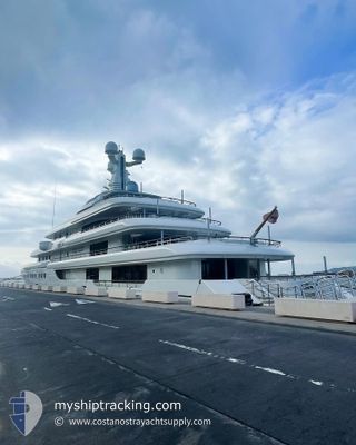
GRACE
Yacht
Current Trip
| Time Travelled | 27 days |
|---|---|
| Remaining Time | 17 mins |
| Distance Travelled | 774.06 nm |
| Remaining Distance | 35.34 nm |
| AVG Speed | 11.2 Knots |
| MAX Speed | 15.2 Knots |
| AVG Wind | 7.3 knots |
| MAX Wind | 18 knots |
| MIN Temp | 16.2°C / 61.16°F |
| MAX Temp | 26.2°C / 79.16°F |
| Draught | 3.5 m |
| Position Received | 2 h, 29 m ago |
Current Position
| Longitude | 21.28399° |
|---|---|
| Latitude | 37.37416° |
| Status | Under way using engine |
| Speed | 12.5 Knots |
| Course | 151.5° |
| Area | Ionian Sea |
| Station | T-AIS |
| Position Received | 2 h, 29 m ago |
Info
Information
The current position of GRACE is in Ionian Sea with coordinates 37.37416° / 21.28399° as reported on 2024-06-16 02:07 by AIS to our vessel tracker app. The vessel's current speed is 12.5 Knots and is heading at the port of PYLOS. The estimated time of arrival as calculated by vessel tracking app is 2024-06-16 04:54 LT
The vessel GRACE (IMO: 1012294, MMSI: 319061600) is a Yacht that was built in 2014 ( 10 years old ). It's sailing under the flag of [KY] Cayman Is.
In this page you can find informations about the vessels current position, last detected port calls, and current voyage information. If the vessels is not in coverage by AIS you will find the latest position.
The current position of GRACE is detected by our AIS receivers and we are not responsible for the reliability of the data. The last position was recorded while the vessel was in Coverage by the Ais receivers of our vessel tracking app.
The current draught of GRACE as reported by AIS is 3.5 meters
Weather
| Temperature | 22.3°C / 72.14°F |
|---|---|
| Wind Speed | 9 knots |
| Direction | 343° NNW |
| Pressure | 1011.2 hPa |
| Humidity | 70.2 % |
| Cloud Coverage | 6 % |
Featured Company
Events
| Time | Event | Details | Position / Dest | Info |
|---|---|---|---|---|
| 2024-06-16 02:07 | OUT of Coverage |
37.37416 / 21.28399
Ionian Sea
PYLOS
|
Speed: 12.5 kn Course: 151.5° |
|
| 2024-06-15 21:26 | Destination Changed | PYLOS KAFELONIA |
38.27038 / 20.71833
PYLOS
|
Speed: 12.9 kn Course: 143.2° |
| 2024-06-15 21:26 | ETA Changed | 2024/06/16 08:00 2024/06/15 15:00 |
38.27038 / 20.71833
PYLOS
|
Speed: 12.9 kn Course: 143.2° |
| 2024-06-15 20:31 | IN Coverage |
38.43840 / 20.60977
Ionian Sea
|
Speed: 11.5 kn Course: 149.6° |
|
| 2024-06-15 12:59 | OUT of Coverage |
38.43258 / 20.61473
Ionian Sea
KAFELONIA
|
Speed: 11.1 kn Course: 330.8° |
|
| 2024-06-15 11:47 | START Moving | 3.47 nm, East of SAMI |
38.23511 / 20.71580
KAFELONIA
|
Speed: 4.6 kn Course: 24° |
| 2024-06-15 11:34 | Status Changed | Under way using engine At anchor |
38.23310 / 20.71468
KAFELONIA
|
Speed: 0.2 kn Course: 318° |
| 2024-06-15 07:35 | Status Changed | At anchor Under way using engine |
38.23291 / 20.71469
KAFELONIA
|
Speed: 0.3 kn Course: 19° |
| 2024-06-15 07:26 | STOP Moving | 3.41 nm, East of SAMI |
38.23413 / 20.71386
KAFELONIA
|
Speed: 0.3 kn Course: 356° |
| 2024-06-15 07:12 | Destination Changed | KAFELONIA CORFU |
38.24696 / 20.71971
KAFELONIA
|
Speed: 11.7 kn Course: 159.5° |