
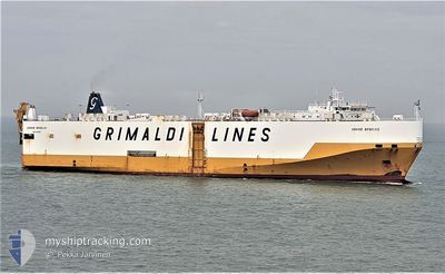
GRAND BENELUX
Vehicles Carrier
Current Trip
| Time Travelled | 1 day |
|---|---|
| Remaining Time | 7 h, 0 mins |
| Distance Travelled | 740.89 nm |
| Remaining Distance | 231.40 nm |
| AVG Speed | 17.3 Knots |
| MAX Speed | 18.1 Knots |
| AVG Wind | 5 knots |
| MAX Wind | 14.3 knots |
| MIN Temp | 19.5°C / 67.1°F |
| MAX Temp | 22.3°C / 72.14°F |
| Draught | 8.3 m |
| Position Received | 6 h, 4 m ago |
Current Position
| Longitude | 20.85480° |
|---|---|
| Latitude | 37.27469° |
| Status | Under way using engine |
| Speed | 17.6 Knots |
| Course | 150.8° |
| Area | Ionian Sea |
| Station | T-AIS |
| Position Received | 6 h, 4 m ago |
Info
Information
The current position of GRAND BENELUX is in Ionian Sea with coordinates 37.27469° / 20.85480° as reported on 2024-05-29 03:55 by AIS to our vessel tracker app. The vessel's current speed is 17.6 Knots and is heading at the port of PIRAEUS. The estimated time of arrival as calculated by vessel tracking app is 2024-05-29 16:59 LT
The vessel GRAND BENELUX (IMO: 9227900, MMSI: 247039400) is a Vehicles Carrier that was built in 2001 ( 23 years old ). It's sailing under the flag of [IT] Italy.
In this page you can find informations about the vessels current position, last detected port calls, and current voyage information. If the vessels is not in coverage by AIS you will find the latest position.
The current position of GRAND BENELUX is detected by our AIS receivers and we are not responsible for the reliability of the data. The last position was recorded while the vessel was in Coverage by the Ais receivers of our vessel tracking app.
The current draught of GRAND BENELUX as reported by AIS is 8.3 meters
Weather
| Temperature | 20°C / 68°F |
|---|---|
| Wind Speed | 15 knots |
| Direction | 272° W |
| Pressure | 1014 hPa |
| Humidity | 81.9 % |
| Cloud Coverage | --- |
Featured Company
Last Port Calls
| Port | Arrival | Departure | Time In Port |
|---|---|---|---|
| 2024-05-25 21:44 | 2024-05-27 15:30 | 1 d | |
| 2024-05-24 04:17 | 2024-05-25 18:01 | 1 d | |
| 2024-05-20 03:15 | 2024-05-20 19:08 | 15 h | |
| 2024-05-17 21:44 | 2024-05-18 21:29 | 23 h | |
| 2024-05-17 15:55 | 2024-05-17 21:17 | 5 h | |
| 2024-05-14 06:21 | 2024-05-15 10:41 | 1 d | |
| 2024-05-12 14:36 | 2024-05-12 18:46 | 4 h | |
| 2024-05-08 04:40 | 2024-05-09 10:53 | 1 d | |
| 2024-05-07 02:24 | 2024-05-07 22:54 | 20 h | |
| 2024-05-03 02:42 | 2024-05-03 19:00 | 16 h |
Most Visited Ports (Last year)
| Port | Arrivals | |
|---|---|---|
| 20 | ||
| 20 | ||
| 17 | ||
| 16 | ||
| 12 | ||
| 8 |
Last Trips
| Origin | Departure | Destination | Arrival | Distance | |
|---|---|---|---|---|---|
| 2024-05-25 20:01 | 2024-05-25 23:44 | 19.07 nm | |||
| 2024-05-20 22:08 | 2024-05-24 06:17 | 1189.93 nm | |||
| 2024-05-19 00:29 | 2024-05-20 06:15 | 83.99 nm | |||
| 2024-05-18 00:17 | 2024-05-18 00:44 | 1.83 nm | |||
| 2024-05-15 13:41 | 2024-05-17 18:55 | 912.93 nm | |||
| 2024-05-12 21:46 | 2024-05-14 09:21 | 199.85 nm | |||
| 2024-05-09 12:53 | 2024-05-12 17:36 | 1295.38 nm | |||
| 2024-05-08 00:54 | 2024-05-08 06:40 | 16.36 nm | |||
| 2024-05-03 22:00 | 2024-05-07 04:24 | 1191.96 nm | |||
| 2024-05-02 23:16 | 2024-05-03 05:42 | 77.99 nm |
Events
| Time | Event | Details | Position / Dest | Info |
|---|---|---|---|---|
| 2024-05-29 04:05 | Status Changed | Default Under way using engine |
37.23167 / 20.88333
GRPIR
|
Speed: 17.6 kn Course: 150.8° |
| 2024-05-29 03:55 | OUT of Coverage |
37.27469 / 20.85480
Ionian Sea
GRPIR
|
Speed: 17.6 kn Course: 150.8° |
|
| 2024-05-28 21:32 | Change Sea Area | Greek part of the Ionian Sea Italian part of the Adriatic Sea |
38.88817 / 19.62357
Ionian Sea
GRPIR
|
Speed: 17.4 kn Course: 150° |
| 2024-05-28 21:32 | Status Changed | Under way using engine Default |
38.88817 / 19.62357
GRPIR
|
Speed: 17 kn Course: 150° |
| 2024-05-28 21:32 | IN Coverage |
38.88817 / 19.62357
Ionian Sea
GRPIR
|
Speed: 17.4 kn Course: 150° |
|
| 2024-05-28 17:27 | Status Changed | Default Under way using engine |
39.93076 / 18.85322
GRPIR
|
Speed: 17.9 kn Course: 150.9° |
| 2024-05-28 17:20 | Status Changed | Under way using engine Default |
39.95778 / 18.83367
GRPIR
|
Speed: 17.9 kn Course: 151° |
| 2024-05-28 17:20 | OUT of Coverage |
39.95778 / 18.83367
Adriatic Sea
GRPIR
|
Speed: 17.9 kn Course: 150.9° |
|
| 2024-05-28 17:14 | Status Changed | Default Under way using engine |
39.98746 / 18.81220
GRPIR
|
Speed: 17.8 kn Course: 150.6° |
| 2024-05-28 14:17 | Status Changed | Under way using engine Default |
40.71612 / 18.17930
GRPIR
|
Speed: 17.7 kn Course: 129° |