
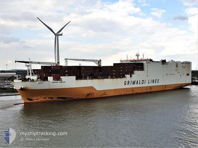
GRANDE ABIDJAN
Cargo
Current Trip
| Time Travelled | 7 days |
|---|---|
| Remaining Time | --- |
| Distance Travelled | 2596.99 nm |
| Remaining Distance | --- |
| AVG Speed | 14.9 Knots |
| MAX Speed | 20.3 Knots |
| AVG Wind | 8.7 knots |
| MAX Wind | 15 knots |
| MIN Temp | 19.7°C / 67.46°F |
| MAX Temp | 25.1°C / 77.18°F |
| Draught | 9.5 m |
| Position Received | 5 d ago |
Current Position
| Longitude | -74.45819° |
|---|---|
| Latitude | 38.30875° |
| Status | Under way using engine |
| Speed | 16.7 Knots |
| Course | 120.8° |
| Area | North Atlantic Ocean |
| Station | T-AIS |
| Position Received | 5 d ago |
Info
Information
The current position of GRANDE ABIDJAN is in North Atlantic Ocean with coordinates 38.30875° / -74.45819° as reported on 2024-06-21 07:58 by AIS to our vessel tracker app. The vessel's current speed is 16.7 Knots and is heading at the port of DAKAR. The estimated time of arrival as calculated by vessel tracking app is 2024-06-29 17:00 LT
The vessel GRANDE ABIDJAN (IMO: 9680712, MMSI: 247341700) is a Cargo It's sailing under the flag of [IT] Italy.
In this page you can find informations about the vessels current position, last detected port calls, and current voyage information. If the vessels is not in coverage by AIS you will find the latest position.
The current position of GRANDE ABIDJAN is detected by our AIS receivers and we are not responsible for the reliability of the data. The last position was recorded while the vessel was in Coverage by the Ais receivers of our vessel tracking app.
The current draught of GRANDE ABIDJAN as reported by AIS is 9.5 meters
Weather
| Temperature | 24.2°C / 75.56°F |
|---|---|
| Wind Speed | 12 knots |
| Direction | 77° ENE |
| Pressure | 1022.1 hPa |
| Humidity | 74.6 % |
| Cloud Coverage | 100 % |
Featured Company
Last Port Calls
| Port | Arrival | Departure | Time In Port |
|---|---|---|---|
| 2024-06-18 09:43 | 2024-06-19 01:18 | 15 h | |
| 2024-06-16 04:09 | 2024-06-17 00:04 | 19 h | |
| 2024-06-12 21:12 | 2024-06-15 00:52 | 2 d | |
| 2024-06-12 00:54 | 2024-06-12 20:49 | 19 h | |
| 2024-06-03 09:34 | 2024-06-04 01:34 | 15 h | |
| 2024-05-30 05:24 | 2024-06-01 05:52 | 2 d | |
| 2024-05-27 18:55 | 2024-05-28 16:30 | 21 h | |
| 2024-05-14 07:33 | 2024-05-15 01:33 | 18 h | |
| 2024-05-10 03:22 | 2024-05-10 14:17 | 10 h | |
| 2024-05-07 08:25 | 2024-05-09 00:16 | 1 d |
Last Trips
| Origin | Departure | Destination | Arrival | Distance | |
|---|---|---|---|---|---|
| 2024-06-16 20:04 | 2024-06-18 05:43 | 254.03 nm | |||
| 2024-06-14 20:52 | 2024-06-16 00:09 | 434.17 nm | |||
| 2024-06-12 16:49 | 2024-06-12 17:12 | 0.71 nm | |||
| 2024-06-03 20:34 | 2024-06-11 20:54 | 2143.86 nm | |||
| 2024-06-01 00:52 | 2024-06-03 04:34 | 484.99 nm | |||
| 2024-05-28 11:30 | 2024-05-30 00:24 | 245.75 nm | |||
| 2024-05-14 22:33 | 2024-05-27 13:55 | 4531.77 nm | |||
| 2024-05-10 11:17 | 2024-05-14 04:33 | 1430.16 nm | |||
| 2024-05-08 21:16 | 2024-05-10 00:22 | 179.64 nm | |||
| 2024-04-27 20:48 | 2024-05-07 05:25 | 3286.87 nm |
Events
| Time | Event | Details | Position / Dest | Info |
|---|---|---|---|---|
| 2024-06-21 08:03 | Status Changed | Default Under way using engine |
38.29554 / -74.43148
USILG>SNDKR
|
Speed: 16.7 kn Course: 120.8° |
| 2024-06-21 07:58 | Status Changed | Under way using engine Default |
38.30875 / -74.45819
USILG>SNDKR
|
Speed: 16.7 kn Course: 121° |
| 2024-06-21 07:58 | OUT of Coverage |
38.30875 / -74.45819
North Atlantic Ocean
USILG>SNDKR
|
Speed: 16.7 kn Course: 120.8° |
|
| 2024-06-21 07:15 | Status Changed | Default Under way using engine |
38.41407 / -74.66836
USILG>SNDKR
|
Speed: 16.3 kn Course: 121° |
| 2024-06-21 04:04 | Draught Changed | 9.5 9 |
39.15128 / -75.24678
USILG>SNDKR
|
Speed: 16.3 kn Course: 145.2° |
| 2024-06-21 04:04 | ETA Changed | 2024/06/29 17:00 |
39.15128 / -75.24678
USILG>SNDKR
|
Speed: 16.3 kn Course: 145.2° |
| 2024-06-21 03:57 | Status Changed | Under way using engine Default |
39.17984 / -75.27110
USILG>SNDKR
|
Speed: 16.4 kn Course: 155° |
| 2024-06-21 03:55 | Status Changed | Default Under way using engine |
39.18500 / -75.27478
USILG>SNDKR
|
Speed: 15.8 kn Course: 155.1° |
| 2024-06-21 03:46 | Status Changed | Under way using engine Default |
39.22390 / -75.29787
USILG>SNDKR
|
Speed: 16.3 kn Course: 143° |
| 2024-06-21 03:03 | Status Changed | Default Under way using engine |
39.36522 / -75.45630
USILG>SNDKR
|
Speed: 14.9 kn Course: 137.9° |