
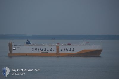
GRANDE ANVERSA
Vehicles Carrier
Current Trip
| Time Travelled | 14 h, 33 mins |
|---|---|
| Remaining Time | --- |
| Distance Travelled | 249.05 nm |
| Remaining Distance | --- |
| AVG Speed | 17.1 Knots |
| MAX Speed | 18.3 Knots |
| AVG Wind | 9.9 knots |
| MAX Wind | 17.5 knots |
| MIN Temp | 17.6°C / 63.68°F |
| MAX Temp | 21.7°C / 71.06°F |
| Draught | 8 m |
| Position Received | 3 m ago |
Current Position
| Longitude | -2.24460° |
|---|---|
| Latitude | 36.42988° |
| Status | Under way using engine |
| Speed | 17.4 Knots |
| Course | 260° |
| Area | Mediterranean Sea - Western Basin |
| Station | T-AIS |
| Position Received | 3 m ago |
Info
Information
The current position of GRANDE ANVERSA is in Mediterranean Sea - Western Basin with coordinates 36.42988° / -2.24460° as reported on 2024-05-17 07:53 by AIS to our vessel tracker app. The vessel's current speed is 17.4 Knots
The vessel GRANDE ANVERSA (IMO: 9287417, MMSI: 247116600) is a Vehicles Carrier that was built in 2004 ( 20 years old ). It's sailing under the flag of [IT] Italy.
In this page you can find informations about the vessels current position, last detected port calls, and current voyage information. If the vessels is not in coverage by AIS you will find the latest position.
The current position of GRANDE ANVERSA is detected by our AIS receivers and we are not responsible for the reliability of the data. The last position was recorded while the vessel was in Coverage by the Ais receivers of our vessel tracking app.
The current draught of GRANDE ANVERSA as reported by AIS is 8 meters
Weather
| Temperature | 17.6°C / 63.68°F |
|---|---|
| Wind Speed | 15 knots |
| Direction | 246° WSW |
| Pressure | 1010.1 hPa |
| Humidity | 85.6 % |
| Cloud Coverage | --- |
Featured Company
Last Port Calls
| Port | Arrival | Departure | Time In Port |
|---|---|---|---|
| 2024-05-16 03:16 | 2024-05-16 17:24 | 14 h | |
| 2024-05-13 06:30 | 2024-05-14 03:59 | 21 h | |
| 2024-05-09 02:45 | 2024-05-10 10:38 | 1 d | |
| 2024-05-08 12:22 | 2024-05-09 02:09 | 13 h | |
| 2024-05-07 00:33 | 2024-05-08 06:06 | 1 d | |
| 2024-05-01 02:47 | 2024-05-02 13:32 | 1 d | |
| 2024-04-28 11:10 | 2024-04-29 00:35 | 13 h | |
| 2024-04-22 15:15 | 2024-04-24 23:07 | 2 d | |
| 2024-04-20 17:49 | 2024-04-21 04:01 | 10 h | |
| 2024-04-20 17:08 | 2024-04-20 17:15 | 7 m |
Last Trips
| Origin | Departure | Destination | Arrival | Distance | |
|---|---|---|---|---|---|
| 2024-05-14 05:59 | 2024-05-16 05:16 | 733.19 nm | |||
| 2024-05-10 13:38 | 2024-05-13 08:30 | 1004.95 nm | |||
| 2024-05-09 05:09 | 2024-05-09 05:45 | 2.12 nm | |||
| 2024-05-08 09:06 | 2024-05-08 15:22 | 81.23 nm | |||
| 2024-05-02 15:32 | 2024-05-07 03:33 | 1563.71 nm | |||
| 2024-04-29 01:35 | 2024-05-01 04:47 | 744.56 nm | |||
| 2024-04-25 01:07 | 2024-04-28 12:10 | 1167.83 nm | |||
| 2024-04-21 05:01 | 2024-04-22 17:15 | 580.26 nm | |||
| 2024-04-20 18:15 | 2024-04-20 18:49 | 3.27 nm | |||
| 2024-04-20 04:53 | 2024-04-20 18:08 | 217.11 nm |
Events
| Time | Event | Details | Position / Dest | Info |
|---|---|---|---|---|
| 2024-05-17 07:37 | Detected in Sea | Spanish part of the Alboran Sea |
36.45848 / -2.15988
Alboran Sea
ESSAG MAPTM
|
Speed: 17.4 kn Course: 228.8° |
| 2024-05-17 07:34 | Status Changed | Under way using engine Default |
36.47063 / -2.14364
ESSAG MAPTM
|
Speed: 17 kn Course: 228° |
| 2024-05-17 07:34 | IN Coverage |
36.45848 / -2.15988
Alboran Sea
ESSAG MAPTM
|
Speed: 17.4 kn Course: 228.8° |
|
| 2024-05-17 05:46 | Status Changed | Default Under way using engine |
36.80064 / -1.66179
ESSAG MAPTM
|
Speed: 17.1 kn Course: 228.3° |
| 2024-05-17 05:41 | Status Changed | Under way using engine Default |
36.81656 / -1.63947
ESSAG MAPTM
|
Speed: 17.3 kn Course: 228° |
| 2024-05-17 05:41 | OUT of Coverage |
36.81656 / -1.63947
Mediterranean Sea - Western Basin
ESSAG MAPTM
|
Speed: 17.1 kn Course: 228.3° |
|
| 2024-05-17 05:30 | Status Changed | Default Under way using engine |
36.85170 / -1.59099
ESSAG MAPTM
|
Speed: 17.3 kn Course: 227.2° |
| 2024-05-17 05:25 | Status Changed | Under way using engine Default |
36.86964 / -1.56674
ESSAG MAPTM
|
Speed: 17.5 kn Course: 226° |
| 2024-05-17 05:22 | Status Changed | Default Under way using engine |
36.87760 / -1.55621
ESSAG MAPTM
|
Speed: 17.7 kn Course: 226.5° |
| 2024-05-17 05:15 | Status Changed | Under way using engine Default |
36.90402 / -1.52167
ESSAG MAPTM
|
Speed: 17.8 kn Course: 226° |