
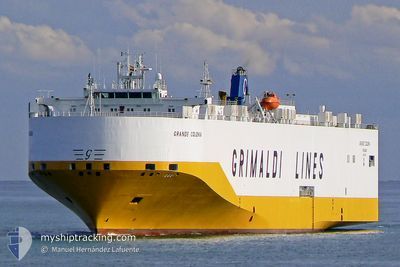
GRANDE COLONIA
Vehicles Carrier
Current Trip
| Time Travelled | 1 day |
|---|---|
| Remaining Time | 6 h, 7 mins |
| Distance Travelled | 298.40 nm |
| Remaining Distance | 80.50 nm |
| AVG Speed | 13.2 Knots |
| MAX Speed | 18 Knots |
| AVG Wind | 16.6 knots |
| MAX Wind | 23.1 knots |
| MIN Temp | 12.9°C / 55.22°F |
| MAX Temp | 15.8°C / 60.44°F |
| Draught | 8.8 m |
| Position Received | 1 m ago |
Current Position
| Longitude | 8.06431° |
|---|---|
| Latitude | 54.03826° |
| Status | Under way using engine |
| Speed | 10.9 Knots |
| Course | 65.2° |
| Area | North Sea |
| Station | T-AIS |
| Position Received | 1 m ago |
Info
Information
The current position of GRANDE COLONIA is in North Sea with coordinates 54.03826° / 8.06431° as reported on 2024-06-17 13:56 by AIS to our vessel tracker app. The vessel's current speed is 10.9 Knots and is heading at the port of HAMBURG. The estimated time of arrival as calculated by vessel tracking app is 2024-06-17 20:04 LT
The vessel GRANDE COLONIA (IMO: 9318527, MMSI: 247217500) is a Vehicles Carrier that was built in 2007 ( 17 years old ). It's sailing under the flag of [IT] Italy.
In this page you can find informations about the vessels current position, last detected port calls, and current voyage information. If the vessels is not in coverage by AIS you will find the latest position.
The current position of GRANDE COLONIA is detected by our AIS receivers and we are not responsible for the reliability of the data. The last position was recorded while the vessel was in Coverage by the Ais receivers of our vessel tracking app.
The current draught of GRANDE COLONIA as reported by AIS is 8.8 meters
Weather
| Temperature | 15.8°C / 60.44°F |
|---|---|
| Wind Speed | 10 knots |
| Direction | 258° WSW |
| Pressure | 1010.6 hPa |
| Humidity | 78.6 % |
| Cloud Coverage | --- |
Featured Company
Last Port Calls
| Port | Arrival | Departure | Time In Port |
|---|---|---|---|
| 2024-06-14 05:53 | 2024-06-16 08:32 | 2 d | |
| 2024-06-12 21:50 | 2024-06-13 12:03 | 14 h | |
| 2024-06-07 21:48 | 2024-06-08 14:06 | 16 h | |
| 2024-06-07 05:54 | 2024-06-07 18:33 | 12 h | |
| 2024-06-04 19:51 | 2024-06-05 09:23 | 13 h | |
| 2024-06-01 09:38 | 2024-06-02 02:22 | 16 h | |
| 2024-05-31 03:55 | 2024-06-01 02:14 | 22 h | |
| 2024-05-27 04:30 | 2024-05-27 12:29 | 7 h | |
| 2024-05-26 03:28 | 2024-05-26 12:29 | 9 h | |
| 2024-05-22 16:12 | 2024-05-23 11:21 | 19 h |
Last Trips
| Origin | Departure | Destination | Arrival | Distance | |
|---|---|---|---|---|---|
| 2024-06-13 13:03 | 2024-06-14 07:53 | 258.55 nm | |||
| 2024-06-08 16:06 | 2024-06-12 22:50 | 1606.53 nm | |||
| 2024-06-07 20:33 | 2024-06-07 23:48 | 18.25 nm | |||
| 2024-06-05 11:23 | 2024-06-07 07:54 | 730.10 nm | |||
| 2024-06-02 05:22 | 2024-06-04 21:51 | 987.37 nm | |||
| 2024-06-01 05:14 | 2024-06-01 12:38 | 76.34 nm | |||
| 2024-05-27 15:29 | 2024-05-31 06:55 | 1007.88 nm | |||
| 2024-05-26 15:29 | 2024-05-27 07:30 | 175.62 nm | |||
| 2024-05-23 13:21 | 2024-05-26 06:28 | 1005.44 nm | |||
| 2024-05-21 19:38 | 2024-05-22 18:12 | 363.24 nm |
Events
| Time | Event | Details | Position / Dest | Info |
|---|---|---|---|---|
| 2024-06-17 10:29 | ETA Changed | 2024/06/17 15:30 2024/06/17 17:00 |
53.86278 / 7.18515
BEANR>DEHAM
|
Speed: 6.8 kn Course: 77.1° |
| 2024-06-17 08:25 | ETA Changed | 2024/06/17 17:00 2024/06/17 15:30 |
53.80437 / 6.78672
BEANR>DEHAM
|
Speed: 7.3 kn Course: 77.2° |
| 2024-06-17 08:14 | Status Changed | Under way using engine Default |
53.79939 / 6.75038
BEANR>DEHAM
|
Speed: 7.3 kn Course: 76° |
| 2024-06-17 08:13 | Status Changed | Default Under way using engine |
53.79886 / 6.74650
BEANR>DEHAM
|
Speed: 7.4 kn Course: 77.4° |
| 2024-06-17 07:55 | Detected in Sea | German part of the North Sea |
53.79106 / 6.68766
North Sea
BEANR>DEHAM
|
Speed: 6.9 kn Course: 77.4° |
| 2024-06-17 07:55 | Status Changed | Under way using engine Default |
53.79106 / 6.68766
BEANR>DEHAM
|
Speed: 6.9 kn Course: 77° |
| 2024-06-17 07:49 | IN Coverage |
53.79106 / 6.68766
North Sea
BEANR>DEHAM
|
Speed: 6.9 kn Course: 77.4° |
|
| 2024-06-17 05:43 | Status Changed | Default Under way using engine |
53.72925 / 6.25581
BEANR>DEHAM
|
Speed: 6.8 kn Course: 70.5° |
| 2024-06-17 05:39 | OUT of Coverage |
53.72686 / 6.24423
North Sea
BEANR>DEHAM
|
Speed: 6.8 kn Course: 70.5° |
|
| 2024-06-17 05:39 | Status Changed | Under way using engine Default |
53.72656 / 6.24278
BEANR>DEHAM
|
Speed: 6.8 kn Course: 70° |