
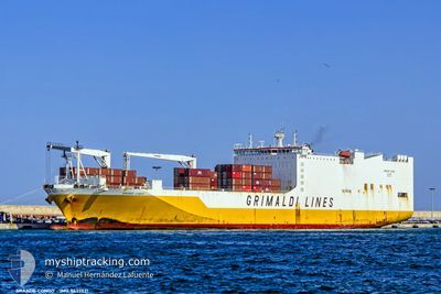
GRANDE CONGO
Ro-Ro Cargo
Aktuelle Reise
| Trip Time | 12 Tage |
|---|---|
| Trip Distanz | 3832.64 nm |
| Durchschnittliche Geschwindigkeit | 11.7 Knoten |
| Maximale Geschwindigkeit | 16.9 Knoten |
| Tiefgang | 8.5 m |
| Durchschnittliche Windgeschwindigkeit | 8.6 Knoten |
| Maximale Windgeschwindigkeit | 16 Knoten |
| Minimale Temperatur | 11.3°C / 52.34°F |
| Maximale Temperatur | 28.5°C / 83.3°F |
| Position erhalten | Jetzt |
Aktuelle Position
| Länge | --- |
|---|---|
| Breite | --- |
| Zustand | Moored |
| Geschwindigkeit | |
| Kurs | 163° |
| Gebiet | North Sea |
| Station | T-AIS |
| Position erhalten | Jetzt |
Schiffsdetails
Information
Die GRANDE CONGO befindet sich derzeit in North Sea mit den Koordinaten 51.46090° / 0.33259°, Diese Position wurde am 2024-11-09 01:46 von unserer Schiffsverfolgungs-App über AIS erfasst. Das Schiff fährt momentan mit einer Geschwindigkeit von 0 Knoten und liegt im Hafen von TILBURY .
Das Schiff GRANDE CONGO (IMO: 9437921, MMSI: 247302700) ist Ro-Ro Cargo das wurde im Jahr 2010 ( 14 Jahre alt ) gebaut. und fährt unter der Flagge von [IT] Italy.
Auf dieser Seite erhalten Sie Informationen zur aktuellen Position des Schiffes, zu den letzten bekannten Hafenanläufen und zu den aktuellen Reiseinformationen. Sollte das Schiff nicht durch AIS abgedeckt sein, wird die zuletzt erfasste Position angezeigt.
Die GRANDE CONGO wird durch unsere AIS-Empfänger ermittelt. Wir übernehmen keine Gewähr für die Richtigkeit der Daten. Die letzte Position wurde von unseren AIS-Empfängern aufgezeichnet, während das Schiff in Reichweite war.
Der aktuelle Entwurf von GRANDE CONGO, wie von AIS gemeldet, betragt 8.7 meter
Wetter
| Temperatur | 7.6°C / 45.68°F |
|---|---|
| Windgeschwindigkeit | 2 Knoten |
| Windrichtung | 127° SE |
| Luftdruck | 1023.6 hPa |
| Luftfeuchtigkeit | 76.7 % |
| Wolken | 46 % |
Featured Company
Letzte Hafenanläufe
| Hafen | Ankunft | Abfahrt | Time In Port |
|---|---|---|---|
| 2024-11-07 01:42 | |||
| 2024-10-25 10:38 | 2024-10-26 00:07 | 13 h | |
| 2024-10-23 11:44 | 2024-10-24 07:45 | 20 h | |
| 2024-10-22 07:17 | 2024-10-23 00:45 | 17 h | |
| 2024-10-20 07:29 | 2024-10-21 09:29 | 1 d | |
| 2024-10-18 19:01 | 2024-10-19 09:29 | 14 h | |
| 2024-10-14 12:08 | 2024-10-15 09:09 | 21 h | |
| 2024-10-11 19:11 | 2024-10-12 17:11 | 22 h | |
| 2024-10-07 11:22 | 2024-10-08 07:08 | 19 h | |
| 2024-09-30 11:36 | 2024-10-02 13:33 | 2 d |
Letzte Reisen
| Herkunft | Abfahrt | Ziel | Ankunft | Distanz | |
|---|---|---|---|---|---|
| 2024-10-26 00:07 | 2024-11-07 01:42 | 3832.64 nm | |||
| 2024-10-24 07:45 | 2024-10-25 10:38 | 223.69 nm | |||
| 2024-10-23 00:45 | 2024-10-23 11:44 | 160.43 nm | |||
| 2024-10-21 10:29 | 2024-10-22 07:17 | 279.02 nm | |||
| 2024-10-19 09:29 | 2024-10-20 08:29 | 180.54 nm | |||
| 2024-10-15 09:09 | 2024-10-18 19:01 | 1124.93 nm | |||
| 2024-10-12 17:11 | 2024-10-14 12:08 | 575.63 nm | |||
| 2024-10-08 08:08 | 2024-10-11 19:11 | 1383.48 nm | |||
| 2024-10-02 15:33 | 2024-10-07 12:22 | 1450.16 nm | |||
| 2024-09-29 22:20 | 2024-09-30 13:36 | 168.51 nm |
Events
| Zeit | Ereignis | Details | Position / Ziel | Information |
|---|---|---|---|---|
| 2024-11-08 14:52 | geänderter Status | Moored Under way using engine |
51.46091 / .33258
[GB] TILBURY
|
Geschwindigkeit: Kurs: 163° |
| 2024-11-08 12:58 | geänderter Status | Under way using engine Moored |
51.45313 / .34747
[GB] TILBURY
|
Geschwindigkeit: Kurs: 61° |
| 2024-11-08 12:38 | geänderter Tiefgang | 8.7 8.5 |
51.45311 / .34750
[GB] TILBURY
|
Geschwindigkeit: Kurs: 61° |
| 2024-11-07 02:57 | geänderter Status | Moored Under way using engine |
51.45317 / .34748
[GB] TILBURY
|
Geschwindigkeit: Kurs: 62° |
| 2024-11-07 01:42 | ZIELHAFEN |
|
51.45718 / .33203
[GB] TILBURY
|
Geschwindigkeit: 1 kn Kurs: 127° |
| 2024-11-07 01:24 | STOP Bewegung | 0.45 nm, North of NORTHFLEET |
51.45858 / .32998
CIABJ>GBTIL
|
Geschwindigkeit: 0.3 kn Kurs: 132° |
| 2024-11-06 16:03 | geänderter Status | Under way using engine Default |
51.40472 / 2.05004
CIABJ>GBTIL
|
Geschwindigkeit: 5.8 kn Kurs: 325° |
| 2024-11-06 15:56 | geänderter Status | Default Under way using engine |
51.39594 / 2.06076
CIABJ>GBTIL
|
Geschwindigkeit: 5.8 kn Kurs: 325.7° |
| 2024-11-06 15:55 | Ändere Seegebiet | United Kingdom part of the North Sea French part of the North Sea |
51.39441 / 2.06247
North Sea
CIABJ>GBTIL
|
Geschwindigkeit: 5.8 kn Kurs: 325.7° |
| 2024-11-06 15:16 | geänderter Status | Under way using engine Default |
51.34014 / 2.11333
CIABJ>GBTIL
|
Geschwindigkeit: 6.2 kn Kurs: 358° |