
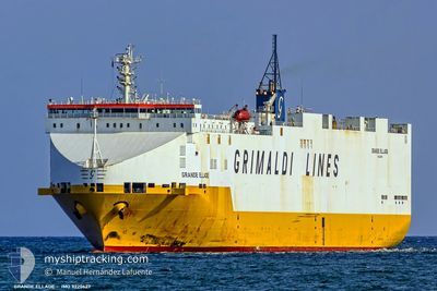
GRANDE ELLADE
Vehicles Carrier
Current Trip
| Time Travelled | 2 days |
|---|---|
| Remaining Time | 2 h, 18 mins |
| Distance Travelled | 975.39 nm |
| Remaining Distance | 35.93 nm |
| AVG Speed | 15 Knots |
| MAX Speed | 17.4 Knots |
| AVG Wind | 6.5 knots |
| MAX Wind | 27 knots |
| MIN Temp | 24.4°C / 75.92°F |
| MAX Temp | 31.8°C / 89.24°F |
| Draught | 8.1 m |
| Position Received | 1 m ago |
Current Position
| Longitude | 14.73423° |
|---|---|
| Latitude | 40.13560° |
| Status | Under way using engine |
| Speed | 14.1 Knots |
| Course | 351.5° |
| Area | Tyrrhenian Sea |
| Station | T-AIS |
| Position Received | 1 m ago |
Info
Information
The current position of GRANDE ELLADE is in Tyrrhenian Sea with coordinates 40.13560° / 14.73423° as reported on 2024-06-21 02:40 by AIS to our vessel tracker app. The vessel's current speed is 14.1 Knots and is heading at the port of SALERNO. The estimated time of arrival as calculated by vessel tracking app is 2024-06-21 04:59 LT
The vessel GRANDE ELLADE (IMO: 9220627, MMSI: 247019600) is a Vehicles Carrier that was built in 2001 ( 23 years old ). It's sailing under the flag of [IT] Italy.
In this page you can find informations about the vessels current position, last detected port calls, and current voyage information. If the vessels is not in coverage by AIS you will find the latest position.
The current position of GRANDE ELLADE is detected by our AIS receivers and we are not responsible for the reliability of the data. The last position was recorded while the vessel was in Coverage by the Ais receivers of our vessel tracking app.
The current draught of GRANDE ELLADE as reported by AIS is 8.1 meters
Weather
| Temperature | 24.5°C / 76.1°F |
|---|---|
| Wind Speed | 2 knots |
| Direction | 106° ESE |
| Pressure | 1015.1 hPa |
| Humidity | 72.4 % |
| Cloud Coverage | --- |
Featured Company
Last Port Calls
| Port | Arrival | Departure | Time In Port |
|---|---|---|---|
| 2024-06-17 15:13 | 2024-06-18 12:50 | 21 h | |
| 2024-06-15 15:13 | 2024-06-16 21:41 | 1 d | |
| 2024-06-07 12:17 | 2024-06-13 14:06 | 6 d | |
| 2024-06-04 05:12 | 2024-06-04 19:06 | 13 h | |
| 2024-05-26 01:11 | 2024-05-28 17:50 | 2 d | |
| 2024-05-24 12:17 | 2024-05-24 22:49 | 10 h | |
| 2024-05-22 08:10 | 2024-05-23 06:49 | 22 h | |
| 2024-05-19 12:45 | 2024-05-20 16:24 | 1 d | |
| 2024-05-13 14:37 | 2024-05-14 19:41 | 1 d | |
| 2024-05-09 17:40 | 2024-05-11 12:19 | 1 d |
Last Trips
| Origin | Departure | Destination | Arrival | Distance | |
|---|---|---|---|---|---|
| 2024-06-17 00:41 | 2024-06-17 17:13 | 278.90 nm | |||
| 2024-06-13 17:06 | 2024-06-15 18:13 | 678.64 nm | |||
| 2024-06-04 21:06 | 2024-06-07 15:17 | 697.11 nm | |||
| 2024-05-28 19:50 | 2024-06-04 07:12 | 2431.00 nm | |||
| 2024-05-25 00:49 | 2024-05-26 03:11 | 403.75 nm | |||
| 2024-05-23 08:49 | 2024-05-24 14:17 | 431.90 nm | |||
| 2024-05-20 18:24 | 2024-05-22 10:10 | 546.72 nm | |||
| 2024-05-14 21:41 | 2024-05-19 14:45 | 1763.94 nm | |||
| 2024-05-11 14:19 | 2024-05-13 16:37 | 764.63 nm | |||
| 2024-05-07 09:32 | 2024-05-09 19:40 | 855.80 nm |
Events
| Time | Event | Details | Position / Dest | Info |
|---|---|---|---|---|
| 2024-06-20 17:33 | ETA Changed | 2024/06/21 05:00 2024/06/21 04:00 |
38.42127 / 15.65250
ITSAL
|
Speed: 14.4 kn Course: 339.6° |
| 2024-06-20 16:44 | Change Sea Area | Italian part of the Tyrrhenian Sea Italian part of the Ionian Sea |
38.25700 / 15.67090
Tyrrhenian Sea
ITSAL
|
Speed: 15.2 kn Course: 67.9° |
| 2024-06-20 14:35 | Status Changed | Under way using engine Default |
37.80973 / 15.88246
ITSAL
|
Speed: 17.1 kn Course: 301° |
| 2024-06-20 14:33 | Status Changed | Default Under way using engine |
37.80519 / 15.89161
ITSAL
|
Speed: 17.1 kn Course: 301.2° |
| 2024-06-20 14:26 | Status Changed | Under way using engine Default |
37.78792 / 15.92734
ITSAL
|
Speed: 17.1 kn Course: 301° |
| 2024-06-20 14:25 | Status Changed | Default Under way using engine |
37.78548 / 15.93241
ITSAL
|
Speed: 17 kn Course: 300.1° |
| 2024-06-20 13:57 | Status Changed | Under way using engine Default |
37.72426 / 16.08542
ITSAL
|
Speed: 17.1 kn Course: 296° |
| 2024-06-20 13:47 | Status Changed | Default Under way using engine |
37.70512 / 16.13579
ITSAL
|
Speed: 17.1 kn Course: 295.2° |
| 2024-06-20 13:40 | Status Changed | Under way using engine Default |
37.69006 / 16.17642
ITSAL
|
Speed: 16.7 kn Course: 294° |
| 2024-06-20 13:40 | IN Coverage |
37.69006 / 16.17642
Ionian Sea
ITSAL
|
Speed: 17 kn Course: 294.2° |