
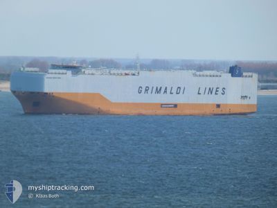
GRANDE NEW YORK
Cargo
Current Trip
JPMKW>PAPCN
| Time Travelled | 10 days |
|---|---|
| Remaining Time | --- |
| Distance Travelled | 3959.32 nm |
| Remaining Distance | --- |
| AVG Speed | 16.9 Knots |
| MAX Speed | 20.7 Knots |
| AVG Wind | 9.4 knots |
| MAX Wind | 21 knots |
| MIN Temp | 14.2°C / 57.56°F |
| MAX Temp | 22.3°C / 72.14°F |
| Draught | 10.2 m |
| Position Received | 8 d ago |
Current Position
| Longitude | 142.16967° |
|---|---|
| Latitude | 34.04241° |
| Status | Under way using engine |
| Speed | 15.3 Knots |
| Course | 77.3° |
| Area | North Pacific Ocean |
| Station | T-AIS |
| Position Received | 8 d ago |
Info
Information
The current position of GRANDE NEW YORK is in North Pacific Ocean with coordinates 34.04241° / 142.16967° as reported on 2024-05-24 07:09 by AIS to our vessel tracker app. The vessel's current speed is 15.3 Knots
The vessel GRANDE NEW YORK (IMO: 9784049, MMSI: 247376300) is a Cargo It's sailing under the flag of [IT] Italy.
In this page you can find informations about the vessels current position, last detected port calls, and current voyage information. If the vessels is not in coverage by AIS you will find the latest position.
The current position of GRANDE NEW YORK is detected by our AIS receivers and we are not responsible for the reliability of the data. The last position was recorded while the vessel was in Coverage by the Ais receivers of our vessel tracking app.
The current draught of GRANDE NEW YORK as reported by AIS is 10.2 meters
Weather
| Temperature | 19.9°C / 67.82°F |
|---|---|
| Wind Speed | 9 knots |
| Direction | 74° ENE |
| Pressure | 1027.4 hPa |
| Humidity | 69.1 % |
| Cloud Coverage | 2 % |
Featured Company
Last Port Calls
| Port | Arrival | Departure | Time In Port |
|---|---|---|---|
| 2024-05-20 21:15 | 2024-05-22 07:48 | 1 d | |
| 2024-05-19 10:24 | 2024-05-20 09:12 | 22 h | |
| 2024-04-30 22:10 | 2024-05-03 18:10 | 2 d | |
| 2024-04-21 10:26 | 2024-04-22 11:50 | 1 d | |
| 2024-04-18 06:41 | 2024-04-18 16:02 | 9 h | |
| 2024-04-14 15:38 | 2024-04-15 20:33 | 1 d | |
| 2024-04-06 21:00 | 2024-04-07 19:34 | 22 h | |
| 2024-04-03 17:09 | 2024-04-06 01:16 | 2 d | |
| 2024-04-01 12:33 | 2024-04-03 12:17 | 1 d |
Most Visited Ports (Last year)
| Port | Arrivals | |
|---|---|---|
| 8 | ||
| 7 | ||
| 6 | ||
| 5 | ||
| 5 | ||
| 4 |
Last Trips
| Origin | Departure | Destination | Arrival | Distance | |
|---|---|---|---|---|---|
| 2024-05-20 18:12 | 2024-05-21 06:15 | 44.96 nm | |||
| 2024-05-03 22:10 | 2024-05-19 19:24 | 6321.31 nm | |||
| 2024-04-22 14:50 | 2024-05-01 02:10 | 2420.10 nm | |||
| 2024-04-15 22:33 | 2024-04-21 13:26 | 1675.91 nm | |||
| 2024-04-15 22:33 | 2024-04-18 08:41 | 969.55 nm | |||
| 2024-04-07 20:34 | 2024-04-14 17:38 | 2327.80 nm | |||
| 2024-04-06 03:16 | 2024-04-06 22:00 | 252.75 nm | |||
| 2024-04-03 14:17 | 2024-04-03 19:09 | 57.45 nm | |||
| 2024-03-23 14:00 | 2024-04-01 14:33 | 2676.15 nm |
Events
| Time | Event | Details | Position / Dest | Info |
|---|---|---|---|---|
| 2024-05-24 07:10 | Status Changed | Default Under way using engine |
34.04375 / 142.17677
JPMKW>PAPCN
|
Speed: 15.3 kn Course: 77.3° |
| 2024-05-24 07:09 | OUT of Coverage |
34.04241 / 142.16967
North Pacific Ocean
JPMKW>PAPCN
|
Speed: 15.3 kn Course: 77.3° |
|
| 2024-05-24 07:08 | Status Changed | Under way using engine Default |
34.04151 / 142.16479
JPMKW>PAPCN
|
Speed: 15.4 kn Course: 77° |
| 2024-05-24 06:55 | Status Changed | Default Under way using engine |
34.02970 / 142.10303
JPMKW>PAPCN
|
Speed: 15.7 kn Course: 77.1° |
| 2024-05-24 06:38 | Status Changed | Under way using engine Default |
34.01328 / 142.01817
JPMKW>PAPCN
|
Speed: 15.8 kn Course: 75° |
| 2024-05-24 06:38 | IN Coverage |
34.01328 / 142.01817
North Pacific Ocean
JPMKW>PAPCN
|
Speed: 15.9 kn Course: 76.7° |
|
| 2024-05-24 00:44 | Status Changed | Default Under way using engine |
33.59515 / 140.09271
JPMKW>PAPCN
|
Speed: 18.8 kn Course: 70° |
| 2024-05-24 00:38 | OUT of Coverage |
33.58677 / 140.06065
North Pacific Ocean
JPMKW>PAPCN
|
Speed: 18.8 kn Course: 70° |
|
| 2024-05-24 00:38 | Change Sea Area | Japanese part of the North Pacific Ocean Japanese part of the Philippine Sea |
33.58532 / 140.05582
North Pacific Ocean
JPMKW>PAPCN
|
Speed: 18.8 kn Course: 70.7° |
| 2024-05-24 00:36 | Status Changed | Under way using engine Default |
33.58297 / 140.04761
JPMKW>PAPCN
|
Speed: 19 kn Course: 73° |