
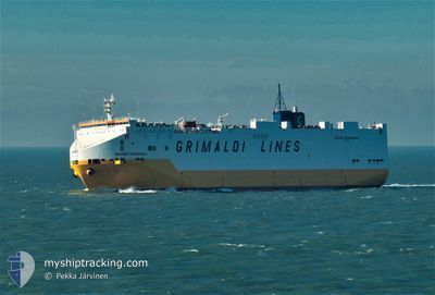
GRANDE SCANDINAVIA
Vehicles Carrier
Current Trip
| Time Travelled | 2 days |
|---|---|
| Remaining Time | 47 mins |
| Distance Travelled | 898.02 nm |
| Remaining Distance | 20.10 nm |
| AVG Speed | 19.9 Knots |
| MAX Speed | 19.9 Knots |
| AVG Wind | 9.9 knots |
| MAX Wind | 22.3 knots |
| MIN Temp | 17.5°C / 63.5°F |
| MAX Temp | 30.3°C / 86.54°F |
| Draught | 7.7 m |
| Position Received | Now |
Current Position
| Longitude | 29.55923° |
|---|---|
| Latitude | 40.74774° |
| Status | Under way using engine |
| Speed | 14.9 Knots |
| Course | 98° |
| Area | Sea of Marmara |
| Station | T-AIS |
| Position Received | Now |
Info
Information
The current position of GRANDE SCANDINAVIA is in Sea of Marmara with coordinates 40.74774° / 29.55923° as reported on 2024-05-24 17:45 by AIS to our vessel tracker app. The vessel's current speed is 14.9 Knots and is heading at the port of IZMIT. The estimated time of arrival as calculated by vessel tracking app is 2024-05-24 18:33 LT
The vessel GRANDE SCANDINAVIA (IMO: 9220615, MMSI: 247018700) is a Vehicles Carrier that was built in 2001 ( 23 years old ). It's sailing under the flag of [IT] Italy.
In this page you can find informations about the vessels current position, last detected port calls, and current voyage information. If the vessels is not in coverage by AIS you will find the latest position.
The current position of GRANDE SCANDINAVIA is detected by our AIS receivers and we are not responsible for the reliability of the data. The last position was recorded while the vessel was in Coverage by the Ais receivers of our vessel tracking app.
The current draught of GRANDE SCANDINAVIA as reported by AIS is 7.7 meters
Weather
| Temperature | 18.1°C / 64.58°F |
|---|---|
| Wind Speed | 3 knots |
| Direction | 205° SSW |
| Pressure | 1014.7 hPa |
| Humidity | 74.4 % |
| Cloud Coverage | 100 % |
Featured Company
Last Port Calls
| Port | Arrival | Departure | Time In Port |
|---|---|---|---|
| 2024-05-22 05:48 | 2024-05-22 10:25 | 4 h | |
| 2024-05-22 02:48 | 2024-05-22 05:28 | 2 h | |
| 2024-05-21 13:32 | |||
| 2024-05-21 08:53 | |||
| 2024-05-20 11:02 | |||
| 2024-05-20 03:20 | 2024-05-20 11:01 | 7 h | |
| 2024-05-15 04:20 | 2024-05-15 12:44 | 8 h | |
| 2024-05-09 20:00 | 2024-05-10 18:43 | 22 h | |
| 2024-05-06 15:34 | 2024-05-08 22:56 | 2 d | |
| 2024-05-05 11:26 | 2024-05-06 12:52 | 1 d |
Last Trips
| Origin | Departure | Destination | Arrival | Distance | |
|---|---|---|---|---|---|
| 2024-05-22 08:28 | 2024-05-22 08:48 | 0.72 nm | |||
| 2024-05-22 08:28 | 2024-05-22 05:48 | 0.72 nm | |||
| 2024-05-22 08:28 | 2024-05-21 16:32 | 0.72 nm | |||
| 2024-05-22 08:28 | 2024-05-21 11:53 | 0.72 nm | |||
| 2024-05-20 14:01 | 2024-05-20 14:02 | --- | |||
| 2024-05-15 14:44 | 2024-05-20 06:20 | 1674.94 nm | |||
| 2024-05-10 19:43 | 2024-05-15 06:20 | 1671.68 nm | |||
| 2024-05-09 00:56 | 2024-05-09 21:00 | 253.47 nm | |||
| 2024-05-06 14:52 | 2024-05-06 17:34 | 31.39 nm | |||
| 2024-04-30 19:59 | 2024-05-05 13:26 | 1767.04 nm |
Events
| Time | Event | Details | Position / Dest | Info |
|---|---|---|---|---|
| 2024-05-24 11:04 | Status Changed | Under way using engine Default |
40.59387 / 27.23067
ILASH>TRIZT
|
Speed: 16.2 kn Course: 67° |
| 2024-05-24 10:58 | Status Changed | Default Under way using engine |
40.58420 / 27.20009
ILASH>TRIZT
|
Speed: 16.2 kn Course: 67° |
| 2024-05-24 10:26 | Status Changed | Under way using engine Default |
40.52434 / 27.02645
ILASH>TRIZT
|
Speed: 16.7 kn Course: 58° |
| 2024-05-24 10:26 | IN Coverage |
40.52771 / 27.03508
Sea of Marmara
ILASH>TRIZT
|
Speed: 16.5 kn Course: 64° |
|
| 2024-05-24 08:50 | Status Changed | Default Under way using engine |
40.30357 / 26.58522
ILASH>TRIZT
|
Speed: 15.2 kn Course: 48° |
| 2024-05-24 08:48 | OUT of Coverage |
40.29661 / 26.57484
Sea of Marmara
ILASH>TRIZT
|
Speed: 15.2 kn Course: 48° |
|
| 2024-05-24 07:05 | Change Sea Area | Turkish part of the Sea of Marmara Turkish part of the Aegean Sea |
40.01909 / 26.18824
Sea of Marmara
ILASH>TRIZT
|
Speed: 8.9 kn Course: 75° |
| 2024-05-24 06:33 | Status Changed | Under way using engine Default |
39.99153 / 26.04461
ILASH>TRIZT
|
Speed: 12.9 kn Course: 41° |
| 2024-05-24 06:10 | Status Changed | Default Under way using engine |
39.92923 / 25.96538
ILASH>TRIZT
|
Speed: 10.2 kn Course: 41° |
| 2024-05-24 05:50 | Change Sea Area | Turkish part of the Aegean Sea Greek part of the Aegean Sea |
39.87488 / 25.90366
Aegean Sea
ILASH>TRIZT
|
Speed: 14.5 kn Course: 42° |