
GRANDE TEMA
Cargo
Current Trip
BRENTON REEF ANCORAG
| Time Travelled | 2 days |
|---|---|
| Remaining Time | --- |
| Distance Travelled | 644.93 nm |
| Remaining Distance | --- |
| AVG Speed | 13.7 Knots |
| MAX Speed | 16.6 Knots |
| AVG Wind | 12 knots |
| MAX Wind | 18.2 knots |
| MIN Temp | 15.5°C / 59.9°F |
| MAX Temp | 25.6°C / 78.08°F |
| Draught | 9.2 m |
| Position Received | 1 m ago |
Current Position
| Longitude | -71.32434° |
|---|---|
| Latitude | 41.32998° |
| Status | At anchor |
| Speed | |
| Course | 316° |
| Area | North Atlantic Ocean |
| Station | T-AIS |
| Position Received | 1 m ago |
Info
Information
The current position of GRANDE TEMA is in North Atlantic Ocean with coordinates 41.32998° / -71.32434° as reported on 2024-05-29 08:44 by AIS to our vessel tracker app. The vessel's current speed is 0 Knots
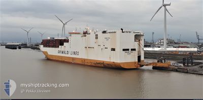
The vessel GRANDE TEMA (IMO: 9672090, MMSI: 247341300) is a Cargo It's sailing under the flag of [IT] Italy.
In this page you can find informations about the vessels current position, last detected port calls, and current voyage information. If the vessels is not in coverage by AIS you will find the latest position.
The current position of GRANDE TEMA is detected by our AIS receivers and we are not responsible for the reliability of the data. The last position was recorded while the vessel was in Coverage by the Ais receivers of our vessel tracking app.
The current draught of GRANDE TEMA as reported by AIS is 9.2 meters
Weather
| Temperature | 15.6°C / 60.08°F |
|---|---|
| Wind Speed | 8 knots |
| Direction | 287° WNW |
| Pressure | 1009.6 hPa |
| Humidity | 87.7 % |
| Cloud Coverage | 1 % |
Featured Company
Last Port Calls
| Port | Arrival | Departure | Time In Port |
|---|---|---|---|
| 2024-05-26 09:48 | 2024-05-26 23:04 | 13 h | |
| 2024-05-23 20:48 | 2024-05-26 09:39 | 2 d | |
| 2024-05-23 01:05 | 2024-05-23 20:33 | 19 h | |
| 2024-05-15 10:36 | 2024-05-15 23:35 | 12 h | |
| 2024-05-12 10:29 | 2024-05-14 03:37 | 1 d | |
| 2024-05-09 14:42 | 2024-05-11 01:49 | 1 d | |
| 2024-04-28 12:56 | 2024-04-29 03:46 | 14 h | |
| 2024-04-23 15:00 | 2024-04-24 21:14 | 1 d | |
| 2024-04-22 06:32 | 2024-04-23 02:44 | 20 h | |
| 2024-04-10 15:58 | 2024-04-11 10:33 | 18 h |
Last Trips
| Origin | Departure | Destination | Arrival | Distance | |
|---|---|---|---|---|---|
| 2024-05-26 05:39 | 2024-05-26 05:48 | 1.13 nm | |||
| 2024-05-23 16:33 | 2024-05-23 16:48 | 0.79 nm | |||
| 2024-05-15 18:35 | 2024-05-22 21:05 | 2129.54 nm | |||
| 2024-05-13 22:37 | 2024-05-15 05:36 | 471.53 nm | |||
| 2024-05-10 20:49 | 2024-05-12 05:29 | 251.73 nm | |||
| 2024-04-29 00:46 | 2024-05-09 09:42 | 4291.50 nm | |||
| 2024-04-24 18:14 | 2024-04-28 09:56 | 1359.95 nm | |||
| 2024-04-22 23:44 | 2024-04-23 12:00 | 177.38 nm | |||
| 2024-04-11 10:33 | 2024-04-22 03:32 | 3431.62 nm | |||
| 2024-04-09 08:33 | 2024-04-10 15:58 | 283.75 nm |
Events
| Time | Event | Details | Position / Dest | Info |
|---|---|---|---|---|
| 2024-05-29 03:56 | Status Changed | At anchor Default |
41.33113 / -71.32350
BRENTON REEF ANCORAG
|
Speed: 0.1 kn Course: 225° |
| 2024-05-29 03:50 | Status Changed | Default At anchor |
41.33123 / -71.32403
BRENTON REEF ANCORAG
|
Speed: 0.2 kn Course: 228° |
| 2024-05-29 03:44 | STOP Moving | 8.96 nm, East of JUDITH POINT |
41.33154 / -71.32395
BRENTON REEF ANCORAG
|
Speed: 0.1 kn Course: 236° |
| 2024-05-29 03:38 | Status Changed | At anchor Under way using engine |
41.33064 / -71.32449
BRENTON REEF ANCORAG
|
Speed: 0.7 kn Course: 269° |
| 2024-05-29 01:52 | Destination Changed | BRENTON REEF ANCORAG US BAL>US DVV |
40.95159 / -71.35265
BRENTON REEF ANCORAG
|
Speed: 15.3 kn Course: 359° |
| 2024-05-29 01:52 | ETA Changed | 2024/05/29 04:00 2024/05/29 07:00 |
40.95159 / -71.35265
BRENTON REEF ANCORAG
|
Speed: 15.3 kn Course: 359° |
| 2024-05-28 23:58 | Status Changed | Under way using engine Default |
40.46924 / -71.33513
US BAL>US DVV
|
Speed: 15.9 kn Course: 17° |
| 2024-05-28 23:55 | Status Changed | Default Under way using engine |
40.45725 / -71.33997
US BAL>US DVV
|
Speed: 16 kn Course: 10.2° |
| 2024-05-28 23:27 | Status Changed | Under way using engine Default |
40.33557 / -71.36031
US BAL>US DVV
|
Speed: 15 kn Course: 11° |
| 2024-05-28 23:22 | IN Coverage |
40.33557 / -71.36031
North Atlantic Ocean
US BAL>US DVV
|
Speed: 16.1 kn Course: 10° |