
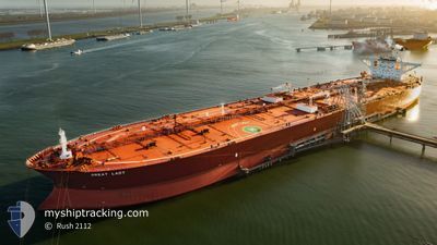
GREAT LADY
Crude Oil Tanker
Current Trip
| Time Travelled | 19 days |
|---|---|
| Remaining Time | --- |
| Distance Travelled | 3748.54 nm |
| Remaining Distance | --- |
| AVG Speed | 8.1 Knots |
| MAX Speed | 15.1 Knots |
| AVG Wind | 13.4 knots |
| MAX Wind | 29 knots |
| MIN Temp | 11.7°C / 53.06°F |
| MAX Temp | 24.8°C / 76.64°F |
| Draught | 11 m |
| Position Received | 19 h, 21 m ago |
Current Position
| Longitude | -68.26186° |
|---|---|
| Latitude | 34.32050° |
| Status | Under way using engine |
| Speed | 10.8 Knots |
| Course | 233.1° |
| Area | North Atlantic Ocean |
| Station | T-AIS |
| Position Received | 19 h, 21 m ago |
Info
Information
The current position of GREAT LADY is in North Atlantic Ocean with coordinates 34.32050° / -68.26186° as reported on 2024-06-16 12:57 by AIS to our vessel tracker app. The vessel's current speed is 10.8 Knots and is heading at the port of CORPUS CHRISTI. The estimated time of arrival as calculated by vessel tracking app is 2024-06-20 11:00 LT
The vessel GREAT LADY (IMO: 9286138, MMSI: 636022378) is a Crude Oil Tanker that was built in 2005 ( 19 years old ). It's sailing under the flag of [LR] Liberia.
In this page you can find informations about the vessels current position, last detected port calls, and current voyage information. If the vessels is not in coverage by AIS you will find the latest position.
The current position of GREAT LADY is detected by our AIS receivers and we are not responsible for the reliability of the data. The last position was recorded while the vessel was in Coverage by the Ais receivers of our vessel tracking app.
The current draught of GREAT LADY as reported by AIS is 11 meters
Weather
| Temperature | 24°C / 75.2°F |
|---|---|
| Wind Speed | 16 knots |
| Direction | 60° ENE |
| Pressure | 1019.3 hPa |
| Humidity | 79.9 % |
| Cloud Coverage | 4 % |
Featured Company
Last Port Calls
| Port | Arrival | Departure | Time In Port |
|---|---|---|---|
| 2024-05-27 07:31 | 2024-05-28 22:31 | 1 d | |
| 2024-05-23 21:38 | 2024-05-26 04:51 | 2 d | |
| 2024-04-30 18:22 | 2024-05-03 15:18 | 2 d |
Most Visited Ports (Last year)
| Port | Arrivals | |
|---|---|---|
| 3 | ||
| 2 | ||
| 1 | ||
| 1 |
Last Trips
| Origin | Departure | Destination | Arrival | Distance | |
|---|---|---|---|---|---|
| 2024-05-26 06:51 | 2024-05-27 09:31 | 306.63 nm | |||
| 2024-05-03 10:18 | 2024-05-23 23:38 | 5348.04 nm |
Events
| Time | Event | Details | Position / Dest | Info |
|---|---|---|---|---|
| 2024-06-16 13:01 | Status Changed | Default Under way using engine |
34.31167 / -68.27500
USCRP FOR ORDER
|
Speed: 10.8 kn Course: 233.1° |
| 2024-06-16 12:57 | OUT of Coverage |
34.32050 / -68.26186
North Atlantic Ocean
USCRP FOR ORDER
|
Speed: 10.8 kn Course: 233.1° |
|
| 2024-06-16 12:51 | Status Changed | Under way using engine Default |
34.33061 / -68.24548
USCRP FOR ORDER
|
Speed: 10 kn Course: 233° |
| 2024-06-16 12:46 | Status Changed | Default Under way using engine |
34.33833 / -68.23167
USCRP FOR ORDER
|
Speed: 10.8 kn Course: 230.8° |
| 2024-06-16 12:37 | Status Changed | Under way using engine Default |
34.35684 / -68.20515
USCRP FOR ORDER
|
Speed: 10.8 kn Course: 231° |
| 2024-06-16 12:16 | Status Changed | Default Under way using engine |
34.39500 / -68.14667
USCRP FOR ORDER
|
Speed: 10.8 kn Course: 231.1° |
| 2024-06-16 12:09 | Status Changed | Under way using engine Default |
34.40890 / -68.12693
USCRP FOR ORDER
|
Speed: 10 kn Course: 232° |
| 2024-06-16 11:58 | IN Coverage |
34.40890 / -68.12693
North Atlantic Ocean
USCRP FOR ORDER
|
Speed: 10.7 kn Course: 230.6° |
|
| 2024-06-16 10:46 | Status Changed | Default Under way using engine |
34.56167 / -67.89667
USCRP FOR ORDER
|
Speed: 10.4 kn Course: 230° |
| 2024-06-16 10:38 | Status Changed | Under way using engine Default |
34.57836 / -67.87494
USCRP FOR ORDER
|
Speed: 10 kn Course: 228° |