
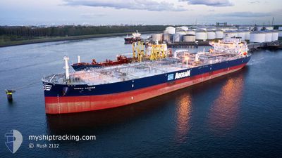
GREEN ADMIRE
Tanker
Current Trip
FOR ORDERS
| Time Travelled | 8 days |
|---|---|
| Remaining Time | --- |
| Distance Travelled | 891.06 nm |
| Remaining Distance | --- |
| AVG Speed | 8.9 Knots |
| MAX Speed | 15.1 Knots |
| AVG Wind | 12.5 knots |
| MAX Wind | 27 knots |
| MIN Temp | 15.1°C / 59.18°F |
| MAX Temp | 29.1°C / 84.38°F |
| Draught | 8.1 m |
| Position Received | 5 d ago |
Current Position
| Longitude | -70.22798° |
|---|---|
| Latitude | 37.24408° |
| Status | Under way using engine |
| Speed | 1.9 Knots |
| Course | 86° |
| Area | North Atlantic Ocean |
| Station | T-AIS |
| Position Received | 5 d ago |
Info
Information
The current position of GREEN ADMIRE is in North Atlantic Ocean with coordinates 37.24408° / -70.22798° as reported on 2024-05-28 00:53 by AIS to our vessel tracker app. The vessel's current speed is 1.9 Knots
The vessel GREEN ADMIRE (IMO: 9927196, MMSI: 636020833) is a Tanker It's sailing under the flag of [LR] Liberia.
In this page you can find informations about the vessels current position, last detected port calls, and current voyage information. If the vessels is not in coverage by AIS you will find the latest position.
The current position of GREEN ADMIRE is detected by our AIS receivers and we are not responsible for the reliability of the data. The last position was recorded while the vessel was in Coverage by the Ais receivers of our vessel tracking app.
The current draught of GREEN ADMIRE as reported by AIS is 8.1 meters
Weather
| Temperature | 16.8°C / 62.24°F |
|---|---|
| Wind Speed | 23 knots |
| Direction | 315° NW |
| Pressure | 1015.1 hPa |
| Humidity | 64.5 % |
| Cloud Coverage | 100 % |
Featured Company
Last Port Calls
| Port | Arrival | Departure | Time In Port |
|---|---|---|---|
| 2024-05-23 17:53 | 2024-05-25 04:56 | 1 d | |
| 2024-04-30 00:21 | 2024-05-02 00:13 | 1 d |
Most Visited Ports (Last year)
| Port | Arrivals | |
|---|---|---|
| 3 | ||
| 2 | ||
| 2 | ||
| 2 | ||
| 1 | ||
| 1 |
Last Trips
| Origin | Departure | Destination | Arrival | Distance | |
|---|---|---|---|---|---|
| 2024-05-01 19:13 | 2024-05-23 13:53 | 3532.21 nm | |||
| 2024-03-18 13:04 | 2024-04-29 19:21 | 4451.32 nm |
Events
| Time | Event | Details | Position / Dest | Info |
|---|---|---|---|---|
| 2024-05-28 01:08 | Status Changed | Default Under way using engine |
37.25212 / -70.22675
FOR ORDERS
|
Speed: 1.9 kn Course: 86° |
| 2024-05-28 00:53 | Status Changed | Under way using engine Default |
37.24408 / -70.22798
FOR ORDERS
|
Speed: 1.9 kn Course: 79° |
| 2024-05-28 00:53 | OUT of Coverage |
37.24408 / -70.22798
North Atlantic Ocean
|
Speed: 1.9 kn Course: 4.5° |
|
| 2024-05-28 00:32 | Status Changed | Default Under way using engine |
37.23291 / -70.22782
FOR ORDERS
|
Speed: 1.9 kn Course: 68° |
| 2024-05-27 20:30 | Status Changed | Under way using engine Default |
37.17596 / -70.30811
FOR ORDERS
|
Speed: 1.7 kn Course: 137° |
| 2024-05-27 20:02 | Status Changed | Default Under way using engine |
37.17324 / -70.32563
FOR ORDERS
|
Speed: 1.7 kn Course: 131° |
| 2024-05-27 19:27 | Status Changed | Under way using engine Default |
37.16872 / -70.34609
FOR ORDERS
|
Speed: 1.7 kn Course: 130° |
| 2024-05-27 19:12 | IN Coverage |
37.16872 / -70.34609
North Atlantic Ocean
|
Speed: 1.6 kn Course: 72.7° |
|
| 2024-05-27 18:31 | Status Changed | Default Under way using engine |
37.15793 / -70.37572
FOR ORDERS
|
Speed: 1.2 kn Course: 131° |
| 2024-05-27 18:12 | OUT of Coverage |
37.15492 / -70.38356
North Atlantic Ocean
|
Speed: 1.2 kn Course: 64.8° |