
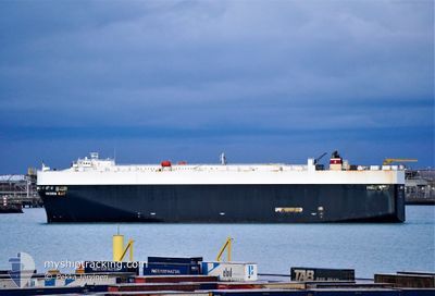
GREEN BAY
Vehicles Carrier
Current Trip
GU GUM
| Time Travelled | 5 days |
|---|---|
| Remaining Time | --- |
| Distance Travelled | 2091.54 nm |
| Remaining Distance | --- |
| AVG Speed | 15.4 Knots |
| MAX Speed | 18.7 Knots |
| AVG Wind | 14.6 knots |
| MAX Wind | 43.8 knots |
| MIN Temp | 21.3°C / 70.34°F |
| MAX Temp | 29.5°C / 85.1°F |
| Draught | 9.3 m |
| Position Received | 5 d ago |
Current Position
| Longitude | 139.81196° |
|---|---|
| Latitude | 34.62396° |
| Status | Moored |
| Speed | 15.2 Knots |
| Course | 170.8° |
| Area | North Pacific Ocean |
| Station | T-AIS |
| Position Received | 5 d ago |
Info
Information
The current position of GREEN BAY is in North Pacific Ocean with coordinates 34.62396° / 139.81196° as reported on 2024-05-28 15:18 by AIS to our vessel tracker app. The vessel's current speed is 15.2 Knots
The vessel GREEN BAY (IMO: 9339818, MMSI: 338009000) is a Vehicles Carrier that was built in 2007 ( 17 years old ). It's sailing under the flag of [US] USA.
In this page you can find informations about the vessels current position, last detected port calls, and current voyage information. If the vessels is not in coverage by AIS you will find the latest position.
The current position of GREEN BAY is detected by our AIS receivers and we are not responsible for the reliability of the data. The last position was recorded while the vessel was in Coverage by the Ais receivers of our vessel tracking app.
The current draught of GREEN BAY as reported by AIS is 9.3 meters
Weather
| Temperature | 29.5°C / 85.1°F |
|---|---|
| Wind Speed | 11 knots |
| Direction | 77° ENE |
| Pressure | 1007.8 hPa |
| Humidity | 73.7 % |
| Cloud Coverage | 78 % |
Featured Company
Last Port Calls
| Port | Arrival | Departure | Time In Port |
|---|---|---|---|
| 2024-05-27 22:59 | 2024-05-28 10:43 | 11 h | |
| 2024-05-26 21:09 | 2024-05-27 09:23 | 12 h | |
| 2024-05-24 21:48 | 2024-05-25 11:32 | 13 h | |
| 2024-05-23 05:56 | 2024-05-24 10:36 | 1 d | |
| 2024-05-20 21:32 | 2024-05-22 05:56 | 1 d | |
| 2024-04-27 01:25 | 2024-04-28 04:33 | 1 d | |
| 2024-04-25 01:14 | 2024-04-25 05:52 | 4 h | |
| 2024-04-22 07:24 | 2024-04-22 19:31 | 12 h | |
| 2024-04-09 23:25 | 2024-04-10 14:52 | 15 h | |
| 2024-04-04 01:13 | 2024-04-04 19:01 | 17 h |
Last Trips
| Origin | Departure | Destination | Arrival | Distance | |
|---|---|---|---|---|---|
| 2024-05-27 18:23 | 2024-05-28 07:59 | 214.57 nm | |||
| 2024-05-25 20:32 | 2024-05-27 06:09 | 432.39 nm | |||
| 2024-05-24 19:36 | 2024-05-25 06:48 | 161.99 nm | |||
| 2024-05-22 14:56 | 2024-05-23 14:56 | 315.96 nm | |||
| 2024-04-27 23:33 | 2024-05-21 06:32 | 8655.49 nm | |||
| 2024-04-25 01:52 | 2024-04-26 20:25 | 663.56 nm | |||
| 2024-04-22 15:31 | 2024-04-24 21:14 | 823.91 nm | |||
| 2024-04-10 11:52 | 2024-04-22 03:24 | 3350.92 nm | |||
| 2024-04-04 16:01 | 2024-04-09 20:25 | 1084.09 nm | |||
| 2024-03-24 03:33 | 2024-04-03 22:13 | 4089.86 nm |
Events
| Time | Event | Details | Position / Dest | Info |
|---|---|---|---|---|
| 2024-06-01 07:22 | START Moving |
13.45887 / 144.66516
GU GUM
|
Speed: 3.1 kn Course: 245° |
|
| 2024-05-31 21:10 | STOP Moving |
13.46027 / 144.66797
GU GUM
|
Speed: 0.2 kn Course: 269° |
|
| 2024-05-28 15:21 | Status Changed | Default Moored |
34.61223 / 139.81485
GU GUM
|
Speed: 15.2 kn Course: 170.8° |
| 2024-05-28 15:18 | OUT of Coverage |
34.62396 / 139.81196
North Pacific Ocean
GU GUM
|
Speed: 15.2 kn Course: 170.8° |
|
| 2024-05-28 14:32 | Status Changed | Moored Default |
34.82160 / 139.76390
GU GUM
|
Speed: 17.7 kn Course: 167° |
| 2024-05-28 13:36 | Status Changed | Default Moored |
35.07764 / 139.70967
GU GUM
|
Speed: 15.2 kn Course: 209.7° |
| 2024-05-28 12:29 | Status Changed | Moored Default |
35.18095 / 139.75270
GU GUM
|
Speed: 10 kn Course: 152° |
| 2024-05-28 12:26 | Status Changed | Default Moored |
35.18705 / 139.74573
GU GUM
|
Speed: 9.3 kn Course: 204.5° |
| 2024-05-28 12:13 | Status Changed | Moored Default |
35.20576 / 139.77188
GU GUM
|
Speed: 9.6 kn Course: 180° |
| 2024-05-28 12:06 | Status Changed | Default Moored |
35.22584 / 139.77237
GU GUM
|
Speed: 11 kn Course: 187.4° |