
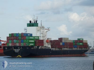
GREEN OCEAN
Cargo
Current Trip
| Time Travelled | 2 days |
|---|---|
| Remaining Time | 2 h, 18 mins |
| Distance Travelled | 937.32 nm |
| Remaining Distance | 34.49 nm |
| AVG Speed | 13.2 Knots |
| MAX Speed | 15.5 Knots |
| AVG Wind | 14.8 knots |
| MAX Wind | 34.7 knots |
| MIN Temp | 11.3°C / 52.34°F |
| MAX Temp | 17.4°C / 63.32°F |
| Draught | 10.1 m |
| Position Received | 2 m ago |
Current Position
| Longitude | -9.10465° |
|---|---|
| Latitude | 41.59605° |
| Status | Under way using engine |
| Speed | 13.6 Knots |
| Course | 158.1° |
| Area | North Atlantic Ocean |
| Station | T-AIS |
| Position Received | 2 m ago |
Info
Information
The current position of GREEN OCEAN is in North Atlantic Ocean with coordinates 41.59605° / -9.10465° as reported on 2024-06-01 13:45 by AIS to our vessel tracker app. The vessel's current speed is 13.6 Knots and is heading at the port of LEIXOES. The estimated time of arrival as calculated by vessel tracking app is 2024-06-01 16:05 LT
The vessel GREEN OCEAN (IMO: 9865960, MMSI: 563095700) is a Cargo It's sailing under the flag of [SG] Singapore.
In this page you can find informations about the vessels current position, last detected port calls, and current voyage information. If the vessels is not in coverage by AIS you will find the latest position.
The current position of GREEN OCEAN is detected by our AIS receivers and we are not responsible for the reliability of the data. The last position was recorded while the vessel was in Coverage by the Ais receivers of our vessel tracking app.
The current draught of GREEN OCEAN as reported by AIS is 10.1 meters
Weather
| Temperature | 17°C / 62.6°F |
|---|---|
| Wind Speed | 12 knots |
| Direction | 342° NNW |
| Pressure | 1014.2 hPa |
| Humidity | 74.4 % |
| Cloud Coverage | --- |
Featured Company
Last Port Calls
| Port | Arrival | Departure | Time In Port |
|---|---|---|---|
| 2024-05-28 08:26 | 2024-05-29 17:46 | 1 d | |
| 2024-05-27 08:22 | 2024-05-28 08:15 | 23 h | |
| 2024-05-24 09:06 | 2024-05-27 06:20 | 2 d | |
| 2024-05-22 17:40 | 2024-05-24 06:45 | 1 d | |
| 2024-05-18 04:12 | 2024-05-18 17:40 | 13 h | |
| 2024-05-15 17:34 | 2024-05-17 01:07 | 1 d | |
| 2024-05-14 05:23 | 2024-05-14 23:31 | 18 h | |
| 2024-05-11 03:34 | 2024-05-11 14:46 | 11 h | |
| 2024-05-09 15:19 | 2024-05-11 03:23 | 1 d | |
| 2024-05-07 12:26 | 2024-05-09 12:50 | 2 d |
Most Visited Ports (Last year)
| Port | Arrivals | |
|---|---|---|
| 47 | ||
| 20 | ||
| 18 | ||
| 17 | ||
| 9 | ||
| 5 |
Last Trips
| Origin | Departure | Destination | Arrival | Distance | |
|---|---|---|---|---|---|
| 2024-05-28 10:15 | 2024-05-28 10:26 | 0.98 nm | |||
| 2024-05-27 08:20 | 2024-05-27 10:22 | 21.87 nm | |||
| 2024-05-24 08:45 | 2024-05-24 11:06 | 22.51 nm | |||
| 2024-05-18 19:40 | 2024-05-22 19:40 | 907.47 nm | |||
| 2024-05-17 02:07 | 2024-05-18 06:12 | 255.27 nm | |||
| 2024-05-15 00:31 | 2024-05-15 18:34 | 209.54 nm | |||
| 2024-05-11 16:46 | 2024-05-14 06:23 | 976.86 nm | |||
| 2024-05-11 05:23 | 2024-05-11 05:34 | 0.85 nm | |||
| 2024-05-09 14:50 | 2024-05-09 17:19 | 22.26 nm | |||
| 2024-05-07 11:56 | 2024-05-07 14:26 | 22.77 nm |
Events
| Time | Event | Details | Position / Dest | Info |
|---|---|---|---|---|
| 2024-06-01 13:12 | Draught Changed | 10.1 10.2 |
41.71217 / -9.16774
PT LEI
|
Speed: 13.7 kn Course: 150.8° |
| 2024-06-01 13:05 | Change Sea Area | Portuguese part of the North Atlantic Ocean French part of the Celtic Sea |
41.73563 / -9.18493
North Atlantic Ocean
PT LEI
|
Speed: 14.1 kn Course: 151.6° |
| 2024-06-01 13:03 | Status Changed | Under way using engine Default |
41.73931 / -9.18744
PT LEI
|
Speed: 14.3 kn Course: 151° |
| 2024-06-01 12:50 | IN Coverage |
41.73563 / -9.18493
North Atlantic Ocean
PT LEI
|
Speed: 14.1 kn Course: 151.6° |
|
| 2024-05-31 05:05 | Status Changed | Default Under way using engine |
48.29446 / -6.29510
PT LEI
|
Speed: 14.1 kn Course: 209.3° |
| 2024-05-31 05:03 | OUT of Coverage |
48.30028 / -6.29036
Celtic Sea
PT LEI
|
Speed: 14.1 kn Course: 209.3° |
|
| 2024-05-31 05:03 | Status Changed | Under way using engine Default |
48.30093 / -6.28980
PT LEI
|
Speed: 14.5 kn Course: 208° |
| 2024-05-31 04:29 | Status Changed | Default Under way using engine |
48.41998 / -6.19120
PT LEI
|
Speed: 14.7 kn Course: 209.5° |
| 2024-05-31 04:16 | Detected in Sea | French part of the Celtic Sea |
48.46642 / -6.15322
Celtic Sea
PT LEI
|
Speed: 14.7 kn Course: 209.5° |
| 2024-05-31 04:16 | Status Changed | Under way using engine Default |
48.46642 / -6.15322
PT LEI
|
Speed: 14.8 kn Course: 208° |