
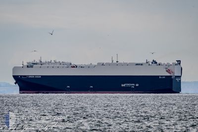
GREEN OCEAN
Cargo
Current Trip
| Time Travelled | 15 days |
|---|---|
| Remaining Time | 1 day |
| Distance Travelled | 6036.63 nm |
| Remaining Distance | 568.82 nm |
| AVG Speed | 15.5 Knots |
| MAX Speed | 22.4 Knots |
| AVG Wind | 10 knots |
| MAX Wind | 20 knots |
| MIN Temp | 18.7°C / 65.66°F |
| MAX Temp | 30.9°C / 87.62°F |
| Draught | 8.3 m |
| Position Received | 23 m ago |
Current Position
| Longitude | 17.89764° |
|---|---|
| Latitude | 36.05002° |
| Status | Under way using engine |
| Speed | 13.3 Knots |
| Course | 89.9° |
| Area | Mediterranean Sea - Eastern Basin |
| Station | T-AIS |
| Position Received | 23 m ago |
Info
Information
The current position of GREEN OCEAN is in Mediterranean Sea - Eastern Basin with coordinates 36.05002° / 17.89764° as reported on 2024-06-21 02:54 by AIS to our vessel tracker app. The vessel's current speed is 13.3 Knots and is heading at the port of THESSALONIKI. The estimated time of arrival as calculated by vessel tracking app is 2024-06-22 22:27 LT
The vessel GREEN OCEAN (IMO: 9981910, MMSI: 369543000) is a Cargo It's sailing under the flag of [US] USA.
In this page you can find informations about the vessels current position, last detected port calls, and current voyage information. If the vessels is not in coverage by AIS you will find the latest position.
The current position of GREEN OCEAN is detected by our AIS receivers and we are not responsible for the reliability of the data. The last position was recorded while the vessel was in Coverage by the Ais receivers of our vessel tracking app.
The current draught of GREEN OCEAN as reported by AIS is 8.3 meters
Weather
| Temperature | 24.9°C / 76.82°F |
|---|---|
| Wind Speed | 9 knots |
| Direction | 353° N |
| Pressure | 1012.6 hPa |
| Humidity | 81.4 % |
| Cloud Coverage | --- |
Featured Company
Last Port Calls
| Port | Arrival | Departure | Time In Port |
|---|---|---|---|
| 2024-05-29 13:53 | 2024-06-05 12:06 | 6 d | |
| 2024-05-13 17:42 | 2024-05-22 19:34 | 9 d | |
| 2024-04-27 13:00 | 2024-04-28 15:53 | 1 d | |
| 2024-04-23 04:47 | 2024-04-27 10:21 | 4 d | |
| 2024-04-04 12:48 |
Most Visited Ports (Last year)
| Port | Arrivals | |
|---|---|---|
| 2 | ||
| 1 | ||
| 1 | ||
| 1 | ||
| 1 | ||
| 1 |
Last Trips
| Origin | Departure | Destination | Arrival | Distance | |
|---|---|---|---|---|---|
| 2024-05-22 14:34 | 2024-05-29 08:53 | 293.48 nm | |||
| 2024-04-28 17:53 | 2024-05-13 12:42 | 5975.46 nm | |||
| 2024-04-27 12:21 | 2024-04-27 15:00 | 5.47 nm | |||
| 2024-04-04 08:48 | 2024-04-23 06:47 | 5547.86 nm |
Events
| Time | Event | Details | Position / Dest | Info |
|---|---|---|---|---|
| 2024-06-21 02:59 | Status Changed | Default Under way using engine |
36.05001 / 17.92186
GRSKG
|
Speed: 13.3 kn Course: 89.9° |
| 2024-06-21 00:56 | Status Changed | Under way using engine Default |
36.04989 / 17.36846
GRSKG
|
Speed: 12.9 kn Course: 90° |
| 2024-06-21 00:49 | Status Changed | Default Under way using engine |
36.04980 / 17.33738
GRSKG
|
Speed: 12.9 kn Course: 90.4° |
| 2024-06-20 22:33 | Detected in Sea | Italian part of the Mediterranean Sea - Eastern Basin |
36.04999 / 16.72724
Mediterranean Sea - Eastern Basin
GRSKG
|
Speed: 13.2 kn Course: 90.1° |
| 2024-06-20 22:33 | Status Changed | Under way using engine Default |
36.04999 / 16.72724
GRSKG
|
Speed: 13.5 kn Course: 90° |
| 2024-06-20 22:33 | IN Coverage |
36.04999 / 16.72724
Mediterranean Sea - Eastern Basin
GRSKG
|
Speed: 13.2 kn Course: 90.1° |
|
| 2024-06-20 17:04 | Status Changed | Default Under way using engine |
36.07439 / 15.19147
GRSKG
|
Speed: 13.3 kn Course: 94.6° |
| 2024-06-20 16:53 | OUT of Coverage |
36.07730 / 15.14230
Mediterranean Sea - Eastern Basin
GRSKG
|
Speed: 13.3 kn Course: 94.6° |
|
| 2024-06-20 10:59 | ETA Changed | 2024/06/23 14:00 2024/06/23 10:30 |
36.47581 / 13.63948
GRSKG
|
Speed: 13.3 kn Course: 137.8° |
| 2024-06-20 10:50 | Change Sea Area | Maltese part of the Mediterranean Sea - Eastern Basin Italian part of the Mediterranean Sea - Eastern Basin |
36.50110 / 13.61121
Mediterranean Sea - Eastern Basin
GRSKG
|
Speed: 12.6 kn Course: 132.1° |