
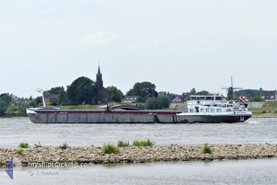
GREVELINGEN
Wing in ground
Current Trip
WEURT
| Time Travelled | 16 h, 22 mins |
|---|---|
| Remaining Time | --- |
| Distance Travelled | 19.93 nm |
| Remaining Distance | --- |
| AVG Speed | 6.2 Knots |
| MAX Speed | 7.2 Knots |
| AVG Wind | 6.2 knots |
| MAX Wind | 8.6 knots |
| MIN Temp | 13.8°C / 56.84°F |
| MAX Temp | 18.5°C / 65.3°F |
| Draught | 0 m |
| Position Received | 2 m ago |
Current Position
| Longitude | 6.13966° |
|---|---|
| Latitude | 51.85062° |
| Status | Moored |
| Speed | |
| Course | --- |
| Area | North Sea |
| Station | T-AIS |
| Position Received | 2 m ago |
Info
Information
The current position of GREVELINGEN is in North Sea with coordinates 51.85062° / 6.13966° as reported on 2024-06-29 09:54 by AIS to our vessel tracker app. The vessel's current speed is 0 Knots
The vessel GREVELINGEN (MMSI: 244710011) is a Wing in ground It's sailing under the flag of [NL] Netherlands.
In this page you can find informations about the vessels current position, last detected port calls, and current voyage information. If the vessels is not in coverage by AIS you will find the latest position.
The current position of GREVELINGEN is detected by our AIS receivers and we are not responsible for the reliability of the data. The last position was recorded while the vessel was in Coverage by the Ais receivers of our vessel tracking app.
Weather
| Temperature | 20.1°C / 68.18°F |
|---|---|
| Wind Speed | 4 knots |
| Direction | 58° ENE |
| Pressure | 1015.7 hPa |
| Humidity | 67.4 % |
| Cloud Coverage | 82 % |
Featured Company
Last Port Calls
| Port | Arrival | Departure | Time In Port |
|---|---|---|---|
| 2024-06-28 16:52 | 2024-06-28 17:35 | 42 m | |
| 2024-06-27 04:28 | 2024-06-27 04:41 | 12 m | |
| 2024-06-26 18:46 | 2024-06-26 21:42 | 2 h | |
| 2024-06-25 20:03 | 2024-06-25 23:16 | 3 h | |
| 2024-06-24 02:59 | 2024-06-24 13:12 | 10 h | |
| 2024-06-21 01:18 | 2024-06-21 12:51 | 11 h | |
| 2024-06-19 17:59 | 2024-06-20 14:26 | 20 h | |
| 2024-06-18 13:39 | 2024-06-19 11:48 | 22 h | |
| 2024-06-17 19:31 | 2024-06-18 05:15 | 9 h | |
| 2024-06-17 16:46 | 2024-06-17 18:00 | 1 h |
Last Trips
| Origin | Departure | Destination | Arrival | Distance | |
|---|---|---|---|---|---|
| 2024-06-27 06:41 | 2024-06-28 18:52 | 84.93 nm | |||
| 2024-06-26 23:42 | 2024-06-27 06:28 | 44.58 nm | |||
| 2024-06-26 01:16 | 2024-06-26 20:46 | 31.66 nm | |||
| 2024-06-24 15:12 | 2024-06-25 22:03 | 132.17 nm | |||
| 2024-06-21 14:51 | 2024-06-24 04:59 | 58.50 nm | |||
| 2024-06-20 16:26 | 2024-06-21 03:18 | 57.50 nm | |||
| 2024-06-19 13:48 | 2024-06-19 19:59 | 41.99 nm | |||
| 2024-06-18 07:15 | 2024-06-18 15:39 | 46.41 nm | |||
| 2024-06-17 20:00 | 2024-06-17 21:31 | 11.04 nm | |||
| 2024-06-17 18:38 | 2024-06-17 18:46 | 0.58 nm |
Events
| Time | Event | Details | Position / Dest | Info |
|---|---|---|---|---|
| 2024-06-28 20:49 | Status Changed | Moored Under way using engine |
51.85068 / 6.13905
WEURT
|
Speed: 0.1 kn Course: 511° |
| 2024-06-28 20:48 | STOP Moving | 1.31 nm, East of TOLKAMER |
51.85064 / 6.13902
WEURT
|
Speed: 0.3 kn Course: 511° |
| 2024-06-28 17:35 | PORT DEPARTURE |
|
52.00493 / 6.11645
WEURT
|
Speed: 6.1 kn Course: 236.9° |
| 2024-06-28 17:28 | START Moving |
52.01322 / 6.12752
[NL] DOESBURG
|
Speed: 6 kn Course: 183° |
|
| 2024-06-28 17:27 | Status Changed | Under way using engine Moored |
52.01482 / 6.12782
[NL] DOESBURG
|
Speed: 1.4 kn Course: 511° |
| 2024-06-28 16:55 | Status Changed | Moored Under way using engine |
52.01511 / 6.12796
[NL] DOESBURG
|
Speed: Course: 511° |
| 2024-06-28 16:52 | STOP Moving |
52.01503 / 6.12790
[NL] DOESBURG
|
Speed: 0.1 kn Course: 511° |
|
| 2024-06-28 16:52 | PORT ARRIVAL |
|
52.01503 / 6.12790
[NL] DOESBURG
|
Speed: 1.2 kn Course: 511° |
| 2024-06-28 15:21 | IN Coverage |
52.11664 / 6.18750
North Sea
|
Speed: 5.9 kn Course: 139.9° |
|
| 2024-06-27 17:17 | OUT of Coverage |
52.11395 / 6.19395
North Sea
|
Speed: 7.6 kn Course: 276.6° |