
GRUMANT
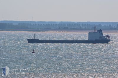
Bulk Carrier
Current Trip
| Time Travelled | --- |
|---|---|
| Remaining Time | --- |
| Distance Travelled | 2093.54 nm |
| Remaining Distance | --- |
| AVG Speed | 9 Knots |
| MAX Speed | 9 Knots |
| AVG Wind | 12 knots |
| MAX Wind | 28 knots |
| MIN Temp | 10.4°C / 50.72°F |
| MAX Temp | 20.5°C / 68.9°F |
| Draught | 6.5 m |
| Position Received | Now |
Current Position
| Longitude | 25.75999° |
|---|---|
| Latitude | 38.57238° |
| Status | Under way using engine |
| Speed | 9.6 Knots |
| Course | 1.5° |
| Area | Aegean Sea |
| Station | T-AIS |
| Position Received | Now |
Info
Information
The current position of GRUMANT is in Aegean Sea with coordinates 38.57238° / 25.75999° as reported on 2024-06-06 11:23 by AIS to our vessel tracker app. The vessel's current speed is 9.6 Knots and is heading at the port of KAVKAZ. The estimated time of arrival as calculated by vessel tracking app is 2024-06-09 12:00 LT
The vessel GRUMANT (IMO: 9385879, MMSI: 273318940) is a Bulk Carrier that was built in 2006 ( 18 years old ). It's sailing under the flag of [RU] Russia.
In this page you can find informations about the vessels current position, last detected port calls, and current voyage information. If the vessels is not in coverage by AIS you will find the latest position.
The current position of GRUMANT is detected by our AIS receivers and we are not responsible for the reliability of the data. The last position was recorded while the vessel was in Coverage by the Ais receivers of our vessel tracking app.
The current draught of GRUMANT as reported by AIS is 6.5 meters
Weather
| Temperature | 23.1°C / 73.58°F |
|---|---|
| Wind Speed | 15 knots |
| Direction | 1° N |
| Pressure | 1013.2 hPa |
| Humidity | 77.2 % |
| Cloud Coverage | 23 % |
Featured Company
Last Port Calls
Most Visited Ports (Last year)
| Port | Arrivals | |
|---|---|---|
| 4 | ||
| 2 | ||
| 1 | ||
| 1 |
Last Trips
| Origin | Departure | Destination | Arrival | Distance |
|---|
Events
| Time | Event | Details | Position / Dest | Info |
|---|---|---|---|---|
| 2024-06-05 20:50 | IN Coverage |
36.50167 / 26.81078
Aegean Sea
KAVKAZ
|
Speed: 9.6 kn Course: 312.8° |
|
| 2024-06-05 19:40 | OUT of Coverage |
36.37190 / 26.98952
Aegean Sea
KAVKAZ
|
Speed: 9.2 kn Course: 313° |
|
| 2024-06-05 14:44 | Detected in Sea | Greek part of the Aegean Sea |
35.84246 / 27.67196
Aegean Sea
KAVKAZ
|
Speed: 9.2 kn Course: 314.7° |
| 2024-06-05 07:37 | Change Sea Area | Greek part of the Mediterranean Sea - Eastern Basin Turkish part of the Mediterranean Sea - Eastern Basin |
35.49652 / 28.83517
Mediterranean Sea - Eastern Basin
KAVKAZ
|
Speed: 9.9 kn Course: 284.6° |
| 2024-06-05 06:55 | Detected in Sea | Turkish part of the Mediterranean Sea - Eastern Basin |
35.46452 / 28.97180
Mediterranean Sea - Eastern Basin
KAVKAZ
|
Speed: 9.7 kn Course: 287° |
| 2024-06-05 00:58 | Detected in Sea | Greek part of the Mediterranean Sea - Eastern Basin |
35.16147 / 30.11764
Mediterranean Sea - Eastern Basin
KAVKAZ
|
Speed: 9.9 kn Course: 287.9° |
| 2024-06-04 23:41 | Status Changed | Under way using engine Default |
35.09205 / 30.36737
KAVKAZ
|
Speed: 9.9 kn Course: 289° |
| 2024-06-04 23:33 | Status Changed | Default Under way using engine |
35.08509 / 30.39208
KAVKAZ
|
Speed: 9.9 kn Course: 288.8° |
| 2024-06-04 23:07 | Status Changed | Under way using engine Default |
35.06381 / 30.47585
KAVKAZ
|
Speed: 9.9 kn Course: 286° |
| 2024-06-04 23:01 | Status Changed | Default Under way using engine |
35.05866 / 30.49692
KAVKAZ
|
Speed: 10.3 kn Course: 284.8° |