
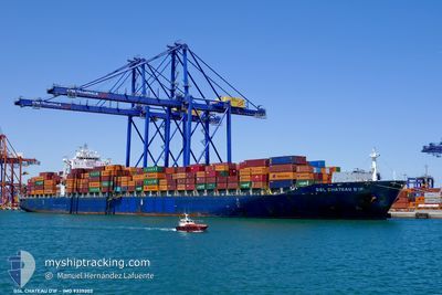
GSL CHATEAU DIF
Container Ship
Current Trip
| Time Travelled | 1 h, 52 mins |
|---|---|
| Remaining Time | 19 h, 25 mins |
| Distance Travelled | 27.48 nm |
| Remaining Distance | 223.73 nm |
| AVG Speed | 11.6 Knots |
| MAX Speed | 12.1 Knots |
| AVG Wind | 3.8 knots |
| MAX Wind | 4.6 knots |
| MIN Temp | 22.7°C / 72.86°F |
| MAX Temp | 23.1°C / 73.58°F |
| Draught | 11.2 m |
| Position Received | 18 m ago |
Current Position
| Longitude | 35.22018° |
|---|---|
| Latitude | 33.95215° |
| Status | Under way using engine |
| Speed | 11.8 Knots |
| Course | 265° |
| Area | Mediterranean Sea - Eastern Basin |
| Station | T-AIS |
| Position Received | 18 m ago |
Info
Information
The current position of GSL CHATEAU DIF is in Mediterranean Sea - Eastern Basin with coordinates 33.95215° / 35.22018° as reported on 2024-05-19 22:09 by AIS to our vessel tracker app. The vessel's current speed is 11.8 Knots and is heading at the port of PORT SAID. The estimated time of arrival as calculated by vessel tracking app is 2024-05-20 17:53 LT
The vessel GSL CHATEAU DIF (IMO: 9335202, MMSI: 215640000) is a Container Ship that was built in 2007 ( 17 years old ). It's sailing under the flag of [MT] Malta.
In this page you can find informations about the vessels current position, last detected port calls, and current voyage information. If the vessels is not in coverage by AIS you will find the latest position.
The current position of GSL CHATEAU DIF is detected by our AIS receivers and we are not responsible for the reliability of the data. The last position was recorded while the vessel was in Coverage by the Ais receivers of our vessel tracking app.
The current draught of GSL CHATEAU DIF as reported by AIS is 11.2 meters
Weather
| Temperature | 22.7°C / 72.86°F |
|---|---|
| Wind Speed | 4 knots |
| Direction | 245° WSW |
| Pressure | 1010 hPa |
| Humidity | 70.9 % |
| Cloud Coverage | 22 % |
Featured Company
Last Port Calls
| Port | Arrival | Departure | Time In Port |
|---|---|---|---|
| 2024-05-19 03:25 | 2024-05-19 20:36 | 17 h | |
| 2024-05-17 11:16 | 2024-05-18 08:20 | 21 h | |
| 2024-05-15 10:40 | |||
| 2024-05-13 19:18 | 2024-05-14 05:02 | 9 h | |
| 2024-05-12 14:29 | 2024-05-13 00:25 | 9 h | |
| 2024-05-09 08:48 | 2024-05-10 15:47 | 1 d | |
| 2024-04-30 17:58 | 2024-05-02 13:38 | 1 d | |
| 2024-04-28 05:15 | 2024-04-29 05:04 | 23 h | |
| 2024-04-26 01:16 | 2024-04-27 15:15 | 1 d | |
| 2024-04-23 10:30 | 2024-04-24 20:36 | 1 d |
Most Visited Ports (Last year)
| Port | Arrivals | |
|---|---|---|
| 11 | ||
| 10 | ||
| 9 | ||
| 9 | ||
| 9 | ||
| 9 |
Last Trips
| Origin | Departure | Destination | Arrival | Distance | |
|---|---|---|---|---|---|
| 2024-05-18 11:20 | 2024-05-19 06:25 | 220.53 nm | |||
| 2024-05-14 07:02 | 2024-05-15 13:40 | 362.80 nm | |||
| 2024-05-13 02:25 | 2024-05-13 21:18 | 172.57 nm | |||
| 2024-05-10 17:47 | 2024-05-12 16:29 | 817.03 nm | |||
| 2024-05-02 15:38 | 2024-05-09 10:48 | 2264.70 nm | |||
| 2024-04-29 07:04 | 2024-04-30 19:58 | 273.27 nm | |||
| 2024-04-27 17:15 | 2024-04-28 07:15 | 118.60 nm | |||
| 2024-04-24 22:36 | 2024-04-26 03:16 | 405.13 nm | |||
| 2024-04-22 11:15 | 2024-04-23 12:30 | 380.70 nm | |||
| 2024-04-15 22:36 | 2024-04-21 03:59 | 1378.00 nm |
Events
| Time | Event | Details | Position / Dest | Info |
|---|---|---|---|---|
| 2024-05-19 21:26 | START Moving | 7.5 nm, West of BEIRUT |
33.95057 / 35.39207
EGPSD
|
Speed: 12.1 kn Course: 270° |
| 2024-05-19 21:09 | STOP Moving | 6.14 nm, South of BEIRUT |
33.81825 / 35.49080
EGPSD
|
Speed: Course: 269° |
| 2024-05-19 21:07 | Draught Changed | 11.2 11.7 |
33.94187 / 35.55048
EGPSD
|
Speed: 10.1 kn Course: 330° |
| 2024-05-19 21:07 | ETA Changed | 2024/05/20 20:00 2024/05/20 12:00 |
33.94187 / 35.55048
EGPSD
|
Speed: 10.1 kn Course: 330° |
| 2024-05-19 20:45 | Status Changed | Under way using engine Default |
33.94078 / 35.55117
EGPSD
|
Speed: 11.1 kn Course: 355° |
| 2024-05-19 20:45 | IN Coverage |
33.94187 / 35.55048
Mediterranean Sea - Eastern Basin
EGPSD
|
Speed: 10.1 kn Course: 330° |
|
| 2024-05-19 20:36 | PORT DEPARTURE |
|
33.91611 / 35.54598
EGPSD
|
Speed: 2.7 kn Course: 22° |
| 2024-05-19 20:29 | START Moving |
33.91080 / 35.54173
[LB] BEIRUT
|
Speed: 31.5 kn Course: 53° |
|
| 2024-05-19 15:54 | Status Changed | Default Moored |
33.90893 / 35.53878
[LB] BEIRUT
|
Speed: Course: 94° |
| 2024-05-19 15:49 | OUT of Coverage |
33.90895 / 35.53887
Mediterranean Sea - Eastern Basin
[LB] BEIRUT
|
Speed: Course: 100° |