
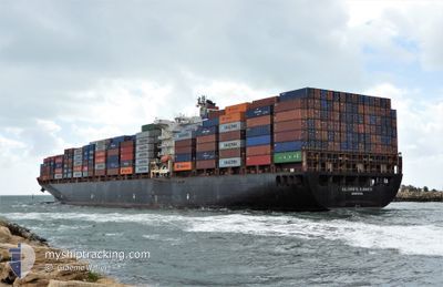
GSL CHRISTEL ELISABE
Container Ship
Current Trip
| Time Travelled | 12 days |
|---|---|
| Remaining Time | --- |
| Distance Travelled | 4210.71 nm |
| Remaining Distance | --- |
| AVG Speed | 13.6 Knots |
| MAX Speed | 17.6 Knots |
| AVG Wind | 12 knots |
| MAX Wind | 22.9 knots |
| MIN Temp | 14.1°C / 57.38°F |
| MAX Temp | 29.9°C / 85.82°F |
| Draught | 10.8 m |
| Position Received | 8 d ago |
Current Position
| Longitude | 145.62985° |
|---|---|
| Latitude | -16.40618° |
| Status | Under way using engine |
| Speed | 16.1 Knots |
| Course | 341.6° |
| Area | Coral Sea |
| Station | T-AIS |
| Position Received | 8 d ago |
Info
Information
The current position of GSL CHRISTEL ELISABE is in Coral Sea with coordinates -16.40618° / 145.62985° as reported on 2024-06-08 01:19 by AIS to our vessel tracker app. The vessel's current speed is 16.1 Knots and is heading at the port of TORRES. The estimated time of arrival as calculated by vessel tracking app is 2024-06-08 00:00 LT
The vessel GSL CHRISTEL ELISABE (IMO: 9280641, MMSI: 636015685) is a Container Ship that was built in 2004 ( 20 years old ). It's sailing under the flag of [LR] Liberia.
In this page you can find informations about the vessels current position, last detected port calls, and current voyage information. If the vessels is not in coverage by AIS you will find the latest position.
The current position of GSL CHRISTEL ELISABE is detected by our AIS receivers and we are not responsible for the reliability of the data. The last position was recorded while the vessel was in Coverage by the Ais receivers of our vessel tracking app.
The current draught of GSL CHRISTEL ELISABE as reported by AIS is 10.8 meters
Weather
| Temperature | 29°C / 84.2°F |
|---|---|
| Wind Speed | 8 knots |
| Direction | 207° SSW |
| Pressure | 1010.4 hPa |
| Humidity | 73.1 % |
| Cloud Coverage | 100 % |
Featured Company
Last Port Calls
| Port | Arrival | Departure | Time In Port |
|---|---|---|---|
| 2024-06-01 05:32 | 2024-06-04 01:19 | 2 d | |
| 2024-05-28 07:18 | 2024-05-30 14:06 | 2 d | |
| 2024-05-14 18:38 | 2024-05-15 12:19 | 17 h | |
| 2024-05-12 00:46 | 2024-05-14 01:05 | 2 d | |
| 2024-05-09 06:20 | 2024-05-10 10:48 | 1 d | |
| 2024-04-25 00:24 | 2024-04-29 16:44 | 4 d | |
| 2024-04-19 23:15 | 2024-04-23 01:27 | 3 d | |
| 2024-04-05 19:18 | 2024-04-07 04:03 | 1 d | |
| 2024-04-04 00:34 | 2024-04-05 18:38 | 1 d | |
| 2024-04-02 06:21 | 2024-04-03 01:13 | 18 h |
Most Visited Ports (Last year)
| Port | Arrivals | |
|---|---|---|
| 16 | ||
| 13 | ||
| 8 | ||
| 6 |
Last Trips
| Origin | Departure | Destination | Arrival | Distance | |
|---|---|---|---|---|---|
| 2024-05-31 00:06 | 2024-06-01 15:32 | 562.57 nm | |||
| 2024-05-15 20:19 | 2024-05-28 17:18 | 3853.52 nm | |||
| 2024-05-14 09:05 | 2024-05-15 02:38 | 7.22 nm | |||
| 2024-05-10 18:48 | 2024-05-12 08:46 | 165.10 nm | |||
| 2024-04-30 02:44 | 2024-05-09 14:20 | 3880.87 nm | |||
| 2024-04-23 11:27 | 2024-04-25 10:24 | 555.76 nm | |||
| 2024-04-07 12:03 | 2024-04-20 09:15 | 4817.49 nm | |||
| 2024-04-06 02:38 | 2024-04-06 03:18 | 2.78 nm | |||
| 2024-04-03 09:13 | 2024-04-04 08:34 | 56.10 nm | |||
| 2024-03-22 18:52 | 2024-04-02 14:21 | 3885.58 nm |
Events
| Time | Event | Details | Position / Dest | Info |
|---|---|---|---|---|
| 2024-06-16 15:05 | STOP Moving |
1.54167 / 104.81167
TORRES STRAIT
|
Speed: Course: -1° |
|
| 2024-06-08 01:24 | Status Changed | Default Under way using engine |
-16.38392 / 145.62219
TORRES STRAIT
|
Speed: 16.1 kn Course: 341.6° |
| 2024-06-08 01:19 | OUT of Coverage |
-16.40618 / 145.62985
Coral Sea
TORRES STRAIT
|
Speed: 16.1 kn Course: 341.6° |
|
| 2024-06-08 01:11 | Status Changed | Under way using engine Default |
-16.44213 / 145.64232
TORRES STRAIT
|
Speed: 16.1 kn Course: 342° |
| 2024-06-08 01:08 | Status Changed | Default Under way using engine |
-16.45237 / 145.64587
TORRES STRAIT
|
Speed: 16.1 kn Course: 341.2° |
| 2024-06-07 22:09 | Status Changed | Under way using engine Default |
-16.87658 / 146.03372
TORRES STRAIT
|
Speed: 10.5 kn Course: 317° |
| 2024-06-07 22:08 | Status Changed | Default Under way using engine |
-16.87827 / 146.03549
TORRES STRAIT
|
Speed: 11.1 kn Course: 346° |
| 2024-06-07 18:42 | Status Changed | Under way using engine Default |
-17.49441 / 146.21453
TORRES STRAIT
|
Speed: 14.4 kn Course: 344° |
| 2024-06-07 18:40 | Status Changed | Default Under way using engine |
-17.50212 / 146.21683
TORRES STRAIT
|
Speed: 14.4 kn Course: 344° |
| 2024-06-07 18:40 | Status Changed | Under way using engine Default |
-17.50290 / 146.21705
TORRES STRAIT
|
Speed: 14.5 kn Course: 344° |