
GSL MYNY
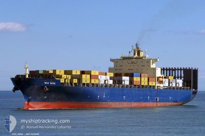
Container Ship
Current Trip
| Time Travelled | 10 days |
|---|---|
| Remaining Time | --- |
| Distance Travelled | 4626.23 nm |
| Remaining Distance | --- |
| AVG Speed | 18.2 Knots |
| MAX Speed | 20.2 Knots |
| AVG Wind | 12.3 knots |
| MAX Wind | 24.8 knots |
| MIN Temp | 12°C / 53.6°F |
| MAX Temp | 28.8°C / 83.84°F |
| Draught | 14.3 m |
| Position Received | 8 d ago |
Current Position
| Longitude | -13.55771° |
|---|---|
| Latitude | 28.09831° |
| Status | Under way using engine |
| Speed | 19.5 Knots |
| Course | 220.6° |
| Area | North Atlantic Ocean |
| Station | T-AIS |
| Position Received | 8 d ago |
Info
Information
The current position of GSL MYNY is in North Atlantic Ocean with coordinates 28.09831° / -13.55771° as reported on 2024-05-20 10:03 by AIS to our vessel tracker app. The vessel's current speed is 19.5 Knots and is heading at the port of SALALAH. The estimated time of arrival as calculated by vessel tracking app is 2024-06-09 08:00 LT
The vessel GSL MYNY (IMO: 9213583, MMSI: 636020773) is a Container Ship that was built in 2000 ( 24 years old ). It's sailing under the flag of [LR] Liberia.
In this page you can find informations about the vessels current position, last detected port calls, and current voyage information. If the vessels is not in coverage by AIS you will find the latest position.
The current position of GSL MYNY is detected by our AIS receivers and we are not responsible for the reliability of the data. The last position was recorded while the vessel was in Coverage by the Ais receivers of our vessel tracking app.
The current draught of GSL MYNY as reported by AIS is 14.3 meters
Weather
| Temperature | 18.2°C / 64.76°F |
|---|---|
| Wind Speed | 11 knots |
| Direction | 283° WNW |
| Pressure | 1015.7 hPa |
| Humidity | 88.2 % |
| Cloud Coverage | 7 % |
Featured Company
Last Port Calls
| Port | Arrival | Departure | Time In Port |
|---|---|---|---|
| 2024-05-18 10:44 | 2024-05-19 00:21 | 13 h | |
| 2024-05-14 04:54 | 2024-05-15 05:49 | 1 d | |
| 2024-05-03 16:16 | 2024-05-05 04:40 | 1 d | |
| 2024-04-04 05:15 | 2024-04-05 06:51 | 1 d | |
| 2024-04-02 21:14 | 2024-04-03 03:44 | 6 h | |
| 2024-03-31 16:14 | 2024-04-01 06:10 | 13 h | |
| 2024-03-30 06:06 | 2024-03-31 10:30 | 1 d | |
| 2024-03-27 12:48 | 2024-03-28 03:03 | 14 h | |
| 2024-03-26 00:05 | 2024-03-27 01:55 | 1 d | |
| 2024-03-21 07:39 | 2024-03-22 16:41 | 1 d |
Last Trips
| Origin | Departure | Destination | Arrival | Distance | |
|---|---|---|---|---|---|
| 2024-05-15 07:49 | 2024-05-18 12:44 | 591.94 nm | |||
| 2024-04-05 10:51 | 2024-05-14 06:54 | 13023.96 nm | |||
| 2024-04-05 10:51 | 2024-05-03 18:16 | 11326.90 nm | |||
| 2024-04-03 07:44 | 2024-04-04 09:15 | 366.56 nm | |||
| 2024-04-01 10:10 | 2024-04-03 01:14 | 740.83 nm | |||
| 2024-03-31 14:30 | 2024-03-31 20:14 | 55.07 nm | |||
| 2024-03-28 06:03 | 2024-03-30 10:06 | 346.79 nm | |||
| 2024-03-27 04:55 | 2024-03-27 15:48 | 107.37 nm | |||
| 2024-03-22 20:41 | 2024-03-26 03:05 | 580.88 nm | |||
| 2024-02-24 07:35 | 2024-03-21 11:39 | 9883.36 nm |
Events
| Time | Event | Details | Position / Dest | Info |
|---|---|---|---|---|
| 2024-05-20 10:13 | Status Changed | Default Under way using engine |
28.05585 / -13.59892
OM SLV
|
Speed: 19.5 kn Course: 220.6° |
| 2024-05-20 10:03 | OUT of Coverage |
28.09831 / -13.55771
North Atlantic Ocean
OM SLV
|
Speed: 19.5 kn Course: 220.6° |
|
| 2024-05-20 09:58 | Change Sea Area | Spanish (Canary Islands) part of the North Atlantic Ocean Moroccan part of the North Atlantic Ocean |
28.11608 / -13.54047
North Atlantic Ocean
OM SLV
|
Speed: 19.6 kn Course: 220.9° |
| 2024-05-20 09:55 | Status Changed | Under way using engine Default |
28.12767 / -13.52919
OM SLV
|
Speed: 19.5 kn Course: 220° |
| 2024-05-20 09:40 | IN Coverage |
28.11608 / -13.54047
North Atlantic Ocean
OM SLV
|
Speed: 19.6 kn Course: 220.9° |