
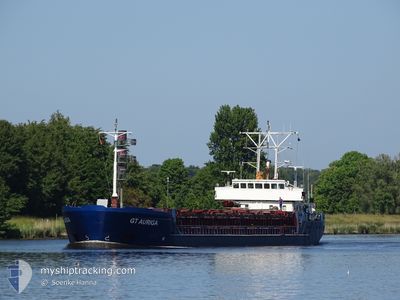
GT AURIGA
General Cargo
Current Trip
| Time Travelled | 5 days |
|---|---|
| Remaining Time | --- |
| Distance Travelled | 1138.20 nm |
| Remaining Distance | --- |
| AVG Speed | 8.2 Knots |
| MAX Speed | 12.6 Knots |
| AVG Wind | 9 knots |
| MAX Wind | 23 knots |
| MIN Temp | 10.7°C / 51.26°F |
| MAX Temp | 18.9°C / 66.02°F |
| Draught | 5.6 m |
| Position Received | 5 h, 35 m ago |
Current Position
| Longitude | -5.88546° |
|---|---|
| Latitude | 50.30813° |
| Status | Under way using engine |
| Speed | 8.4 Knots |
| Course | 354.1° |
| Area | Celtic Sea |
| Station | T-AIS |
| Position Received | 5 h, 35 m ago |
Info
Information
The current position of GT AURIGA is in Celtic Sea with coordinates 50.30813° / -5.88546° as reported on 2024-05-28 23:54 by AIS to our vessel tracker app. The vessel's current speed is 8.4 Knots and is heading at the port of FOYNES. The estimated time of arrival as calculated by vessel tracking app is 2024-05-30 02:00 LT
The vessel GT AURIGA (IMO: 9041318, MMSI: 304010285) is a General Cargo that was built in 1993 ( 31 years old ). It's sailing under the flag of [AG] Antigua Barbuda.
In this page you can find informations about the vessels current position, last detected port calls, and current voyage information. If the vessels is not in coverage by AIS you will find the latest position.
The current position of GT AURIGA is detected by our AIS receivers and we are not responsible for the reliability of the data. The last position was recorded while the vessel was in Coverage by the Ais receivers of our vessel tracking app.
The current draught of GT AURIGA as reported by AIS is 5.6 meters
Weather
| Temperature | 13.4°C / 56.12°F |
|---|---|
| Wind Speed | 13 knots |
| Direction | 287° WNW |
| Pressure | 1011.2 hPa |
| Humidity | 84.6 % |
| Cloud Coverage | 24 % |
Featured Company
Last Port Calls
| Port | Arrival | Departure | Time In Port |
|---|---|---|---|
| 2024-05-21 15:00 | 2024-05-23 18:03 | 2 d | |
| 2024-05-17 21:01 | 2024-05-19 05:27 | 1 d | |
| 2024-05-14 23:24 | 2024-05-15 11:10 | 11 h | |
| 2024-05-10 02:29 | 2024-05-12 11:45 | 2 d | |
| 2024-05-09 08:16 | 2024-05-09 23:58 | 15 h | |
| 2024-05-04 20:39 | 2024-05-06 18:04 | 1 d | |
| 2024-04-28 10:24 | 2024-04-29 19:06 | 1 d | |
| 2024-04-21 15:54 | |||
| 2024-04-14 18:30 | 2024-04-15 13:30 | 18 h | |
| 2024-04-13 19:26 | 2024-04-13 23:54 | 4 h |
Last Trips
| Origin | Departure | Destination | Arrival | Distance | |
|---|---|---|---|---|---|
| 2024-05-19 08:27 | 2024-05-21 17:00 | 109.60 nm | |||
| 2024-05-15 13:10 | 2024-05-18 00:01 | 500.44 nm | |||
| 2024-05-12 13:45 | 2024-05-15 01:24 | 149.07 nm | |||
| 2024-05-10 01:58 | 2024-05-10 04:29 | 25.92 nm | |||
| 2024-05-06 20:04 | 2024-05-09 10:16 | 538.47 nm | |||
| 2024-04-29 20:06 | 2024-05-04 22:39 | 633.94 nm | |||
| 2024-04-21 17:54 | 2024-04-28 11:24 | 1393.84 nm | |||
| 2024-04-14 01:54 | 2024-04-14 20:30 | 132.13 nm | |||
| 2024-04-06 16:41 | 2024-04-13 21:26 | 1013.80 nm | |||
| 2024-04-04 15:34 | 2024-04-05 16:40 | 215.64 nm |
Events
| Time | Event | Details | Position / Dest | Info |
|---|---|---|---|---|
| 2024-05-29 00:00 | Status Changed | Default Under way using engine |
50.32103 / -5.88774
IEFOV
|
Speed: 8.4 kn Course: 354.1° |
| 2024-05-28 23:54 | Detected in Sea | United Kingdom part of the Celtic Sea |
50.30813 / -5.88547
Celtic Sea
IEFOV
|
Speed: 8.4 kn Course: 354.1° |
| 2024-05-28 23:54 | Status Changed | Under way using engine Default |
50.30813 / -5.88547
IEFOV
|
Speed: 8.3 kn Course: 359° |
| 2024-05-28 23:54 | OUT of Coverage |
50.30813 / -5.88547
Celtic Sea
IEFOV
|
Speed: 8.4 kn Course: 354.1° |
|
| 2024-05-28 23:52 | IN Coverage |
50.30813 / -5.88547
Celtic Sea
IEFOV
|
Speed: 8.4 kn Course: 354.1° |
|
| 2024-05-28 19:55 | Status Changed | Default Under way using engine |
49.94172 / -5.54473
IEFOV
|
Speed: 7.7 kn Course: 287.7° |
| 2024-05-28 19:51 | OUT of Coverage |
49.93910 / -5.53201
English Channel
IEFOV
|
Speed: 7.7 kn Course: 287.7° |
|
| 2024-05-28 19:51 | Status Changed | Under way using engine Default |
49.93866 / -5.52997
IEFOV
|
Speed: 7.4 kn Course: 286° |
| 2024-05-28 19:28 | Status Changed | Default Under way using engine |
49.92475 / -5.46077
IEFOV
|
Speed: 7.7 kn Course: 286.6° |
| 2024-05-28 19:22 | Status Changed | Under way using engine Default |
49.92138 / -5.44340
IEFOV
|
Speed: 7.3 kn Course: 288° |