
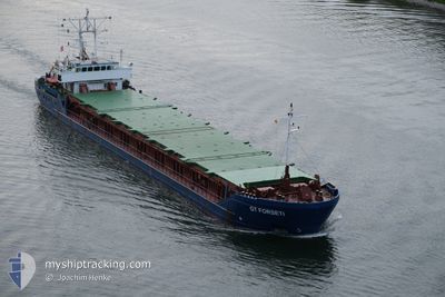
GT FORSETI
General Cargo
Current Trip
| Time Travelled | 1 day |
|---|---|
| Remaining Time | --- |
| Distance Travelled | 407.37 nm |
| Remaining Distance | --- |
| AVG Speed | 9 Knots |
| MAX Speed | 10.6 Knots |
| AVG Wind | 10.6 knots |
| MAX Wind | 14.9 knots |
| MIN Temp | 11.3°C / 52.34°F |
| MAX Temp | 14.9°C / 58.82°F |
| Draught | 5.3 m |
| Position Received | 1 m ago |
Current Position
| Longitude | 11.06857° |
|---|---|
| Latitude | 54.60364° |
| Status | Under way using engine |
| Speed | 9.8 Knots |
| Course | 263.2° |
| Area | Baltic Sea |
| Station | T-AIS |
| Position Received | 1 m ago |
Info
Information
The current position of GT FORSETI is in Baltic Sea with coordinates 54.60364° / 11.06857° as reported on 2024-05-31 02:09 by AIS to our vessel tracker app. The vessel's current speed is 9.8 Knots and is heading at the port of POOLE. The estimated time of arrival as calculated by vessel tracking app is 2024-06-03 04:00 LT
The vessel GT FORSETI (IMO: 9041320, MMSI: 304010297) is a General Cargo that was built in 1993 ( 31 years old ). It's sailing under the flag of [AG] Antigua Barbuda.
In this page you can find informations about the vessels current position, last detected port calls, and current voyage information. If the vessels is not in coverage by AIS you will find the latest position.
The current position of GT FORSETI is detected by our AIS receivers and we are not responsible for the reliability of the data. The last position was recorded while the vessel was in Coverage by the Ais receivers of our vessel tracking app.
The current draught of GT FORSETI as reported by AIS is 5.3 meters
Weather
| Temperature | 13.9°C / 57.02°F |
|---|---|
| Wind Speed | 14 knots |
| Direction | 37° NE |
| Pressure | 1005.6 hPa |
| Humidity | 94.6 % |
| Cloud Coverage | 100 % |
Featured Company
Last Port Calls
| Port | Arrival | Departure | Time In Port |
|---|---|---|---|
| 2024-05-27 06:05 | 2024-05-29 05:54 | 1 d | |
| 2024-05-21 05:58 | 2024-05-22 16:23 | 1 d | |
| 2024-05-17 09:06 | 2024-05-18 12:36 | 1 d | |
| 2024-05-14 10:29 | 2024-05-15 22:35 | 1 d | |
| 2024-05-04 06:04 | 2024-05-09 11:40 | 5 d | |
| 2024-04-30 11:56 | 2024-05-02 18:33 | 2 d | |
| 2024-04-27 16:34 | 2024-04-27 17:42 | 1 h | |
| 2024-04-23 11:08 | 2024-04-27 15:10 | 4 d | |
| 2024-04-23 08:12 | 2024-04-23 08:14 | 1 m | |
| 2024-04-13 13:53 | 2024-04-16 19:31 | 3 d |
Most Visited Ports (Last year)
| Port | Arrivals | |
|---|---|---|
| 8 | ||
| 6 | ||
| 5 | ||
| 4 | ||
| 4 | ||
| 3 |
Last Trips
| Origin | Departure | Destination | Arrival | Distance | |
|---|---|---|---|---|---|
| 2024-05-22 18:23 | 2024-05-27 09:05 | 436.07 nm | |||
| 2024-05-18 13:36 | 2024-05-21 07:58 | 539.57 nm | |||
| 2024-05-15 23:35 | 2024-05-17 10:06 | 299.15 nm | |||
| 2024-05-09 14:40 | 2024-05-14 11:29 | 881.35 nm | |||
| 2024-05-02 20:33 | 2024-05-04 09:04 | 358.22 nm | |||
| 2024-04-27 19:42 | 2024-04-30 13:56 | 539.42 nm | |||
| 2024-04-27 17:10 | 2024-04-27 18:34 | 9.47 nm | |||
| 2024-04-23 10:14 | 2024-04-23 13:08 | 11.78 nm | |||
| 2024-04-16 21:31 | 2024-04-23 10:12 | 787.82 nm | |||
| 2024-04-12 16:35 | 2024-04-13 15:53 | 224.66 nm |
Events
| Time | Event | Details | Position / Dest | Info |
|---|---|---|---|---|
| 2024-05-31 00:59 | Change Sea Area | German part of the Baltic Sea Danish part of the Baltic Sea |
54.55730 / 11.34118
Baltic Sea
POOLE VIA NOK
|
Speed: 9.4 kn Course: 293.8° |
| 2024-05-30 17:44 | Detected in Sea | Danish part of the Baltic Sea |
54.84325 / 12.93578
Baltic Sea
POOLE VIA NOK
|
Speed: 9 kn Course: 250.6° |
| 2024-05-30 14:17 | Change Sea Area | German part of the Baltic Sea Swedish part of the Baltic Sea |
55.02085 / 13.78395
Baltic Sea
POOLE VIA NOK
|
Speed: 8.8 kn Course: 247.4° |
| 2024-05-30 09:11 | Change Sea Area | Swedish part of the Baltic Sea Danish part of the Kattegat |
55.51694 / 14.76867
Baltic Sea
POOLE VIA NOK
|
Speed: 9 kn Course: 244.4° |
| 2024-05-30 07:20 | Detected in Sea | Danish part of the Kattegat |
55.64908 / 15.21334
Kattegat
POOLE VIA NOK
|
Speed: 8.9 kn Course: 244° |
| 2024-05-29 19:21 | Draught Changed | 5.3 3.8 |
56.66159 / 17.96194
POOLE VIA NOK
|
Speed: 9.3 kn Course: 235.4° |
| 2024-05-29 19:21 | Destination Changed | POOLE VIA NOK VENTSPILS |
56.66159 / 17.96194
POOLE VIA NOK
|
Speed: 9.3 kn Course: 235.4° |
| 2024-05-29 19:21 | ETA Changed | 2024/06/03 04:00 2024/05/24 12:00 |
56.66159 / 17.96194
POOLE VIA NOK
|
Speed: 9.3 kn Course: 235.4° |
| 2024-05-29 17:48 | Status Changed | Under way using engine Default |
56.80471 / 18.30547
VENTSPILS
|
Speed: 9 kn Course: 235° |
| 2024-05-29 17:48 | IN Coverage |
56.80275 / 18.30060
Baltic Sea
|
Speed: 9 kn Course: 233.6° |