
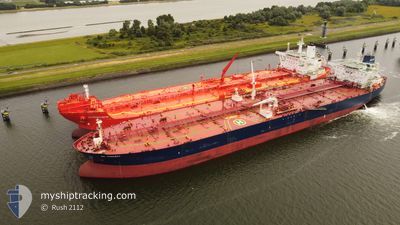
GUANYIN
Crude Oil Tanker
Current Trip
| Time Travelled | --- |
|---|---|
| Remaining Time | 2 days |
| Distance Travelled | 10276.50 nm |
| Remaining Distance | 536.60 nm |
| AVG Speed | 11.8 Knots |
| MAX Speed | 16.2 Knots |
| AVG Wind | 13.8 knots |
| MAX Wind | 30.8 knots |
| MIN Temp | 11.9°C / 53.42°F |
| MAX Temp | 33°C / 91.4°F |
| Draught | 8.5 m |
| Position Received | Now |
Current Position
| Longitude | 12.19397° |
|---|---|
| Latitude | 54.44591° |
| Status | Under way using engine |
| Speed | 8.4 Knots |
| Course | 30.9° |
| Area | Baltic Sea |
| Station | T-AIS |
| Position Received | Now |
Info
Information
The current position of GUANYIN is in Baltic Sea with coordinates 54.44591° / 12.19397° as reported on 2024-05-17 05:34 by AIS to our vessel tracker app. The vessel's current speed is 8.4 Knots and is heading at the port of TALLINN OLD HARBOR. The estimated time of arrival as calculated by vessel tracking app is 2024-05-20 01:21 LT
The vessel GUANYIN (IMO: 9299707, MMSI: 636012383) is a Crude Oil Tanker that was built in 2005 ( 19 years old ). It's sailing under the flag of [LR] Liberia.
In this page you can find informations about the vessels current position, last detected port calls, and current voyage information. If the vessels is not in coverage by AIS you will find the latest position.
The current position of GUANYIN is detected by our AIS receivers and we are not responsible for the reliability of the data. The last position was recorded while the vessel was in Coverage by the Ais receivers of our vessel tracking app.
The current draught of GUANYIN as reported by AIS is 8.5 meters
Weather
| Temperature | 12.7°C / 54.86°F |
|---|---|
| Wind Speed | 18 knots |
| Direction | 100° E |
| Pressure | 1013.7 hPa |
| Humidity | 78.6 % |
| Cloud Coverage | 43 % |
Featured Company
Last Port Calls
| Port | Arrival | Departure | Time In Port |
|---|---|---|---|
| 2024-05-03 05:01 | 2024-05-03 14:07 | 9 h | |
| 2024-04-01 04:45 | 2024-04-01 13:42 | 8 h | |
| 2024-03-13 09:08 | 2024-03-14 17:24 | 1 d | |
| 2024-03-09 04:48 | 2024-03-10 16:50 | 1 d |
Last Trips
| Origin | Departure | Destination | Arrival | Distance | |
|---|---|---|---|---|---|
| 2024-03-14 20:24 | 2024-05-03 07:01 | 6123.58 nm | |||
| 2024-03-14 20:24 | 2024-04-01 06:45 | 4784.29 nm | |||
| 2024-03-10 17:50 | 2024-03-13 12:08 | 564.37 nm | |||
| 2023-12-27 12:11 | 2024-03-09 05:48 | 7127.28 nm |
Events
| Time | Event | Details | Position / Dest | Info |
|---|---|---|---|---|
| 2024-05-17 05:05 | Change Sea Area | German part of the Baltic Sea Danish part of the Baltic Sea |
54.40859 / 12.10555
Baltic Sea
EETLL
|
Speed: 8.4 kn Course: 80.5° |
| 2024-05-17 02:41 | Detected in Sea | Danish part of the Baltic Sea |
54.51056 / 11.42451
Baltic Sea
EETLL
|
Speed: 11.9 kn Course: 114.2° |
| 2024-05-17 01:14 | Change Sea Area | German part of the Baltic Sea Danish part of the Baltic Sea |
54.64083 / 11.00806
Baltic Sea
EETLL
|
Speed: 11.9 kn Course: 123.2° |
| 2024-05-17 00:35 | Change Sea Area | Danish part of the Baltic Sea Danish part of the Kattegat |
54.73095 / 10.84295
Baltic Sea
EETLL
|
Speed: 12.2 kn Course: 162.1° |
| 2024-05-16 07:01 | Change Sea Area | Danish part of the Kattegat Danish part of the Skaggerak |
57.77794 / 10.85035
Kattegat
EETLL
|
Speed: 11.2 kn Course: 129.6° |
| 2024-05-16 00:02 | ETA Changed | 2024/05/19 06:00 2024/05/19 20:00 |
57.62213 / 8.57453
EETLL
|
Speed: 12.4 kn Course: 78.3° |
| 2024-05-15 23:37 | Change Sea Area | Danish part of the Skaggerak Norwegian part of the Skaggerak |
57.60627 / 8.41631
Skaggerak
EETLL
|
Speed: 12.4 kn Course: 79.3° |
| 2024-05-15 22:02 | Change Sea Area | Norwegian part of the Skaggerak Norwegian part of the North Sea |
57.55384 / 7.82196
Skaggerak
EETLL
|
Speed: 12.4 kn Course: 89.9° |
| 2024-05-15 19:38 | Change Sea Area | Norwegian part of the North Sea Danish part of the North Sea |
57.35645 / 7.48650
North Sea
EETLL
|
Speed: 13.3 kn Course: 323.6° |
| 2024-05-15 13:48 | Status Changed | Under way using engine Default |
56.25403 / 6.76909
EETLL
|
Speed: 12 kn Course: 35° |