
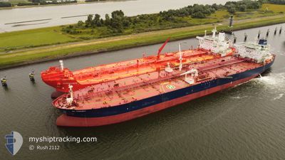
GUANYIN
Crude Oil Tanker
Current Trip
| Time Travelled | 24 days |
|---|---|
| Remaining Time | 5 days |
| Distance Travelled | 6275.29 nm |
| Remaining Distance | 1658.85 nm |
| AVG Speed | 11.7 Knots |
| MAX Speed | 11.7 Knots |
| AVG Wind | 11 knots |
| MAX Wind | 29 knots |
| MIN Temp | 11°C / 51.8°F |
| MAX Temp | 39.3°C / 102.74°F |
| Draught | 15 m |
| Position Received | 2 d ago |
Current Position
| Longitude | 39.36617° |
|---|---|
| Latitude | 18.85130° |
| Status | Under way using engine |
| Speed | 11.7 Knots |
| Course | 164.8° |
| Area | Red Sea |
| Station | T-AIS |
| Position Received | 2 d ago |
Info
Information
The current position of GUANYIN is in Red Sea with coordinates 18.85130° / 39.36617° as reported on 2024-06-19 05:26 by AIS to our vessel tracker app. The vessel's current speed is 11.7 Knots and is heading at the port of SIKKA. The estimated time of arrival as calculated by vessel tracking app is 2024-06-26 23:47 LT
The vessel GUANYIN (IMO: 9299707, MMSI: 636012383) is a Crude Oil Tanker that was built in 2005 ( 19 years old ). It's sailing under the flag of [LR] Liberia.
In this page you can find informations about the vessels current position, last detected port calls, and current voyage information. If the vessels is not in coverage by AIS you will find the latest position.
The current position of GUANYIN is detected by our AIS receivers and we are not responsible for the reliability of the data. The last position was recorded while the vessel was in Coverage by the Ais receivers of our vessel tracking app.
The current draught of GUANYIN as reported by AIS is 15 meters
Weather
| Temperature | 31.5°C / 88.7°F |
|---|---|
| Wind Speed | 5 knots |
| Direction | 151° SSE |
| Pressure | 1005.5 hPa |
| Humidity | 72.5 % |
| Cloud Coverage | 98 % |
Featured Company
Last Port Calls
| Port | Arrival | Departure | Time In Port |
|---|---|---|---|
| 2024-06-16 03:29 | 2024-06-16 12:21 | 8 h | |
| 2024-05-25 22:20 | 2024-05-28 04:21 | 2 d | |
| 2024-05-03 05:01 | 2024-05-03 14:07 | 9 h | |
| 2024-04-01 04:45 | 2024-04-01 13:42 | 8 h |
Most Visited Ports (Last year)
| Port | Arrivals | |
|---|---|---|
| 9 | ||
| 3 | ||
| 2 | ||
| 1 | ||
| 1 |
Last Trips
| Origin | Departure | Destination | Arrival | Distance | |
|---|---|---|---|---|---|
| 2024-05-28 07:21 | 2024-06-16 05:29 | 4891.28 nm | |||
| 2024-03-14 20:24 | 2024-05-26 01:20 | 11022.44 nm | |||
| 2024-03-14 20:24 | 2024-05-03 07:01 | 6123.58 nm | |||
| 2024-03-14 20:24 | 2024-04-01 06:45 | 4784.29 nm |
Events
| Time | Event | Details | Position / Dest | Info |
|---|---|---|---|---|
| 2024-06-19 05:31 | Status Changed | Default Under way using engine |
18.83503 / 39.37072
INSIK
|
Speed: 11.7 kn Course: 164.8° |
| 2024-06-19 05:26 | OUT of Coverage |
18.85130 / 39.36617
Red Sea
INSIK
|
Speed: 11.7 kn Course: 164.8° |
|
| 2024-06-19 05:14 | Status Changed | Under way using engine Default |
18.88678 / 39.35486
INSIK
|
Speed: 11.5 kn Course: 162° |
| 2024-06-19 05:07 | Status Changed | Default Under way using engine |
18.90675 / 39.34689
INSIK
|
Speed: 11.6 kn Course: 149.4° |
| 2024-06-19 04:44 | Status Changed | Under way using engine Default |
18.97241 / 39.30626
INSIK
|
Speed: 11 kn Course: 150° |
| 2024-06-19 04:40 | Status Changed | Default Under way using engine |
18.98167 / 39.29833
INSIK
|
Speed: 11.6 kn Course: 150.2° |
| 2024-06-19 04:23 | Status Changed | Under way using engine Default |
19.03173 / 39.27084
INSIK
|
Speed: 11.5 kn Course: 151° |
| 2024-06-19 04:14 | Status Changed | Default Under way using engine |
19.05697 / 39.25608
INSIK
|
Speed: 11.5 kn Course: 150.8° |
| 2024-06-19 04:08 | Status Changed | Under way using engine Default |
19.07225 / 39.24697
INSIK
|
Speed: 11.5 kn Course: 151° |
| 2024-06-19 03:44 | Status Changed | Default Under way using engine |
19.13972 / 39.20695
INSIK
|
Speed: 11.5 kn Course: 150.2° |