
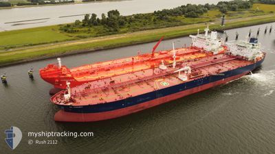
GUANYIN
Crude Oil Tanker
Current Trip
| Time Travelled | 13 days |
|---|---|
| Remaining Time | 3 days |
| Distance Travelled | 3704.32 nm |
| Remaining Distance | 1075.40 nm |
| AVG Speed | 10.6 Knots |
| MAX Speed | 14.4 Knots |
| AVG Wind | 11.4 knots |
| MAX Wind | 25 knots |
| MIN Temp | 11°C / 51.8°F |
| MAX Temp | 22.7°C / 72.86°F |
| Draught | 15 m |
| Position Received | Now |
Current Position
| Longitude | 12.06967° |
|---|---|
| Latitude | 36.96822° |
| Status | Under way using engine |
| Speed | 11.2 Knots |
| Course | 120.7° |
| Area | Mediterranean Sea - Eastern Basin |
| Station | T-AIS |
| Position Received | Now |
Info
Information
The current position of GUANYIN is in Mediterranean Sea - Eastern Basin with coordinates 36.96822° / 12.06967° as reported on 2024-06-10 18:43 by AIS to our vessel tracker app. The vessel's current speed is 11.2 Knots and is heading at the port of PORT SAID. The estimated time of arrival as calculated by vessel tracking app is 2024-06-14 17:00 LT
The vessel GUANYIN (IMO: 9299707, MMSI: 636012383) is a Crude Oil Tanker that was built in 2005 ( 19 years old ). It's sailing under the flag of [LR] Liberia.
In this page you can find informations about the vessels current position, last detected port calls, and current voyage information. If the vessels is not in coverage by AIS you will find the latest position.
The current position of GUANYIN is detected by our AIS receivers and we are not responsible for the reliability of the data. The last position was recorded while the vessel was in Coverage by the Ais receivers of our vessel tracking app.
The current draught of GUANYIN as reported by AIS is 15 meters
Weather
| Temperature | 21.9°C / 71.42°F |
|---|---|
| Wind Speed | 8 knots |
| Direction | 347° NNW |
| Pressure | 1011 hPa |
| Humidity | 81.6 % |
| Cloud Coverage | 90 % |
Featured Company
Last Port Calls
| Port | Arrival | Departure | Time In Port |
|---|---|---|---|
| 2024-05-25 22:20 | 2024-05-28 04:21 | 2 d | |
| 2024-05-03 05:01 | 2024-05-03 14:07 | 9 h | |
| 2024-04-01 04:45 | 2024-04-01 13:42 | 8 h |
Most Visited Ports (Last year)
| Port | Arrivals | |
|---|---|---|
| 8 | ||
| 3 | ||
| 2 | ||
| 1 | ||
| 1 |
Last Trips
| Origin | Departure | Destination | Arrival | Distance | |
|---|---|---|---|---|---|
| 2024-03-14 20:24 | 2024-05-26 01:20 | 11022.44 nm | |||
| 2024-03-14 20:24 | 2024-05-03 07:01 | 6123.58 nm | |||
| 2024-03-14 20:24 | 2024-04-01 06:45 | 4784.29 nm |
Events
| Time | Event | Details | Position / Dest | Info |
|---|---|---|---|---|
| 2024-06-10 17:59 | Change Sea Area | Italian part of the Mediterranean Sea - Eastern Basin Tunisian part of the Mediterranean Sea - Eastern Basin |
37.03717 / 11.91947
Mediterranean Sea - Eastern Basin
EGPSD
|
Speed: 11.4 kn Course: 116.3° |
| 2024-06-10 17:33 | ETA Changed | 2024/06/14 09:00 |
37.07585 / 11.82712
EGPSD
|
Speed: 11.7 kn Course: 119.2° |
| 2024-06-10 17:19 | Status Changed | Under way using engine Default |
37.09662 / 11.77810
EGPSD
|
Speed: 11.5 kn Course: 118° |
| 2024-06-10 17:13 | Status Changed | Default Under way using engine |
37.10523 / 11.75726
EGPSD
|
Speed: 11.6 kn Course: 117.4° |
| 2024-06-10 17:08 | Status Changed | Under way using engine Default |
37.11290 / 11.73886
EGPSD
|
Speed: 11.6 kn Course: 120° |
| 2024-06-10 16:25 | Status Changed | Default Under way using engine |
37.18210 / 11.59002
EGPSD
|
Speed: 11.1 kn Course: 119.7° |
| 2024-06-10 15:47 | Detected in Sea | Tunisian part of the Mediterranean Sea - Eastern Basin |
37.23972 / 11.46378
Mediterranean Sea - Eastern Basin
|
Speed: 11.2 kn Course: 118.6° |
| 2024-06-10 15:47 | Status Changed | Under way using engine Default |
37.23972 / 11.46378
EGPSD
|
Speed: 11 kn Course: 120° |
| 2024-06-10 15:37 | IN Coverage |
37.23972 / 11.46378
Mediterranean Sea - Eastern Basin
|
Speed: 11.2 kn Course: 118.6° |
|
| 2024-06-10 02:02 | OUT of Coverage |
37.60288 / 8.31342
Mediterranean Sea - Western Basin
|
Speed: 11.7 kn Course: 84.2° |