
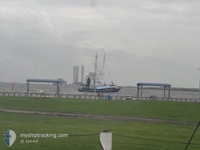
GUARDIAN ANGEL
Fishing
Current Trip
Unknown
| Time Travelled | 16 days |
|---|---|
| Remaining Time | --- |
| Distance Travelled | 451.34 nm |
| Remaining Distance | --- |
| AVG Speed | 6.2 Knots |
| MAX Speed | 10.5 Knots |
| AVG Wind | 12.9 knots |
| MAX Wind | 27.7 knots |
| MIN Temp | 23.4°C / 74.12°F |
| MAX Temp | 27.8°C / 82.04°F |
| Draught | --- |
| Position Received | 3 d ago |
Current Position
| Longitude | -90.58240° |
|---|---|
| Latitude | 28.99340° |
| Status | Default |
| Speed | 1.6 Knots |
| Course | --- |
| Area | Gulf of Mexico |
| Station | T-AIS |
| Position Received | 3 d ago |
Info
Information
The current position of GUARDIAN ANGEL is in Gulf of Mexico with coordinates 28.99340° / -90.58240° as reported on 2024-06-03 03:09 by AIS to our vessel tracker app. The vessel's current speed is 1.6 Knots
The vessel GUARDIAN ANGEL (MMSI: 367743890) is a Fishing It's sailing under the flag of [US] USA.
In this page you can find informations about the vessels current position, last detected port calls, and current voyage information. If the vessels is not in coverage by AIS you will find the latest position.
The current position of GUARDIAN ANGEL is detected by our AIS receivers and we are not responsible for the reliability of the data. The last position was recorded while the vessel was in Coverage by the Ais receivers of our vessel tracking app.
Weather
| Temperature | 27.3°C / 81.14°F |
|---|---|
| Wind Speed | 11 knots |
| Direction | 151° SSE |
| Pressure | 1014.5 hPa |
| Humidity | 77.5 % |
| Cloud Coverage | 12 % |
Featured Company
Last Port Calls
| Port | Arrival | Departure | Time In Port |
|---|---|---|---|
| 2024-05-14 00:22 | 2024-05-20 13:33 | 6 d | |
| 2024-05-13 19:50 | 2024-05-13 23:30 | 3 h | |
| 2024-05-13 00:35 | 2024-05-13 19:12 | 18 h | |
| 2024-04-17 15:57 | 2024-04-18 22:58 | 1 d |
Most Visited Ports (Last year)
| Port | Arrivals | |
|---|---|---|
| 3 | ||
| 2 |
Last Trips
| Origin | Departure | Destination | Arrival | Distance | |
|---|---|---|---|---|---|
| 2024-05-13 18:30 | 2024-05-13 19:22 | 4.90 nm | |||
| 2024-05-13 14:12 | 2024-05-13 14:50 | 3.79 nm | |||
| 2024-04-18 17:58 | 2024-05-12 19:35 | 67.99 nm |
Events
| Time | Event | Details | Position / Dest | Info |
|---|---|---|---|---|
| 2024-06-03 03:09 | OUT of Coverage |
28.99340 / -90.58240
Gulf of Mexico
|
Speed: 1.6 kn Course: 88.6° |
|
| 2024-06-03 01:14 | IN Coverage |
28.98584 / -90.66285
Gulf of Mexico
|
Speed: 2.3 kn Course: 64.9° |
|
| 2024-05-29 04:13 | OUT of Coverage |
29.09661 / -92.22889
Gulf of Mexico
|
Speed: 2.4 kn Course: 135.9° |
|
| 2024-05-28 23:01 | IN Coverage |
29.14069 / -92.27734
Gulf of Mexico
|
Speed: 2.2 kn Course: 98.2° |
|
| 2024-05-28 16:07 | OUT of Coverage |
29.11816 / -92.22067
Gulf of Mexico
|
Speed: 2.9 kn Course: 320.7° |
|
| 2024-05-27 23:12 | IN Coverage |
29.27290 / -92.60174
Gulf of Mexico
|
Speed: 2.5 kn Course: 109.2° |
|
| 2024-05-27 22:07 | OUT of Coverage |
29.28195 / -92.65445
Gulf of Mexico
|
Speed: 2.5 kn Course: 112.1° |
|
| 2024-05-27 21:22 | IN Coverage |
29.29794 / -92.68499
Gulf of Mexico
|
Speed: 2.4 kn Course: 121.6° |
|
| 2024-05-27 17:00 | OUT of Coverage |
29.30892 / -92.89313
Gulf of Mexico
|
Speed: 2.8 kn Course: 80.7° |
|
| 2024-05-27 16:03 | IN Coverage |
29.30948 / -92.92728
Gulf of Mexico
|
Speed: 0.7 kn Course: 252.7° |