
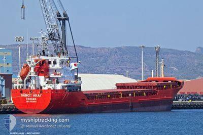
GUNCE AKAY
General Cargo
Current Trip
| Time Travelled | 3 days |
|---|---|
| Remaining Time | 2 days |
| Distance Travelled | 792.11 nm |
| Remaining Distance | 646.09 nm |
| AVG Speed | 10.1 Knots |
| MAX Speed | 11 Knots |
| AVG Wind | 10 knots |
| MAX Wind | 20 knots |
| MIN Temp | 18.5°C / 65.3°F |
| MAX Temp | 25.4°C / 77.72°F |
| Draught | 6.8 m |
| Position Received | 1 h, 18 m ago |
Current Position
| Longitude | 11.63119° |
|---|---|
| Latitude | 37.45509° |
| Status | Under way using engine |
| Speed | 9.6 Knots |
| Course | 282.5° |
| Area | Mediterranean Sea - Western Basin |
| Station | T-AIS |
| Position Received | 1 h, 18 m ago |
Info
Information
The current position of GUNCE AKAY is in Mediterranean Sea - Western Basin with coordinates 37.45509° / 11.63119° as reported on 2024-05-23 05:04 by AIS to our vessel tracker app. The vessel's current speed is 9.6 Knots and is heading at the port of CARBONERAS. The estimated time of arrival as calculated by vessel tracking app is 2024-05-25 22:16 LT
The vessel GUNCE AKAY (IMO: 9421051, MMSI: 374071000) is a General Cargo that was built in 2007 ( 17 years old ). It's sailing under the flag of [PA] Panama.
In this page you can find informations about the vessels current position, last detected port calls, and current voyage information. If the vessels is not in coverage by AIS you will find the latest position.
The current position of GUNCE AKAY is detected by our AIS receivers and we are not responsible for the reliability of the data. The last position was recorded while the vessel was in Coverage by the Ais receivers of our vessel tracking app.
The current draught of GUNCE AKAY as reported by AIS is 6.8 meters
Weather
| Temperature | 19.6°C / 67.28°F |
|---|---|
| Wind Speed | 1 knots |
| Direction | 54° NE |
| Pressure | 1018 hPa |
| Humidity | 76.1 % |
| Cloud Coverage | 1 % |
Featured Company
Last Port Calls
| Port | Arrival | Departure | Time In Port |
|---|---|---|---|
| 2024-05-16 18:54 | 2024-05-19 22:50 | 3 d | |
| 2024-05-11 18:06 | 2024-05-14 02:30 | 2 d | |
| 2024-05-06 05:04 | 2024-05-06 19:57 | 14 h | |
| 2024-04-21 05:40 | 2024-04-29 11:04 | 8 d | |
| 2024-04-17 20:05 | 2024-04-19 18:32 | 1 d | |
| 2024-04-15 16:25 | 2024-04-15 19:17 | 2 h | |
| 2024-04-12 06:00 | 2024-04-13 13:30 | 1 d | |
| 2024-04-04 10:43 | 2024-04-10 16:03 | 6 d | |
| 2024-03-31 15:52 | 2024-03-31 21:27 | 5 h | |
| 2024-03-10 08:23 | 2024-03-13 22:15 | 3 d |
Last Trips
| Origin | Departure | Destination | Arrival | Distance | |
|---|---|---|---|---|---|
| 2024-05-14 05:30 | 2024-05-16 21:54 | 412.91 nm | |||
| 2024-05-06 22:57 | 2024-05-11 21:06 | 254.56 nm | |||
| 2024-04-29 13:04 | 2024-05-06 08:04 | 1229.98 nm | |||
| 2024-04-19 20:32 | 2024-04-21 07:40 | 321.99 nm | |||
| 2024-04-15 21:17 | 2024-04-17 22:05 | 427.94 nm | |||
| 2024-04-13 14:30 | 2024-04-15 18:25 | 475.40 nm | |||
| 2024-04-10 18:03 | 2024-04-12 07:00 | 363.62 nm | |||
| 2024-03-31 23:27 | 2024-04-04 12:43 | 771.53 nm | |||
| 2024-03-02 13:00 | 2024-03-10 10:23 | 1505.33 nm |
Events
| Time | Event | Details | Position / Dest | Info |
|---|---|---|---|---|
| 2024-05-23 05:06 | Status Changed | Default Under way using engine |
37.45500 / 11.62500
ESCRS
|
Speed: 9.6 kn Course: 282.5° |
| 2024-05-23 05:04 | OUT of Coverage |
37.45509 / 11.63119
Mediterranean Sea - Western Basin
ESCRS
|
Speed: 9.6 kn Course: 282.5° |
|
| 2024-05-23 04:37 | Detected in Sea | Italian part of the Mediterranean Sea - Western Basin |
37.44008 / 11.72281
Mediterranean Sea - Western Basin
ESCRS
|
Speed: 9.9 kn Course: 280.7° |
| 2024-05-23 02:53 | Status Changed | Under way using engine Default |
37.37946 / 12.09223
ESCRS
|
Speed: 10.2 kn Course: 280° |
| 2024-05-23 02:24 | Status Changed | Default Under way using engine |
37.36356 / 12.19494
ESCRS
|
Speed: 10.3 kn Course: 280.7° |
| 2024-05-23 02:02 | Status Changed | Under way using engine Default |
37.35202 / 12.27124
ESCRS
|
Speed: 10 kn Course: 280° |
| 2024-05-23 01:49 | IN Coverage |
37.35251 / 12.26768
Mediterranean Sea - Eastern Basin
ESCRS
|
Speed: 10.3 kn Course: 279.9° |
|
| 2024-05-23 00:24 | Status Changed | Default Under way using engine |
37.30429 / 12.60707
ESCRS
|
Speed: 10.2 kn Course: 281.1° |
| 2024-05-23 00:18 | OUT of Coverage |
37.30066 / 12.62990
Mediterranean Sea - Eastern Basin
ESCRS
|
Speed: 10.2 kn Course: 281.1° |
|
| 2024-05-22 15:35 | Status Changed | Under way using engine Default |
36.80547 / 14.28286
ESCRS
|
Speed: 9.1 kn Course: 294° |