
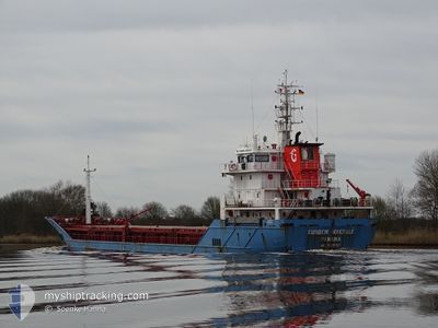
GUNDEM MAKBULE
General Cargo
Current Trip
NO DATA
| Time Travelled | 2 days |
|---|---|
| Remaining Time | --- |
| Distance Travelled | 424.77 nm |
| Remaining Distance | --- |
| AVG Speed | 9.5 Knots |
| MAX Speed | 9.5 Knots |
| AVG Wind | 8.5 knots |
| MAX Wind | 23.8 knots |
| MIN Temp | 21.9°C / 71.42°F |
| MAX Temp | 29.5°C / 85.1°F |
| Draught | 4.5 m |
| Position Received | 1 m ago |
Current Position
| Longitude | 29.50058° |
|---|---|
| Latitude | 36.08676° |
| Status | At anchor |
| Speed | 8.8 Knots |
| Course | 93.4° |
| Area | Mediterranean Sea - Eastern Basin |
| Station | T-AIS |
| Position Received | 1 m ago |
Info
Information
The current position of GUNDEM MAKBULE is in Mediterranean Sea - Eastern Basin with coordinates 36.08676° / 29.50058° as reported on 2024-06-09 12:44 by AIS to our vessel tracker app. The vessel's current speed is 8.8 Knots
The vessel GUNDEM MAKBULE (IMO: 9520388, MMSI: 374281000) is a General Cargo that was built in 2009 ( 15 years old ). It's sailing under the flag of [PA] Panama.
In this page you can find informations about the vessels current position, last detected port calls, and current voyage information. If the vessels is not in coverage by AIS you will find the latest position.
The current position of GUNDEM MAKBULE is detected by our AIS receivers and we are not responsible for the reliability of the data. The last position was recorded while the vessel was in Coverage by the Ais receivers of our vessel tracking app.
The current draught of GUNDEM MAKBULE as reported by AIS is 4.5 meters
Weather
| Temperature | 25.7°C / 78.26°F |
|---|---|
| Wind Speed | 5 knots |
| Direction | 201° SSW |
| Pressure | 1006 hPa |
| Humidity | 73.5 % |
| Cloud Coverage | --- |
Featured Company
Last Port Calls
| Port | Arrival | Departure | Time In Port |
|---|---|---|---|
| 2024-06-06 04:49 | 2024-06-06 12:55 | 8 h | |
| 2024-05-30 21:13 | 2024-06-01 12:02 | 1 d | |
| 2024-05-27 05:05 | 2024-05-29 17:09 | 2 d | |
| 2024-05-19 10:04 | 2024-05-19 10:44 | 39 m | |
| 2024-05-15 19:35 | 2024-05-17 18:22 | 1 d | |
| 2024-05-12 15:39 | 2024-05-13 15:57 | 1 d | |
| 2024-05-03 11:36 | 2024-05-05 22:18 | 2 d | |
| 2024-05-01 06:52 | 2024-05-02 14:34 | 1 d | |
| 2024-04-29 08:52 | |||
| 2024-04-17 18:23 | 2024-04-22 20:40 | 5 d |
Most Visited Ports (Last year)
| Port | Arrivals | |
|---|---|---|
| 4 | ||
| 3 | ||
| 2 | ||
| 2 | ||
| 2 | ||
| 2 |
Last Trips
| Origin | Departure | Destination | Arrival | Distance | |
|---|---|---|---|---|---|
| 2024-06-01 14:02 | 2024-06-06 07:49 | 986.01 nm | |||
| 2024-05-29 19:09 | 2024-05-30 23:13 | 254.86 nm | |||
| 2024-05-19 12:44 | 2024-05-27 07:05 | 1009.31 nm | |||
| 2024-05-17 20:22 | 2024-05-19 12:04 | 316.91 nm | |||
| 2024-05-13 17:57 | 2024-05-15 21:35 | 3.65 nm | |||
| 2024-05-06 01:18 | 2024-05-12 17:39 | 1465.19 nm | |||
| 2024-05-02 17:34 | 2024-05-03 14:36 | 216.55 nm | |||
| 2024-04-29 11:52 | 2024-05-01 09:52 | 418.11 nm | |||
| 2024-04-17 12:30 | 2024-04-17 20:23 | 77.89 nm | |||
| 2024-04-10 15:46 | 2024-04-16 11:26 | 1149.32 nm |
Events
| Time | Event | Details | Position / Dest | Info |
|---|---|---|---|---|
| 2024-06-09 12:11 | Change Sea Area | Greek part of the Mediterranean Sea - Eastern Basin Turkish part of the Mediterranean Sea - Eastern Basin |
36.11382 / 29.40612
Mediterranean Sea - Eastern Basin
|
Speed: 8.6 kn Course: 114.2° |
| 2024-06-09 07:43 | Detected in Sea | Turkish part of the Mediterranean Sea - Eastern Basin |
36.40483 / 28.57483
Mediterranean Sea - Eastern Basin
|
Speed: 10.4 kn Course: 117.4° |
| 2024-06-09 06:11 | Change Sea Area | Greek part of the Mediterranean Sea - Eastern Basin Turkish part of the Aegean Sea |
36.50850 / 28.26367
Mediterranean Sea - Eastern Basin
|
Speed: 10.5 kn Course: 103.4° |
| 2024-06-09 06:09 | Status Changed | At anchor Default |
36.50961 / 28.25786
NO DATA
|
Speed: 10.3 kn Course: 84° |
| 2024-06-09 05:18 | Status Changed | Default At anchor |
36.50349 / 28.07849
NO DATA
|
Speed: 9.8 kn Course: 87.8° |
| 2024-06-09 05:13 | Status Changed | At anchor Default |
36.50300 / 28.06150
NO DATA
|
Speed: 9.8 kn Course: 87° |
| 2024-06-09 05:00 | Status Changed | Default At anchor |
36.50146 / 28.01653
NO DATA
|
Speed: 9.9 kn Course: 89.3° |
| 2024-06-09 04:40 | Change Sea Area | Turkish part of the Aegean Sea Greek part of the Aegean Sea |
36.50117 / 27.95183
Aegean Sea
|
Speed: 9.5 kn Course: 90.9° |
| 2024-06-09 02:58 | Change Sea Area | Greek part of the Aegean Sea Turkish part of the Aegean Sea |
36.56416 / 27.63029
Aegean Sea
|
Speed: 9.5 kn Course: 110.7° |
| 2024-06-09 02:57 | Status Changed | At anchor Default |
36.56483 / 27.62833
NO DATA
|
Speed: 9.4 kn Course: 111° |