
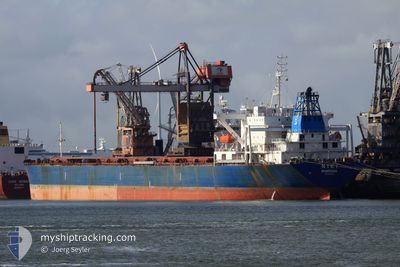
HAFEET
Bulk Carrier
Current Trip
| Time Travelled | 33 days |
|---|---|
| Remaining Time | 2 h, 25 mins |
| Distance Travelled | 103.56 nm |
| Remaining Distance | 35.77 nm |
| AVG Speed | 4.6 Knots |
| MAX Speed | 6.8 Knots |
| AVG Wind | 7.9 knots |
| MAX Wind | 23 knots |
| MIN Temp | 28°C / 82.4°F |
| MAX Temp | 35°C / 95°F |
| Draught | 8 m |
| Position Received | 1 m ago |
Current Position
| Longitude | 54.24682° |
|---|---|
| Latitude | 24.89590° |
| Status | Moored |
| Speed | |
| Course | 1° |
| Area | Persian Gulf |
| Station | T-AIS |
| Position Received | 1 m ago |
Info
Information
The current position of HAFEET is in Persian Gulf with coordinates 24.89590° / 54.24682° as reported on 2024-06-20 15:05 by AIS to our vessel tracker app. The vessel's current speed is 0 Knots and is heading at the port of MUSAFFAH. The estimated time of arrival as calculated by vessel tracking app is 2024-06-20 17:32 LT
The vessel HAFEET (IMO: 9015591, MMSI: 471235000) is a Bulk Carrier that was built in 1989 ( 35 years old ). It's sailing under the flag of [00] Unknown.
In this page you can find informations about the vessels current position, last detected port calls, and current voyage information. If the vessels is not in coverage by AIS you will find the latest position.
The current position of HAFEET is detected by our AIS receivers and we are not responsible for the reliability of the data. The last position was recorded while the vessel was in Coverage by the Ais receivers of our vessel tracking app.
The current draught of HAFEET as reported by AIS is 8 meters
Weather
| Temperature | 33.2°C / 91.76°F |
|---|---|
| Wind Speed | 8 knots |
| Direction | 321° NW |
| Pressure | 996 hPa |
| Humidity | 68.8 % |
| Cloud Coverage | --- |
Featured Company
Events
| Time | Event | Details | Position / Dest | Info |
|---|---|---|---|---|
| 2024-06-20 02:44 | Status Changed | Moored Under way using engine |
24.89965 / 54.24867
MUSAFFAH S2
|
Speed: Course: 245° |
| 2024-06-20 01:56 | STOP Moving |
24.90026 / 54.24884
MUSAFFAH S2
|
Speed: 0.3 kn Course: 249° |
|
| 2024-06-19 22:34 | START Moving | 16.09 nm, North West of ABU DHABI |
24.72319 / 54.16275
MUSAFFAH S2
|
Speed: 3.1 kn Course: 28° |
| 2024-06-19 22:23 | Status Changed | Under way using engine At anchor |
24.71860 / 54.16459
MUSAFFAH S2
|
Speed: 0.6 kn Course: 299° |
| 2024-06-19 21:22 | Destination Changed | MUSAFFAH S2 MUSAFFAH S1 |
24.71938 / 54.16483
MUSAFFAH S2
|
Speed: 0.4 kn Course: 256° |
| 2024-06-19 21:22 | Draught Changed | 8 13.5 |
24.71938 / 54.16483
MUSAFFAH S2
|
Speed: 0.4 kn Course: 256° |
| 2024-06-19 21:22 | ETA Changed | 2024/06/20 05:00 2024/06/04 21:00 |
24.71938 / 54.16483
MUSAFFAH S2
|
Speed: 0.4 kn Course: 256° |
| 2024-06-19 16:10 | Status Changed | At anchor Default |
24.71739 / 54.16410
MUSAFFAH S1
|
Speed: Course: 324° |
| 2024-06-19 16:08 | Status Changed | Default At anchor |
24.71742 / 54.16414
MUSAFFAH S1
|
Speed: Course: 325° |
| 2024-06-19 06:55 | Status Changed | At anchor Default |
24.72121 / 54.16327
MUSAFFAH S1
|
Speed: Course: 207° |