
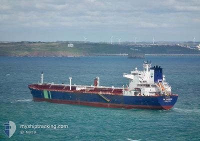
HAFNIA ZAMBESI
Oil Products Tanker
Current Trip
BRSSO
| Time Travelled | 1 day |
|---|---|
| Remaining Time | --- |
| Distance Travelled | 294.59 nm |
| Remaining Distance | --- |
| AVG Speed | 11.3 Knots |
| MAX Speed | 12.5 Knots |
| AVG Wind | 12.8 knots |
| MAX Wind | 18.5 knots |
| MIN Temp | 18.5°C / 65.3°F |
| MAX Temp | 25.8°C / 78.44°F |
| Draught | 8.2 m |
| Position Received | 4 d ago |
Current Position
| Longitude | -45.49406° |
|---|---|
| Latitude | -23.91114° |
| Status | Under way using engine |
| Speed | 9.9 Knots |
| Course | 38.5° |
| Area | South Atlantic Ocean |
| Station | T-AIS |
| Position Received | 4 d ago |
Info
Information
The current position of HAFNIA ZAMBESI is in South Atlantic Ocean with coordinates -23.91114° / -45.49406° as reported on 2024-05-25 01:14 by AIS to our vessel tracker app. The vessel's current speed is 9.9 Knots
The vessel HAFNIA ZAMBESI (IMO: 9393101, MMSI: 564368000) is a Oil Products Tanker that was built in 2010 ( 14 years old ). It's sailing under the flag of [SG] Singapore.
In this page you can find informations about the vessels current position, last detected port calls, and current voyage information. If the vessels is not in coverage by AIS you will find the latest position.
The current position of HAFNIA ZAMBESI is detected by our AIS receivers and we are not responsible for the reliability of the data. The last position was recorded while the vessel was in Coverage by the Ais receivers of our vessel tracking app.
The current draught of HAFNIA ZAMBESI as reported by AIS is 8.2 meters
Weather
| Temperature | 25.8°C / 78.44°F |
|---|---|
| Wind Speed | 14 knots |
| Direction | --- N |
| Pressure | 1016 hPa |
| Humidity | 81.3 % |
| Cloud Coverage | 98 % |
Featured Company
Last Port Calls
| Port | Arrival | Departure | Time In Port |
|---|---|---|---|
| 2024-05-25 02:36 | 2024-05-27 23:11 | 2 d | |
| 2024-05-21 11:37 | 2024-05-22 04:47 | 17 h | |
| 2024-05-03 04:53 | 2024-05-05 19:09 | 2 d | |
| 2024-04-09 00:59 | 2024-04-09 01:38 | 39 m | |
| 2024-04-04 23:42 | 2024-04-08 04:54 | 3 d | |
| 2024-03-30 17:07 | 2024-04-03 04:02 | 3 d | |
| 2024-03-22 16:35 | 2024-03-22 23:07 | 6 h |
Most Visited Ports (Last year)
| Port | Arrivals | |
|---|---|---|
| 2 | ||
| 2 | ||
| 2 | ||
| 2 | ||
| 1 | ||
| 1 |
Last Trips
| Origin | Departure | Destination | Arrival | Distance | |
|---|---|---|---|---|---|
| 2024-05-22 01:47 | 2024-05-24 23:36 | 26.42 nm | |||
| 2024-05-05 16:09 | 2024-05-21 08:37 | 1068.13 nm | |||
| 2024-04-08 20:38 | 2024-05-03 01:53 | 4845.91 nm | |||
| 2024-04-07 23:54 | 2024-04-08 19:59 | 221.15 nm | |||
| 2024-04-02 23:02 | 2024-04-04 18:42 | 133.18 nm | |||
| 2024-03-22 18:07 | 2024-03-30 12:07 | 662.59 nm | |||
| 2024-02-06 07:02 | 2024-03-22 11:35 | 12772.27 nm |
Events
| Time | Event | Details | Position / Dest | Info |
|---|---|---|---|---|
| 2024-05-27 23:11 | PORT DEPARTURE |
|
-23.81711 / -45.39154
BRSSO
|
Speed: 7.1 kn Course: 225° |
| 2024-05-25 02:36 | STOP Moving |
-23.80115 / -45.38408
[BR] SAO SEBASTIAO
|
Speed: 0.2 kn Course: 210° |
|
| 2024-05-25 02:36 | PORT ARRIVAL |
|
-23.80115 / -45.38408
[BR] SAO SEBASTIAO
|
Speed: 1.3 kn Course: 221° |
| 2024-05-25 01:20 | Status Changed | Default Under way using engine |
-23.89881 / -45.48304
BRSSO
|
Speed: 9.9 kn Course: 38.5° |
| 2024-05-25 01:14 | OUT of Coverage |
-23.91114 / -45.49406
South Atlantic Ocean
|
Speed: 9.9 kn Course: 38.5° |
|
| 2024-05-25 01:14 | Status Changed | Under way using engine Default |
-23.91145 / -45.49435
BRSSO
|
Speed: 6.4 kn Course: 40° |
| 2024-05-25 01:08 | Status Changed | Default Under way using engine |
-23.92260 / -45.50407
BRSSO
|
Speed: 4.3 kn Course: 40° |
| 2024-05-25 01:02 | START Moving | 9.6 nm, South West of SAO SEBASTIAO |
-23.92844 / -45.50959
BRSSO
|
Speed: 3.2 kn Course: 41° |
| 2024-05-25 00:55 | Status Changed | Under way using engine Default |
-23.93085 / -45.51122
BRSSO
|
Speed: 0.5 kn Course: 21° |
| 2024-05-25 00:39 | IN Coverage |
-23.93085 / -45.51122
South Atlantic Ocean
|
Speed: 0.3 kn Course: 44° |