
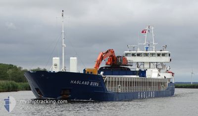
HAGLAND BORG
General Cargo
Current Trip
| Time Travelled | 2 days |
|---|---|
| Remaining Time | 2 h, 33 mins |
| Distance Travelled | 359.23 nm |
| Remaining Distance | 16.16 nm |
| AVG Speed | 8.3 Knots |
| MAX Speed | 12.7 Knots |
| AVG Wind | 7.1 knots |
| MAX Wind | 16.6 knots |
| MIN Temp | 7.8°C / 46.04°F |
| MAX Temp | 17.2°C / 62.96°F |
| Draught | 3.2 m |
| Position Received | 2 m ago |
Current Position
| Longitude | 5.43379° |
|---|---|
| Latitude | 59.94967° |
| Status | Under way using engine |
| Speed | 4.4 Knots |
| Course | 125° |
| Area | North Sea |
| Station | T-AIS |
| Position Received | 2 m ago |
Info
Information
The current position of HAGLAND BORG is in North Sea with coordinates 59.94967° / 5.43379° as reported on 2024-06-16 02:15 by AIS to our vessel tracker app. The vessel's current speed is 4.4 Knots and is heading at the port of HOYLANDSBYGDA. The estimated time of arrival as calculated by vessel tracking app is 2024-06-16 04:51 LT
The vessel HAGLAND BORG (IMO: 9173563, MMSI: 258709000) is a General Cargo that was built in 1997 ( 27 years old ). It's sailing under the flag of [NO] Norway.
In this page you can find informations about the vessels current position, last detected port calls, and current voyage information. If the vessels is not in coverage by AIS you will find the latest position.
The current position of HAGLAND BORG is detected by our AIS receivers and we are not responsible for the reliability of the data. The last position was recorded while the vessel was in Coverage by the Ais receivers of our vessel tracking app.
The current draught of HAGLAND BORG as reported by AIS is 3.2 meters
Weather
| Temperature | 11.1°C / 51.98°F |
|---|---|
| Wind Speed | 2 knots |
| Direction | 117° ESE |
| Pressure | 999.7 hPa |
| Humidity | 89.9 % |
| Cloud Coverage | 100 % |
Featured Company
Last Port Calls
| Port | Arrival | Departure | Time In Port |
|---|---|---|---|
| 2024-06-12 17:13 | 2024-06-13 15:03 | 21 h | |
| 2024-06-09 01:46 | 2024-06-09 17:39 | 15 h | |
| 2024-06-07 18:38 | 2024-06-08 02:55 | 8 h | |
| 2024-06-05 20:09 | 2024-06-06 11:20 | 15 h | |
| 2024-06-04 15:16 | 2024-06-04 20:00 | 4 h | |
| 2024-06-01 07:43 | 2024-06-01 21:35 | 13 h | |
| 2024-05-31 10:12 | 2024-06-01 03:01 | 16 h | |
| 2024-05-25 20:24 | 2024-05-26 02:49 | 6 h | |
| 2024-05-24 17:34 | 2024-05-25 02:01 | 8 h | |
| 2024-05-22 17:58 | 2024-05-22 21:32 | 3 h |
Last Trips
| Origin | Departure | Destination | Arrival | Distance | |
|---|---|---|---|---|---|
| 2024-06-09 19:39 | 2024-06-12 19:13 | 653.63 nm | |||
| 2024-06-08 04:55 | 2024-06-09 03:46 | 253.40 nm | |||
| 2024-06-06 13:20 | 2024-06-07 20:38 | 315.14 nm | |||
| 2024-06-04 22:00 | 2024-06-05 22:09 | 139.46 nm | |||
| 2024-06-01 23:35 | 2024-06-04 17:16 | 294.89 nm | |||
| 2024-06-01 05:01 | 2024-06-01 09:43 | 51.01 nm | |||
| 2024-05-26 04:49 | 2024-05-31 12:12 | 695.99 nm | |||
| 2024-05-25 04:01 | 2024-05-25 22:24 | 141.18 nm | |||
| 2024-05-22 23:32 | 2024-05-24 19:34 | 399.60 nm | |||
| 2024-05-22 14:15 | 2024-05-22 19:58 | 30.67 nm |
Events
| Time | Event | Details | Position / Dest | Info |
|---|---|---|---|---|
| 2024-06-15 21:03 | ETA Changed | 2024/06/16 08:00 2024/06/14 19:00 |
60.42469 / 5.04614
NOHLB
|
Speed: 7.3 kn Course: 141.4° |
| 2024-06-15 15:46 | Change Sea Area | Norwegian part of the North Sea Norwegian part of the Norwegian Sea |
60.99837 / 4.75387
North Sea
|
Speed: 7.8 kn Course: 184.1° |
| 2024-06-15 01:18 | Status Changed | Under way using engine Moored |
62.48683 / 6.38447
NOHLB
|
Speed: 2.3 kn Course: 295° |
| 2024-06-15 01:18 | START Moving | 1.11 nm, North East of SPJELKAVIK |
62.48683 / 6.38447
NOHLB
|
Speed: 6.1 kn Course: 292.6° |
| 2024-06-15 01:17 | ETA Changed | 2024/06/14 19:00 2024/06/16 07:00 |
62.48568 / 6.38919
NOHLB
|
Speed: 2.3 kn Course: 295° |
| 2024-06-14 19:38 | Draught Changed | 3.2 4.8 |
62.48536 / 6.39054
NOHLB
|
Speed: Course: 256° |
| 2024-06-14 19:38 | Destination Changed | NOHLB NOALV |
62.48536 / 6.39054
NOHLB
|
Speed: Course: 256° |
| 2024-06-14 19:38 | ETA Changed | 2024/06/16 07:00 2024/06/14 19:00 |
62.48536 / 6.39054
NOHLB
|
Speed: Course: 256° |
| 2024-06-14 17:19 | Status Changed | Moored Under way using engine |
62.48534 / 6.39057
NOALV
|
Speed: Course: 257° |
| 2024-06-14 17:14 | STOP Moving | 1.21 nm, North East of SPJELKAVIK |
62.48536 / 6.39064
NOALV
|
Speed: 0.2 kn Course: 257° |