
HAJE HALIMEH
General Cargo
Current Trip
COSTANTA
| Time Travelled | 5 days |
|---|---|
| Remaining Time | --- |
| Distance Travelled | 23.27 nm |
| Remaining Distance | --- |
| AVG Speed | 8.9 Knots |
| MAX Speed | 9.9 Knots |
| AVG Wind | 13.5 knots |
| MAX Wind | 14.3 knots |
| MIN Temp | 15.5°C / 59.9°F |
| MAX Temp | 16.3°C / 61.34°F |
| Draught | 8.4 m |
| Position Received | 5 d ago |
Current Position
| Longitude | 28.88700° |
|---|---|
| Latitude | 44.12100° |
| Status | Under way using engine |
| Speed | 8.1 Knots |
| Course | 58.8° |
| Area | Black Sea |
| Station | T-AIS |
| Position Received | 5 d ago |
Info
Information
The current position of HAJE HALIMEH is in Black Sea with coordinates 44.12100° / 28.88700° as reported on 2024-05-27 15:53 by AIS to our vessel tracker app. The vessel's current speed is 8.1 Knots
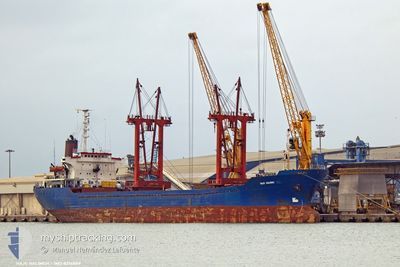
The vessel HAJE HALIMEH (IMO: 8214889, MMSI: 620999090) is a General Cargo that was built in 1983 ( 41 years old ). It's sailing under the flag of [KM] Comoros.
In this page you can find informations about the vessels current position, last detected port calls, and current voyage information. If the vessels is not in coverage by AIS you will find the latest position.
The current position of HAJE HALIMEH is detected by our AIS receivers and we are not responsible for the reliability of the data. The last position was recorded while the vessel was in Coverage by the Ais receivers of our vessel tracking app.
The current draught of HAJE HALIMEH as reported by AIS is 8.4 meters
Weather
| Temperature | 15.8°C / 60.44°F |
|---|---|
| Wind Speed | 4 knots |
| Direction | 116° ESE |
| Pressure | 1014.8 hPa |
| Humidity | 81.7 % |
| Cloud Coverage | 17 % |
Featured Company
Last Port Calls
| Port | Arrival | Departure | Time In Port |
|---|---|---|---|
| 2024-05-22 04:28 | 2024-05-27 14:54 | 5 d | |
| 2024-04-28 11:32 | 2024-04-30 18:15 | 2 d | |
| 2024-04-23 10:20 | 2024-04-23 17:08 | 6 h | |
| 2024-04-09 17:00 | 2024-04-15 03:50 | 5 d | |
| 2024-04-04 08:04 |
Last Trips
| Origin | Departure | Destination | Arrival | Distance | |
|---|---|---|---|---|---|
| 2024-04-30 20:15 | 2024-05-22 07:28 | 1382.57 nm | |||
| 2024-04-23 19:08 | 2024-04-28 13:32 | 17.77 nm | |||
| 2024-04-15 06:50 | 2024-04-23 12:20 | 1286.05 nm | |||
| 2024-04-04 11:04 | 2024-04-09 20:00 | 212.55 nm |
Events
| Time | Event | Details | Position / Dest | Info |
|---|---|---|---|---|
| 2024-05-28 00:49 | STOP Moving | 13.8 nm, East of SFANTU GHEORGHE |
44.84533 / 29.90555
COSTANTA
|
Speed: 0.2 kn Course: -1° |
| 2024-05-27 15:57 | Status Changed | Default Under way using engine |
44.12550 / 28.89700
COSTANTA
|
Speed: 8.1 kn Course: 58.8° |
| 2024-05-27 15:53 | OUT of Coverage |
44.12100 / 28.88700
Black Sea
|
Speed: 8.1 kn Course: 58.8° |
|
| 2024-05-27 15:52 | Status Changed | Under way using engine Default |
44.11964 / 28.88385
COSTANTA
|
Speed: 8.2 kn Course: 56° |
| 2024-05-27 15:45 | Status Changed | Default Under way using engine |
44.11102 / 28.86430
COSTANTA
|
Speed: 9.6 kn Course: 58.9° |
| 2024-05-27 14:54 | PORT DEPARTURE |
|
44.09843 / 28.70366
COSTANTA
|
Speed: 8.6 kn Course: 153° |
| 2024-05-27 14:49 | Status Changed | Under way using engine Default |
44.11094 / 28.69488
[RO] CONSTANTA
|
Speed: 6.1 kn Course: -1° |
| 2024-05-27 14:45 | Status Changed | Default Under way using engine |
44.11737 / 28.68911
[RO] CONSTANTA
|
Speed: 8.2 kn Course: 149.7° |
| 2024-05-27 14:22 | START Moving |
44.15472 / 28.65846
[RO] CONSTANTA
|
Speed: 4.7 kn Course: 81.2° |
|
| 2024-05-27 14:13 | Status Changed | Under way using engine Default |
44.15432 / 28.65089
[RO] CONSTANTA
|
Speed: Course: -1° |