
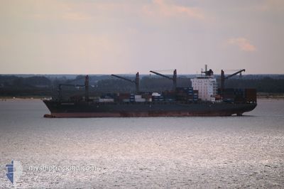
HANSA ASIA
Container Ship
Current Trip
| Time Travelled | 2 h, 31 mins |
|---|---|
| Remaining Time | --- |
| Distance Travelled | 35.88 nm |
| Remaining Distance | --- |
| AVG Speed | 17.6 Knots |
| MAX Speed | 20.1 Knots |
| AVG Wind | 3 knots |
| MAX Wind | 3.3 knots |
| MIN Temp | 24.1°C / 75.38°F |
| MAX Temp | 28.1°C / 82.58°F |
| Draught | 9.4 m |
| Position Received | 25 m ago |
Current Position
| Longitude | -59.44348° |
|---|---|
| Latitude | -3.14742° |
| Status | Under way using engine |
| Speed | 17.5 Knots |
| Course | 118° |
| Area | South Atlantic Ocean |
| Station | T-AIS |
| Position Received | 25 m ago |
Info
Information
The current position of HANSA ASIA is in South Atlantic Ocean with coordinates -3.14742° / -59.44348° as reported on 2024-06-08 12:39 by AIS to our vessel tracker app. The vessel's current speed is 17.5 Knots and is heading at the port of MACAPA.
The vessel HANSA ASIA (IMO: 9459400, MMSI: 538090582) is a Container Ship that was built in 2012 ( 12 years old ). It's sailing under the flag of [MH] Marshall Is.
In this page you can find informations about the vessels current position, last detected port calls, and current voyage information. If the vessels is not in coverage by AIS you will find the latest position.
The current position of HANSA ASIA is detected by our AIS receivers and we are not responsible for the reliability of the data. The last position was recorded while the vessel was in Coverage by the Ais receivers of our vessel tracking app.
The current draught of HANSA ASIA as reported by AIS is 9.4 meters
Weather
| Temperature | 28.6°C / 83.48°F |
|---|---|
| Wind Speed | 3 knots |
| Direction | 67° ENE |
| Pressure | 1015.5 hPa |
| Humidity | 70.4 % |
| Cloud Coverage | 100 % |
Featured Company
Last Port Calls
| Port | Arrival | Departure | Time In Port |
|---|---|---|---|
| 2024-06-05 17:18 | 2024-06-08 10:34 | 2 d | |
| 2024-05-28 04:35 | 2024-05-30 11:37 | 2 d | |
| 2024-05-22 16:38 | 2024-05-23 23:10 | 1 d | |
| 2024-05-17 23:38 | 2024-05-18 20:14 | 20 h | |
| 2024-05-13 18:15 | 2024-05-14 09:22 | 15 h | |
| 2024-05-01 12:12 | 2024-05-03 15:29 | 2 d | |
| 2024-04-25 17:08 | 2024-04-28 12:16 | 2 d | |
| 2024-04-18 15:36 | 2024-04-19 15:24 | 23 h | |
| 2024-04-15 08:03 | 2024-04-15 23:42 | 15 h | |
| 2024-04-14 00:35 | 2024-04-14 21:47 | 21 h |
Most Visited Ports (Last year)
| Port | Arrivals | |
|---|---|---|
| 13 | ||
| 11 | ||
| 11 | ||
| 10 | ||
| 10 | ||
| 7 |
Last Trips
| Origin | Departure | Destination | Arrival | Distance | |
|---|---|---|---|---|---|
| 2024-05-30 07:37 | 2024-06-05 13:18 | 1900.35 nm | |||
| 2024-05-23 18:10 | 2024-05-28 00:35 | 1185.65 nm | |||
| 2024-05-18 15:14 | 2024-05-22 11:38 | 25.65 nm | |||
| 2024-05-14 04:22 | 2024-05-17 18:38 | 320.60 nm | |||
| 2024-05-03 12:29 | 2024-05-13 13:15 | 2374.97 nm | |||
| 2024-04-28 08:16 | 2024-05-01 09:12 | 1133.69 nm | |||
| 2024-04-19 11:24 | 2024-04-25 13:08 | 1963.78 nm | |||
| 2024-04-15 18:42 | 2024-04-18 11:36 | 1155.72 nm | |||
| 2024-04-14 16:47 | 2024-04-15 03:03 | 18.97 nm | |||
| 2024-04-13 02:18 | 2024-04-13 19:35 | 289.12 nm |
Events
| Time | Event | Details | Position / Dest | Info |
|---|---|---|---|---|
| 2024-06-08 12:43 | Status Changed | Default Under way using engine |
-3.15545 / -59.42858
BRMCP
|
Speed: 17.5 kn Course: 118° |
| 2024-06-08 12:38 | Status Changed | Under way using engine Default |
-3.14405 / -59.44987
BRMCP
|
Speed: 17.8 kn Course: 105° |
| 2024-06-08 12:38 | IN Coverage |
-3.14742 / -59.44348
South Atlantic Ocean
|
Speed: 17.5 kn Course: 118° |
|
| 2024-06-08 11:26 | Status Changed | Default Under way using engine |
-3.06264 / -59.78202
BRMCP
|
Speed: 17 kn Course: 66.1° |
| 2024-06-08 11:24 | OUT of Coverage |
-3.06561 / -59.78969
South Atlantic Ocean
|
Speed: 17 kn Course: 66.1° |
|
| 2024-06-08 11:11 | Status Changed | Under way using engine Default |
-3.09350 / -59.84898
BRMCP
|
Speed: 19.2 kn Course: 58° |
| 2024-06-08 11:11 | IN Coverage |
-3.08889 / -59.84041
South Atlantic Ocean
|
Speed: 19.5 kn Course: 61.6° |
|
| 2024-06-08 10:34 | PORT DEPARTURE |
|
-3.14989 / -59.93731
BRMCP
|
Speed: 10.3 kn Course: 108° |
| 2024-06-08 10:25 | START Moving |
-3.16579 / -59.99385
[BR] MANAUS
|
Speed: 4 kn Course: 115° |
|
| 2024-06-05 17:18 | PORT ARRIVAL |
|
-3.15934 / -59.99720
[BR] MANAUS
|
Speed: 10.1 kn Course: 235° |