
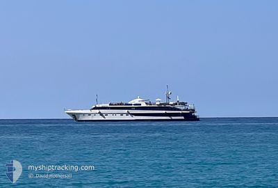
HARMONY G
Yacht
Current Trip
| Trip Time | 17 h, 51 mins |
|---|---|
| Trip Distance | 66.25 nm |
| AVG Speed | 6.8 Knots |
| MAX Speed | 8.9 Knots |
| Draught | 2.8 m |
| AVG Wind | 11.9 knots |
| MAX Wind | 15.7 knots |
| MIN Temp | 24.4°C / 75.92°F |
| MAX Temp | 25°C / 77°F |
| Position Received | 7 m ago |
Current Position
| Longitude | 24.94967° |
|---|---|
| Latitude | 36.61438° |
| Status | Moored |
| Speed | |
| Course | 150° |
| Area | Aegean Sea |
| Station | T-AIS |
| Position Received | 7 m ago |
Info
Information
The current position of HARMONY G is in Aegean Sea with coordinates 36.61438° / 24.94967° as reported on 2024-06-17 12:40 by AIS to our vessel tracker app. The vessel's current speed is 0 Knots and is currently inside the port of FOLEGANDROS.
The vessel HARMONY G (IMO: 8984989, MMSI: 239780000) is a Yacht that was built in 2001 ( 23 years old ). It's sailing under the flag of [GR] Greece.
In this page you can find informations about the vessels current position, last detected port calls, and current voyage information. If the vessels is not in coverage by AIS you will find the latest position.
The current position of HARMONY G is detected by our AIS receivers and we are not responsible for the reliability of the data. The last position was recorded while the vessel was in Coverage by the Ais receivers of our vessel tracking app.
The current draught of HARMONY G as reported by AIS is 2.8 meters
Weather
| Temperature | 25.2°C / 77.36°F |
|---|---|
| Wind Speed | 10 knots |
| Direction | 308° NW |
| Pressure | 1012.8 hPa |
| Humidity | 70.8 % |
| Cloud Coverage | 37 % |
Featured Company
Last Port Calls
| Port | Arrival | Departure | Time In Port |
|---|---|---|---|
| 2024-06-17 10:52 | |||
| 2024-06-16 16:52 | 2024-06-16 17:01 | 8 m | |
| 2024-06-16 06:07 | 2024-06-16 06:53 | 45 m | |
| 2024-06-15 14:09 | 2024-06-15 21:16 | 7 h | |
| 2024-06-15 04:20 | 2024-06-15 12:09 | 7 h | |
| 2024-06-14 18:27 | 2024-06-14 21:15 | 2 h | |
| 2024-06-13 23:12 | 2024-06-14 13:33 | 14 h | |
| 2024-06-13 13:05 | 2024-06-13 18:52 | 5 h | |
| 2024-06-12 12:39 | 2024-06-13 08:18 | 19 h | |
| 2024-06-12 04:43 | 2024-06-12 08:57 | 4 h |
Last Trips
| Origin | Departure | Destination | Arrival | Distance | |
|---|---|---|---|---|---|
| 2024-06-16 20:01 | 2024-06-17 13:52 | 66.25 nm | |||
| 2024-06-16 09:53 | 2024-06-16 19:52 | 1.90 nm | |||
| 2024-06-16 00:16 | 2024-06-16 09:07 | 66.03 nm | |||
| 2024-06-15 15:09 | 2024-06-15 17:09 | 5.01 nm | |||
| 2024-06-15 00:15 | 2024-06-15 07:20 | 52.85 nm | |||
| 2024-06-14 16:33 | 2024-06-14 21:27 | 41.43 nm | |||
| 2024-06-13 21:52 | 2024-06-14 02:12 | 37.72 nm | |||
| 2024-06-13 11:18 | 2024-06-13 16:05 | 40.56 nm | |||
| 2024-06-12 11:57 | 2024-06-12 15:39 | 32.10 nm | |||
| 2024-06-09 21:55 | 2024-06-12 07:43 | 189.83 nm |
Events
| Time | Event | Details | Position / Dest | Info |
|---|---|---|---|---|
| 2024-06-17 11:13 | Status Changed | Moored Under way using engine |
36.61437 / 24.94965
[GR] FOLEGANDROS
|
Speed: Course: 152° |
| 2024-06-17 10:52 | STOP Moving |
36.61340 / 24.95002
[GR] FOLEGANDROS
|
Speed: 0.3 kn Course: 162° |
|
| 2024-06-17 10:52 | PORT ARRIVAL |
|
36.61342 / 24.94997
[GR] FOLEGANDROS
|
Speed: 8.6 kn Course: 184.6° |
| 2024-06-17 08:52 | Destination Changed | FOLEGANDROS POLYEGOS |
36.73637 / 24.65021
FOLEGANDROS
|
Speed: 8.8 kn Course: 107.9° |
| 2024-06-17 08:52 | ETA Changed | 2024/06/17 11:00 2024/06/17 05:00 |
36.73637 / 24.65021
FOLEGANDROS
|
Speed: 8.8 kn Course: 107.9° |
| 2024-06-17 08:47 | Status Changed | Under way using engine At anchor |
36.74202 / 24.63914
POLYEGOS
|
Speed: 6.2 kn Course: 147.2° |
| 2024-06-17 08:46 | IN Coverage |
36.73858 / 24.64317
Aegean Sea
POLYEGOS
|
Speed: 8.2 kn Course: 119.4° |
|
| 2024-06-17 03:40 | OUT of Coverage |
36.74409 / 24.63814
Aegean Sea
POLYEGOS
|
Speed: 0.4 kn Course: 356.4° |
|
| 2024-06-16 21:16 | Destination Changed | POLYEGOS SANTORINI |
36.39151 / 25.36520
POLYEGOS
|
Speed: 6.9 kn Course: 279° |
| 2024-06-16 21:16 | ETA Changed | 2024/06/17 05:00 2024/06/16 06:00 |
36.39151 / 25.36520
POLYEGOS
|
Speed: 6.9 kn Course: 279° |