
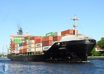
HARRISON
Container Ship
Current Trip
| Time Travelled | 4 h, 39 mins |
|---|---|
| Remaining Time | 14 h, 46 mins |
| Distance Travelled | 23.70 nm |
| Remaining Distance | 100.42 nm |
| AVG Speed | 6.2 Knots |
| MAX Speed | 7.2 Knots |
| AVG Wind | 3.5 knots |
| MAX Wind | 4.9 knots |
| MIN Temp | 17°C / 62.6°F |
| MAX Temp | 17.9°C / 64.22°F |
| Draught | 9.3 m |
| Position Received | 1 m ago |
Current Position
| Longitude | 9.60192° |
|---|---|
| Latitude | 54.22715° |
| Status | Under way using engine |
| Speed | 6.9 Knots |
| Course | 207.4° |
| Area | Baltic Sea |
| Station | T-AIS |
| Position Received | 1 m ago |
Info
Information
The current position of HARRISON is in Baltic Sea with coordinates 54.22715° / 9.60192° as reported on 2024-06-28 02:02 by AIS to our vessel tracker app. The vessel's current speed is 6.9 Knots and is heading at the port of BREMERHAVEN. The estimated time of arrival as calculated by vessel tracking app is 2024-06-28 16:49 LT
The vessel HARRISON (IMO: 9220079, MMSI: 538001652) is a Container Ship that was built in 2002 ( 22 years old ). It's sailing under the flag of [MH] Marshall Is.
In this page you can find informations about the vessels current position, last detected port calls, and current voyage information. If the vessels is not in coverage by AIS you will find the latest position.
The current position of HARRISON is detected by our AIS receivers and we are not responsible for the reliability of the data. The last position was recorded while the vessel was in Coverage by the Ais receivers of our vessel tracking app.
The current draught of HARRISON as reported by AIS is 9.3 meters
Weather
| Temperature | 17.4°C / 63.32°F |
|---|---|
| Wind Speed | 3 knots |
| Direction | 210° SSW |
| Pressure | 1007.1 hPa |
| Humidity | 94.1 % |
| Cloud Coverage | 61 % |
Featured Company
Last Port Calls
| Port | Arrival | Departure | Time In Port |
|---|---|---|---|
| 2024-06-27 20:10 | 2024-06-27 21:24 | 1 h | |
| 2024-06-24 11:40 | 2024-06-26 02:30 | 1 d | |
| 2024-06-21 19:09 | 2024-06-22 00:15 | 5 h | |
| 2024-06-20 13:17 | 2024-06-21 11:05 | 21 h | |
| 2024-06-18 11:47 | 2024-06-19 22:15 | 1 d | |
| 2024-06-14 16:51 | 2024-06-15 20:15 | 1 d | |
| 2024-06-14 02:43 | 2024-06-14 14:51 | 12 h | |
| 2024-06-11 10:01 | 2024-06-12 20:22 | 1 d | |
| 2024-06-10 07:38 | 2024-06-10 15:57 | 8 h | |
| 2024-06-08 18:03 | 2024-06-09 02:35 | 8 h |
Most Visited Ports (Last year)
| Port | Arrivals | |
|---|---|---|
| 27 | ||
| 18 | ||
| 15 | ||
| 15 | ||
| 14 | ||
| 10 |
Last Trips
| Origin | Departure | Destination | Arrival | Distance | |
|---|---|---|---|---|---|
| 2024-06-26 05:30 | 2024-06-27 22:10 | 634.37 nm | |||
| 2024-06-22 02:15 | 2024-06-24 14:40 | 757.05 nm | |||
| 2024-06-21 13:05 | 2024-06-21 21:09 | 107.61 nm | |||
| 2024-06-20 00:15 | 2024-06-20 15:17 | 128.18 nm | |||
| 2024-06-15 22:15 | 2024-06-18 13:47 | 497.57 nm | |||
| 2024-06-14 16:51 | 2024-06-14 18:51 | 11.75 nm | |||
| 2024-06-12 22:22 | 2024-06-14 04:43 | 310.74 nm | |||
| 2024-06-10 17:57 | 2024-06-11 12:01 | 267.51 nm | |||
| 2024-06-09 04:35 | 2024-06-10 09:38 | 446.99 nm | |||
| 2024-06-07 22:04 | 2024-06-08 20:03 | 361.55 nm |
Events
| Time | Event | Details | Position / Dest | Info |
|---|---|---|---|---|
| 2024-06-27 23:27 | START Moving | 7.34 nm, West of KIEL |
54.34176 / 9.95128
DEBRV VIA DENOK
|
Speed: 3.4 kn Course: 255° |
| 2024-06-27 23:05 | STOP Moving | 7.23 nm, West of KIEL |
54.34203 / 9.95443
DEBRV VIA DENOK
|
Speed: 0.3 kn Course: 259° |
| 2024-06-27 22:17 | START Moving | 3.88 nm, West of KIEL |
54.36050 / 10.05785
DEBRV VIA DENOK
|
Speed: 4.3 kn Course: 245° |
| 2024-06-27 22:02 | STOP Moving | 3.79 nm, North West of KIEL |
54.36117 / 10.06092
DEBRV VIA DENOK
|
Speed: 0.3 kn Course: 252° |
| 2024-06-27 21:24 | PORT DEPARTURE |
|
54.36672 / 10.13410
DEBRV VIA DENOK
|
Speed: 5.5 kn Course: 292° |
| 2024-06-27 21:22 | START Moving |
54.36612 / 10.13793
[DE] KIEL
|
Speed: 3.2 kn Course: 284° |
|
| 2024-06-27 20:29 | STOP Moving |
54.36560 / 10.14203
[DE] KIEL
|
Speed: 0.3 kn Course: 282° |
|
| 2024-06-27 20:10 | PORT ARRIVAL |
|
54.36310 / 10.16406
[DE] KIEL
|
Speed: 3.5 kn Course: 268° |
| 2024-06-27 17:50 | Change Sea Area | German part of the Baltic Sea Danish part of the Baltic Sea |
54.56634 / 10.56234
Baltic Sea
DEBRV VIA DENOK
|
Speed: 10.5 kn Course: 246° |
| 2024-06-27 16:59 | Detected in Sea | Danish part of the Baltic Sea |
54.58907 / 10.81185
Baltic Sea
DEBRV VIA DENOK
|
Speed: 10.5 kn Course: 261.7° |