
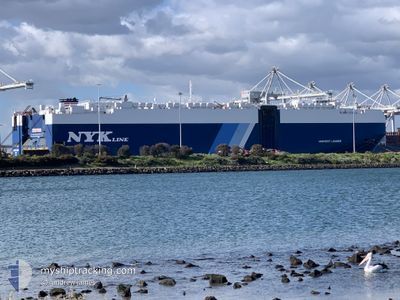
HARVEST LEADER
Cargo
Current Trip
JP MIZ A
| Time Travelled | 15 h, 27 mins |
|---|---|
| Remaining Time | --- |
| Distance Travelled | 152.06 nm |
| Remaining Distance | --- |
| AVG Speed | 11.4 Knots |
| MAX Speed | 14.5 Knots |
| AVG Wind | 21.9 knots |
| MAX Wind | 41.9 knots |
| MIN Temp | 18°C / 64.4°F |
| MAX Temp | 23.5°C / 74.3°F |
| Draught | 8.6 m |
| Position Received | 13 h, 11 m ago |
Current Position
| Longitude | 139.67324° |
|---|---|
| Latitude | 34.97090° |
| Status | Under way using engine |
| Speed | 12.3 Knots |
| Course | 197.7° |
| Area | North Pacific Ocean |
| Station | T-AIS |
| Position Received | 13 h, 11 m ago |
Info
Information
The current position of HARVEST LEADER is in North Pacific Ocean with coordinates 34.97090° / 139.67324° as reported on 2024-06-21 06:44 by AIS to our vessel tracker app. The vessel's current speed is 12.3 Knots
The vessel HARVEST LEADER (IMO: 9690523, MMSI: 311000187) is a Cargo It's sailing under the flag of [BS] Bahamas.
In this page you can find informations about the vessels current position, last detected port calls, and current voyage information. If the vessels is not in coverage by AIS you will find the latest position.
The current position of HARVEST LEADER is detected by our AIS receivers and we are not responsible for the reliability of the data. The last position was recorded while the vessel was in Coverage by the Ais receivers of our vessel tracking app.
The current draught of HARVEST LEADER as reported by AIS is 8.6 meters
Weather
| Temperature | 22.8°C / 73.04°F |
|---|---|
| Wind Speed | 10 knots |
| Direction | 193° SSW |
| Pressure | 1007.8 hPa |
| Humidity | 80.5 % |
| Cloud Coverage | 100 % |
Featured Company
Last Port Calls
| Port | Arrival | Departure | Time In Port |
|---|---|---|---|
| 2024-06-20 22:07 | 2024-06-21 04:28 | 6 h | |
| 2024-06-18 22:35 | 2024-06-19 02:57 | 4 h | |
| 2024-06-16 06:29 | 2024-06-18 11:33 | 2 d | |
| 2024-06-13 20:05 | 2024-06-14 06:39 | 10 h | |
| 2024-05-30 17:36 | 2024-05-31 07:52 | 14 h | |
| 2024-05-26 16:16 | 2024-05-28 09:24 | 1 d | |
| 2024-05-23 18:12 | 2024-05-24 14:32 | 20 h | |
| 2024-05-17 20:56 | 2024-05-18 07:18 | 10 h | |
| 2024-05-14 20:38 | 2024-05-15 16:22 | 19 h | |
| 2024-05-11 20:30 | 2024-05-12 11:03 | 14 h |
Last Trips
| Origin | Departure | Destination | Arrival | Distance | |
|---|---|---|---|---|---|
| 2024-06-19 11:57 | 2024-06-21 07:07 | 549.78 nm | |||
| 2024-06-18 20:33 | 2024-06-19 07:35 | 162.16 nm | |||
| 2024-06-14 15:39 | 2024-06-16 15:29 | 541.01 nm | |||
| 2024-05-31 17:52 | 2024-06-14 05:05 | 4945.52 nm | |||
| 2024-05-28 19:24 | 2024-05-31 03:36 | 561.07 nm | |||
| 2024-05-25 00:32 | 2024-05-27 02:16 | 596.53 nm | |||
| 2024-05-18 17:18 | 2024-05-24 04:12 | 842.83 nm | |||
| 2024-05-16 02:22 | 2024-05-18 06:56 | 613.49 nm | |||
| 2024-05-12 21:03 | 2024-05-15 06:38 | 808.90 nm | |||
| 2024-05-03 16:12 | 2024-05-12 06:30 | 2725.29 nm |
Events
| Time | Event | Details | Position / Dest | Info |
|---|---|---|---|---|
| 2024-06-21 06:49 | Status Changed | Default Under way using engine |
34.95323 / 139.66444
JP MIZ A
|
Speed: 12.3 kn Course: 197.7° |
| 2024-06-21 06:44 | OUT of Coverage |
34.97090 / 139.67324
North Pacific Ocean
JP MIZ A
|
Speed: 12.3 kn Course: 197.7° |
|
| 2024-06-21 06:15 | Status Changed | Under way using engine Default |
35.06360 / 139.71408
JP MIZ A
|
Speed: 12.2 kn Course: 198° |
| 2024-06-21 06:13 | Status Changed | Default Under way using engine |
35.06963 / 139.71642
JP MIZ A
|
Speed: 12.2 kn Course: 197.8° |
| 2024-06-21 04:28 | PORT DEPARTURE |
|
35.41574 / 139.71065
JP MIZ A
|
Speed: 14.6 kn Course: 190° |
| 2024-06-21 04:12 | ETA Changed | 2024/06/22 12:00 2024/06/22 10:00 |
35.45119 / 139.68468
[JP] YOKOHAMA
|
Speed: 3.1 kn Course: 128° |
| 2024-06-21 04:12 | START Moving |
35.45119 / 139.68468
[JP] YOKOHAMA
|
Speed: 3.1 kn Course: 128° |
|
| 2024-06-21 03:58 | Status Changed | Under way using engine Moored |
35.45507 / 139.68340
[JP] YOKOHAMA
|
Speed: Course: 299° |
| 2024-06-21 03:57 | ETA Changed | 2024/06/22 10:00 2024/06/20 20:00 |
35.45508 / 139.68341
[JP] YOKOHAMA
|
Speed: Course: 298° |
| 2024-06-21 03:13 | Destination Changed | JP MIZ A JP YOK DS |
35.45507 / 139.68340
[JP] YOKOHAMA
|
Speed: Course: 298° |