
HARVEST RAIN
Cargo
Current Trip
| Time Travelled | 15 days |
|---|---|
| Remaining Time | --- |
| Distance Travelled | 2880.05 nm |
| Remaining Distance | --- |
| AVG Speed | 10.8 Knots |
| MAX Speed | 15 Knots |
| AVG Wind | 12.9 knots |
| MAX Wind | 30 knots |
| MIN Temp | 14.6°C / 58.28°F |
| MAX Temp | 20.4°C / 68.72°F |
| Draught | 7.5 m |
| Position Received | 6 d ago |
Current Position
| Longitude | -14.56889° |
|---|---|
| Latitude | 26.62425° |
| Status | Under way using engine |
| Speed | 11.3 Knots |
| Course | 210.7° |
| Area | North Atlantic Ocean |
| Station | T-AIS |
| Position Received | 6 d ago |
Info
Information
The current position of HARVEST RAIN is in North Atlantic Ocean with coordinates 26.62425° / -14.56889° as reported on 2024-05-10 21:39 by AIS to our vessel tracker app. The vessel's current speed is 11.3 Knots
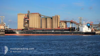
The vessel HARVEST RAIN (IMO: 9643893, MMSI: 538006315) is a Cargo It's sailing under the flag of [MH] Marshall Is.
In this page you can find informations about the vessels current position, last detected port calls, and current voyage information. If the vessels is not in coverage by AIS you will find the latest position.
The current position of HARVEST RAIN is detected by our AIS receivers and we are not responsible for the reliability of the data. The last position was recorded while the vessel was in Coverage by the Ais receivers of our vessel tracking app.
The current draught of HARVEST RAIN as reported by AIS is 7.5 meters
Weather
| Temperature | 17.3°C / 63.14°F |
|---|---|
| Wind Speed | 14 knots |
| Direction | 356° N |
| Pressure | 1013.9 hPa |
| Humidity | 83.5 % |
| Cloud Coverage | 47 % |
Featured Company
Most Visited Ports (Last year)
| Port | Arrivals | |
|---|---|---|
| 1 | ||
| 1 | ||
| 1 | ||
| 1 | ||
| 1 | ||
| 1 |
Last Trips
| Origin | Departure | Destination | Arrival | Distance | |
|---|---|---|---|---|---|
| 2024-02-19 07:28 | 2024-03-23 17:19 | 5817.43 nm |
Events
| Time | Event | Details | Position / Dest | Info |
|---|---|---|---|---|
| 2024-05-12 11:41 | STOP Moving | 6.38 nm, South of CASADO |
20.71526 / -17.00276
MRNDB
|
Speed: 0.2 kn Course: 286° |
| 2024-05-10 21:45 | Status Changed | Default Under way using engine |
26.60650 / -14.58107
MRNDB
|
Speed: 11.3 kn Course: 210.7° |
| 2024-05-10 21:39 | OUT of Coverage |
26.62425 / -14.56889
North Atlantic Ocean
MRNDB
|
Speed: 11.3 kn Course: 210.7° |
|
| 2024-05-10 21:31 | Status Changed | Under way using engine Default |
26.64386 / -14.55565
MRNDB
|
Speed: 11.2 kn Course: 210° |
| 2024-05-10 21:25 | IN Coverage |
26.64386 / -14.55565
North Atlantic Ocean
MRNDB
|
Speed: 11.3 kn Course: 210.6° |
|
| 2024-05-10 19:06 | Status Changed | Default Under way using engine |
27.02652 / -14.27260
MRNDB
|
Speed: 11.8 kn Course: 213.4° |
| 2024-05-10 19:02 | Status Changed | Under way using engine Default |
27.03599 / -14.26548
MRNDB
|
Speed: 11.8 kn Course: 214° |
| 2024-05-10 19:02 | OUT of Coverage |
27.03599 / -14.26548
North Atlantic Ocean
MRNDB
|
Speed: 11.8 kn Course: 213.4° |
|
| 2024-05-10 18:21 | Status Changed | Default Under way using engine |
27.14900 / -14.18357
MRNDB
|
Speed: 12 kn Course: 210.7° |
| 2024-05-10 18:17 | Status Changed | Under way using engine Default |
27.16203 / -14.17521
MRNDB
|
Speed: 12 kn Course: 212° |