
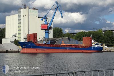
HAV PIKE
General Cargo
Current Trip
| Time Travelled | 2 days |
|---|---|
| Remaining Time | 19 h, 57 mins |
| Distance Travelled | 266.17 nm |
| Remaining Distance | 135.69 nm |
| AVG Speed | 8.4 Knots |
| MAX Speed | 11.3 Knots |
| AVG Wind | 16.7 knots |
| MAX Wind | 25 knots |
| MIN Temp | 8.2°C / 46.76°F |
| MAX Temp | 13°C / 55.4°F |
| Draught | 3.9 m |
| Position Received | Now |
Current Position
| Longitude | 1.00724° |
|---|---|
| Latitude | 53.08715° |
| Status | Under way using engine |
| Speed | 7.2 Knots |
| Course | 132.3° |
| Area | North Sea |
| Station | T-AIS |
| Position Received | Now |
Info
Information
The current position of HAV PIKE is in North Sea with coordinates 53.08715° / 1.00724° as reported on 2024-06-10 17:28 by AIS to our vessel tracker app. The vessel's current speed is 7.2 Knots and is heading at the port of ROTTERDAM. The estimated time of arrival as calculated by vessel tracking app is 2024-06-11 13:26 LT
The vessel HAV PIKE (IMO: 9106912, MMSI: 304036000) is a General Cargo that was built in 1994 ( 30 years old ). It's sailing under the flag of [AG] Antigua Barbuda.
In this page you can find informations about the vessels current position, last detected port calls, and current voyage information. If the vessels is not in coverage by AIS you will find the latest position.
The current position of HAV PIKE is detected by our AIS receivers and we are not responsible for the reliability of the data. The last position was recorded while the vessel was in Coverage by the Ais receivers of our vessel tracking app.
The current draught of HAV PIKE as reported by AIS is 3.9 meters
Weather
| Temperature | 11.2°C / 52.16°F |
|---|---|
| Wind Speed | 18 knots |
| Direction | 338° NNW |
| Pressure | 1012.2 hPa |
| Humidity | 73.8 % |
| Cloud Coverage | 20 % |
Featured Company
Last Port Calls
| Port | Arrival | Departure | Time In Port |
|---|---|---|---|
| 2024-04-17 20:55 | 2024-06-07 17:36 | ||
| 2024-04-07 03:54 | 2024-04-08 16:49 | 1 d | |
| 2024-04-01 22:22 | 2024-04-03 16:46 | 1 d |
Last Trips
| Origin | Departure | Destination | Arrival | Distance | |
|---|---|---|---|---|---|
| 2024-04-08 18:49 | 2024-04-17 21:55 | 1747.50 nm | |||
| 2024-04-03 18:46 | 2024-04-07 05:54 | 205.55 nm | |||
| 2024-03-19 16:01 | 2024-04-02 00:22 | 1833.44 nm |
Events
| Time | Event | Details | Position / Dest | Info |
|---|---|---|---|---|
| 2024-06-10 16:33 | Status Changed | Under way using engine Default |
53.15982 / .87541
NL RTM
|
Speed: 7 kn Course: 133° |
| 2024-06-10 16:28 | Status Changed | Default Under way using engine |
53.16621 / .86433
NL RTM
|
Speed: 6.9 kn Course: 133.6° |
| 2024-06-10 16:04 | ETA Changed | 2024/06/11 11:00 2024/06/11 06:00 |
53.19848 / .80736
NL RTM
|
Speed: 6.9 kn Course: 135.2° |
| 2024-06-10 14:23 | Destination Changed | NL RTM HUMBER RIVER |
53.36957 / .66534
NL RTM
|
Speed: 7.2 kn Course: 163.6° |
| 2024-06-10 14:23 | ETA Changed | 2024/06/11 06:00 2024/06/08 18:00 |
53.36957 / .66534
NL RTM
|
Speed: 7.2 kn Course: 163.6° |
| 2024-06-10 14:04 | Status Changed | Under way using engine Default |
53.40525 / .64677
HUMBER RIVER
|
Speed: 8.5 kn Course: 153° |
| 2024-06-10 13:53 | Status Changed | Default Under way using engine |
53.42699 / .62966
HUMBER RIVER
|
Speed: 7.3 kn Course: 159.4° |
| 2024-06-10 13:48 | Status Changed | Under way using engine Default |
53.43758 / .62262
HUMBER RIVER
|
Speed: 7 kn Course: 164° |
| 2024-06-10 13:45 | Status Changed | Default Under way using engine |
53.44363 / .61885
HUMBER RIVER
|
Speed: 7.2 kn Course: 159.4° |
| 2024-06-10 13:36 | Status Changed | Under way using engine Default |
53.46061 / .60892
HUMBER RIVER
|
Speed: 7.2 kn Course: 159° |