
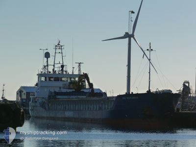
HAV VESTLANDIA
General Cargo
Current Trip
| Time Travelled | 2 days |
|---|---|
| Remaining Time | --- |
| Distance Travelled | 543.82 nm |
| Remaining Distance | --- |
| AVG Speed | 10.3 Knots |
| MAX Speed | 12.2 Knots |
| AVG Wind | 23.7 knots |
| MAX Wind | 30 knots |
| MIN Temp | 7°C / 44.6°F |
| MAX Temp | 9.2°C / 48.56°F |
| Draught | 4 m |
| Position Received | 1 d ago |
Current Position
| Longitude | -20.68225° |
|---|---|
| Latitude | 63.16105° |
| Status | Under way using engine |
| Speed | 10.3 Knots |
| Course | 104.2° |
| Area | North Atlantic Ocean |
| Station | T-AIS |
| Position Received | 1 d ago |
Info
Information
The current position of HAV VESTLANDIA is in North Atlantic Ocean with coordinates 63.16105° / -20.68225° as reported on 2024-05-30 10:25 by AIS to our vessel tracker app. The vessel's current speed is 10.3 Knots and is heading at the port of TERNEUZEN. The estimated time of arrival as calculated by vessel tracking app is 2024-06-02 17:00 LT
The vessel HAV VESTLANDIA (IMO: 9197454, MMSI: 231855000) is a General Cargo that was built in 2005 ( 19 years old ). It's sailing under the flag of [FO] Faroe Is.
In this page you can find informations about the vessels current position, last detected port calls, and current voyage information. If the vessels is not in coverage by AIS you will find the latest position.
The current position of HAV VESTLANDIA is detected by our AIS receivers and we are not responsible for the reliability of the data. The last position was recorded while the vessel was in Coverage by the Ais receivers of our vessel tracking app.
The current draught of HAV VESTLANDIA as reported by AIS is 4 meters
Weather
| Temperature | 7°C / 44.6°F |
|---|---|
| Wind Speed | 17 knots |
| Direction | 226° SW |
| Pressure | 1014.8 hPa |
| Humidity | 94.7 % |
| Cloud Coverage | 100 % |
Featured Company
Last Port Calls
| Port | Arrival | Departure | Time In Port |
|---|---|---|---|
| 2024-05-27 15:22 | 2024-05-29 21:44 | 2 d | |
| 2024-05-21 12:50 | 2024-05-22 15:40 | 1 d | |
| 2024-05-17 07:04 | 2024-05-18 23:56 | 1 d | |
| 2024-05-14 14:42 | 2024-05-14 16:39 | 1 h | |
| 2024-05-13 19:20 | 2024-05-14 05:13 | 9 h | |
| 2024-05-03 11:42 | 2024-05-05 22:16 | 2 d | |
| 2024-04-30 06:17 | 2024-05-02 03:57 | 1 d | |
| 2024-04-26 06:45 | 2024-04-26 09:31 | 2 h | |
| 2024-04-22 04:22 | 2024-04-24 02:23 | 1 d | |
| 2024-04-16 22:50 | 2024-04-17 18:07 | 19 h |
Most Visited Ports (Last year)
| Port | Arrivals | |
|---|---|---|
| 18 | ||
| 10 | ||
| 5 | ||
| 5 | ||
| 4 | ||
| 4 |
Last Trips
| Origin | Departure | Destination | Arrival | Distance | |
|---|---|---|---|---|---|
| 2024-05-22 17:40 | 2024-05-27 15:22 | 1190.05 nm | |||
| 2024-05-19 01:56 | 2024-05-21 14:50 | 544.84 nm | |||
| 2024-05-14 18:39 | 2024-05-17 09:04 | 544.27 nm | |||
| 2024-05-14 07:13 | 2024-05-14 16:42 | 92.92 nm | |||
| 2024-05-05 22:16 | 2024-05-13 21:20 | 1228.82 nm | |||
| 2024-05-02 03:57 | 2024-05-03 11:42 | 348.16 nm | |||
| 2024-04-26 11:31 | 2024-04-30 06:17 | 904.38 nm | |||
| 2024-04-24 04:23 | 2024-04-26 08:45 | 543.30 nm | |||
| 2024-04-17 20:07 | 2024-04-22 06:22 | 603.69 nm | |||
| 2024-04-11 15:20 | 2024-04-17 00:50 | 992.88 nm |
Events
| Time | Event | Details | Position / Dest | Info |
|---|---|---|---|---|
| 2024-05-30 10:39 | Status Changed | Default Under way using engine |
63.15167 / -20.59833
FOR ORDER
|
Speed: 10.3 kn Course: 104.2° |
| 2024-05-30 10:25 | OUT of Coverage |
63.16105 / -20.68225
North Atlantic Ocean
FOR ORDER
|
Speed: 10.3 kn Course: 104.2° |
|
| 2024-05-30 08:54 | Draught Changed | 4 5.7 |
63.26787 / -21.18655
FOR ORDER
|
Speed: 10.3 kn Course: 121.6° |
| 2024-05-30 08:54 | Destination Changed | FOR ORDER GRUNDARTANGI |
63.26787 / -21.18655
FOR ORDER
|
Speed: 10.3 kn Course: 121.6° |
| 2024-05-30 08:54 | ETA Changed | 2024/06/02 17:00 2024/05/28 18:00 |
63.26787 / -21.18655
FOR ORDER
|
Speed: 10.3 kn Course: 121.6° |
| 2024-05-30 08:43 | Detected in Sea | Icelandic part of the North Atlantic Ocean |
63.28479 / -21.24686
North Atlantic Ocean
|
Speed: 10.2 kn Course: 120.9° |
| 2024-05-30 08:43 | Status Changed | Under way using engine Default |
63.28479 / -21.24686
GRUNDARTANGI
|
Speed: 10 kn Course: 123° |
| 2024-05-30 08:36 | IN Coverage |
63.28479 / -21.24686
North Atlantic Ocean
|
Speed: 10.2 kn Course: 120.9° |
|
| 2024-05-29 21:45 | START Moving | 0.95 nm, South of GRUNDARTANGI |
64.34167 / -21.78333
GRUNDARTANGI
|
Speed: 8 kn Course: -1° |
| 2024-05-29 21:44 | PORT DEPARTURE |
|
64.34167 / -21.78333
GRUNDARTANGI
|
Speed: 3 kn Course: -1° |