
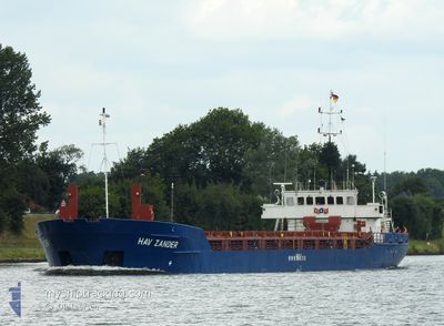
HAV ZANDER
General Cargo
Current Trip
| Time Travelled | 3 days |
|---|---|
| Remaining Time | --- |
| Distance Travelled | 544.32 nm |
| Remaining Distance | --- |
| AVG Speed | 5.9 Knots |
| MAX Speed | 8 Knots |
| AVG Wind | 14.9 knots |
| MAX Wind | 23 knots |
| MIN Temp | 16°C / 60.8°F |
| MAX Temp | 25.6°C / 78.08°F |
| Draught | 3.1 m |
| Position Received | 11 h, 6 m ago |
Current Position
| Longitude | -6.50485° |
|---|---|
| Latitude | 36.04599° |
| Status | Under way using engine |
| Speed | 7.8 Knots |
| Course | 287.5° |
| Area | North Atlantic Ocean |
| Station | T-AIS |
| Position Received | 11 h, 6 m ago |
Info
Information
The current position of HAV ZANDER is in North Atlantic Ocean with coordinates 36.04599° / -6.50485° as reported on 2024-05-17 17:10 by AIS to our vessel tracker app. The vessel's current speed is 7.8 Knots and is heading at the port of GIJON. The estimated time of arrival as calculated by vessel tracking app is 2024-05-21 06:00 LT
The vessel HAV ZANDER (IMO: 9001849, MMSI: 311014900) is a General Cargo that was built in 1990 ( 34 years old ). It's sailing under the flag of [BS] Bahamas.
In this page you can find informations about the vessels current position, last detected port calls, and current voyage information. If the vessels is not in coverage by AIS you will find the latest position.
The current position of HAV ZANDER is detected by our AIS receivers and we are not responsible for the reliability of the data. The last position was recorded while the vessel was in Coverage by the Ais receivers of our vessel tracking app.
The current draught of HAV ZANDER as reported by AIS is 3.1 meters
Weather
| Temperature | 16°C / 60.8°F |
|---|---|
| Wind Speed | 13 knots |
| Direction | 344° NNW |
| Pressure | 1013.6 hPa |
| Humidity | 74 % |
| Cloud Coverage | --- |
Featured Company
Last Port Calls
| Port | Arrival | Departure | Time In Port |
|---|---|---|---|
| 2024-05-13 22:19 | 2024-05-14 11:17 | 12 h | |
| 2024-05-11 15:51 | 2024-05-11 20:07 | 4 h | |
| 2024-05-04 02:49 | 2024-05-04 12:24 | 9 h | |
| 2024-05-01 21:26 | 2024-05-01 21:40 | 14 m | |
| 2024-05-01 20:15 | 2024-05-01 20:17 | 2 m | |
| 2024-04-27 23:52 | 2024-04-29 16:16 | 1 d | |
| 2024-04-16 17:41 | 2024-04-17 14:57 | 21 h | |
| 2024-04-15 07:16 | 2024-04-15 18:37 | 11 h | |
| 2024-04-09 13:54 | 2024-04-10 17:11 | 1 d | |
| 2024-04-02 20:22 | 2024-04-03 21:01 | 1 d |
Last Trips
| Origin | Departure | Destination | Arrival | Distance | |
|---|---|---|---|---|---|
| 2024-05-11 21:07 | 2024-05-14 00:19 | 420.31 nm | |||
| 2024-05-04 14:24 | 2024-05-11 16:51 | 1338.48 nm | |||
| 2024-05-01 23:40 | 2024-05-04 04:49 | 146.25 nm | |||
| 2024-05-01 22:17 | 2024-05-01 23:26 | 2.02 nm | |||
| 2024-04-29 17:16 | 2024-05-01 22:15 | 409.09 nm | |||
| 2024-04-17 16:57 | 2024-04-28 00:52 | 1757.94 nm | |||
| 2024-04-15 20:37 | 2024-04-16 19:41 | 171.65 nm | |||
| 2024-04-10 19:11 | 2024-04-15 09:16 | 883.11 nm | |||
| 2024-04-03 23:01 | 2024-04-09 15:54 | 802.59 nm | |||
| 2024-04-02 20:13 | 2024-04-02 22:22 | 13.92 nm |
Events
| Time | Event | Details | Position / Dest | Info |
|---|---|---|---|---|
| 2024-05-17 17:23 | Status Changed | Default Under way using engine |
36.05500 / -6.53833
GIJON
|
Speed: 7.8 kn Course: 287.5° |
| 2024-05-17 17:10 | Status Changed | Under way using engine Default |
36.04599 / -6.50485
GIJON
|
Speed: 7 kn Course: 286° |
| 2024-05-17 17:10 | OUT of Coverage |
36.04599 / -6.50485
North Atlantic Ocean
GIJON
|
Speed: 7.8 kn Course: 287.5° |
|
| 2024-05-17 16:59 | IN Coverage |
36.04599 / -6.50485
North Atlantic Ocean
GIJON
|
Speed: 7.8 kn Course: 287.5° |
|
| 2024-05-17 13:42 | Status Changed | Default Under way using engine |
35.96603 / -5.99008
GIJON
|
Speed: 7.2 kn Course: 269° |
| 2024-05-17 13:42 | Status Changed | Under way using engine Default |
35.96603 / -5.98972
GIJON
|
Speed: 7.2 kn Course: 269° |
| 2024-05-17 13:42 | OUT of Coverage |
35.96603 / -5.98972
North Atlantic Ocean
GIJON
|
Speed: 7.2 kn Course: 269° |
|
| 2024-05-17 13:42 | Detected in Sea | Spanish part of the North Atlantic Ocean |
35.96603 / -5.98972
North Atlantic Ocean
GIJON
|
Speed: 7.2 kn Course: 269° |
| 2024-05-17 12:59 | Status Changed | Default Under way using engine |
35.96599 / -5.88236
GIJON
|
Speed: 7 kn Course: 269.7° |
| 2024-05-17 12:50 | Status Changed | Under way using engine Default |
35.96612 / -5.86203
GIJON
|
Speed: 6.8 kn Course: 270° |