
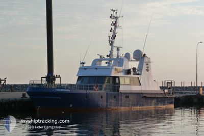
HAVOERNEN
Fishery Patrol Vessel
Current Position
| Longitude | 9.97595° |
|---|---|
| Latitude | 57.59200° |
| Status | Under way using engine |
| Speed | |
| Course | 313° |
| Area | Skaggerak |
| Station | T-AIS |
| Position Received | 1 d ago |
Info
Information
The current position of HAVOERNEN is in Skaggerak with coordinates 57.59200° / 9.97595° as reported on 2024-05-23 21:25 by AIS to our vessel tracker app. The vessel's current speed is 0 Knots and is currently inside the port of HIRTSHALS.
The vessel HAVOERNEN (IMO: 9108477, MMSI: 219635000) is a Fishery Patrol Vessel that was built in 1995 ( 29 years old ). It's sailing under the flag of [DK] Denmark.
In this page you can find informations about the vessels current position, last detected port calls, and current voyage information. If the vessels is not in coverage by AIS you will find the latest position.
The current position of HAVOERNEN is detected by our AIS receivers and we are not responsible for the reliability of the data. The last position was recorded while the vessel was in Coverage by the Ais receivers of our vessel tracking app.
The current draught of HAVOERNEN as reported by AIS is 2.5 meters
Weather
| Temperature | 14.6°C / 58.28°F |
|---|---|
| Wind Speed | 7 knots |
| Direction | 222° SW |
| Pressure | 1014.5 hPa |
| Humidity | 97.3 % |
| Cloud Coverage | 100 % |
Featured Company
Last Port Calls
| Port | Arrival | Departure | Time In Port |
|---|---|---|---|
| 2024-05-23 21:01 | |||
| 2024-05-05 12:27 | |||
| 2024-04-29 14:12 | |||
| 2024-04-27 13:09 | 2024-04-29 06:03 | 1 d | |
| 2024-04-25 15:06 | 2024-04-26 06:45 | 15 h | |
| 2024-03-26 13:42 | 2024-04-05 06:42 | 9 d | |
| 2024-03-21 04:35 | 2024-03-23 04:51 | 2 d | |
| 2024-03-08 17:09 | 2024-03-09 07:19 | 14 h | |
| 2024-03-08 05:48 | |||
| 2024-03-02 06:11 |
Most Visited Ports (Last year)
| Port | Arrivals | |
|---|---|---|
| 5 | ||
| 5 | ||
| 4 | ||
| 3 | ||
| 3 | ||
| 3 |
Last Trips
| Origin | Departure | Destination | Arrival | Distance | |
|---|---|---|---|---|---|
| 2024-04-29 08:03 | 2024-04-29 16:12 | 30.56 nm | |||
| 2024-04-26 08:45 | 2024-04-27 15:09 | 106.18 nm | |||
| 2024-04-05 08:42 | 2024-04-25 17:06 | 174.65 nm | |||
| 2024-03-23 05:51 | 2024-03-26 14:42 | 208.98 nm | |||
| 2024-03-09 08:19 | 2024-03-21 05:35 | 359.11 nm | |||
| 2024-03-08 06:48 | 2024-03-08 18:09 | 92.73 nm |
Events
| Time | Event | Details | Position / Dest | Info |
|---|---|---|---|---|
| 2024-05-23 21:25 | OUT of Coverage |
57.59200 / 9.97595
Skaggerak
[DK] HIRTSHALS
|
Speed: Course: 0.1° |
|
| 2024-05-23 21:11 | STOP Moving |
57.59197 / 9.97586
[DK] HIRTSHALS
|
Speed: 0.3 kn Course: 325° |
|
| 2024-05-23 21:01 | PORT ARRIVAL |
|
57.59838 / 9.95908
[DK] HIRTSHALS
|
Speed: 9.1 kn Course: 176.8° |
| 2024-05-23 19:44 | Change Sea Area | Danish part of the Skaggerak Danish part of the Kattegat |
57.83840 / 9.92975
Skaggerak
|
Speed: 12 kn Course: 182° |
| 2024-05-23 19:42 | IN Coverage |
57.83840 / 9.92975
Skaggerak
|
Speed: 12 kn Course: 182° |
|
| 2024-05-18 06:04 | OUT of Coverage |
56.97925 / 10.41112
Kattegat
|
Speed: 12.1 kn Course: 37.2° |
|
| 2024-05-18 05:18 | IN Coverage |
56.98757 / 10.20696
Kattegat
|
Speed: 10.8 kn Course: 118.2° |