
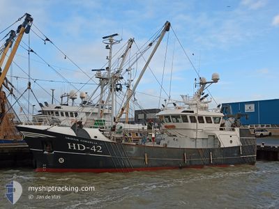
HD42 GRIETJECORNELIA
Fishing
Current Trip
| Time Travelled | 2 days |
|---|---|
| Remaining Time | 10 h, 8 mins |
| Distance Travelled | 189.98 nm |
| Remaining Distance | 157.65 nm |
| AVG Speed | 8.9 Knots |
| MAX Speed | 11.1 Knots |
| AVG Wind | 10.3 knots |
| MAX Wind | 17.5 knots |
| MIN Temp | 13.8°C / 56.84°F |
| MAX Temp | 14.6°C / 58.28°F |
| Draught | 3.2 m |
| Position Received | 13 h, 41 m ago |
Current Position
| Longitude | 7.93609° |
|---|---|
| Latitude | 54.49853° |
| Status | Engaged in Fishing |
| Speed | 3 Knots |
| Course | 114° |
| Area | North Sea |
| Station | T-AIS |
| Position Received | 13 h, 41 m ago |
Info
Information
The current position of HD42 GRIETJECORNELIA is in North Sea with coordinates 54.49853° / 7.93609° as reported on 2024-05-23 01:55 by AIS to our vessel tracker app. The vessel's current speed is 3 Knots and is heading at the port of DEN HELDER. The estimated time of arrival as calculated by vessel tracking app is 2024-05-24 01:44 LT
The vessel HD42 GRIETJECORNELIA (IMO: 9860001, MMSI: 245795000) is a Fishing It's sailing under the flag of [NL] Netherlands.
In this page you can find informations about the vessels current position, last detected port calls, and current voyage information. If the vessels is not in coverage by AIS you will find the latest position.
The current position of HD42 GRIETJECORNELIA is detected by our AIS receivers and we are not responsible for the reliability of the data. The last position was recorded while the vessel was in Coverage by the Ais receivers of our vessel tracking app.
The current draught of HD42 GRIETJECORNELIA as reported by AIS is 3.2 meters
Weather
| Temperature | 14.4°C / 57.92°F |
|---|---|
| Wind Speed | 1 knots |
| Direction | 294° WNW |
| Pressure | 1010.5 hPa |
| Humidity | 91.1 % |
| Cloud Coverage | 100 % |
Featured Company
Last Port Calls
| Port | Arrival | Departure | Time In Port |
|---|---|---|---|
| 2024-05-17 05:57 | 2024-05-20 21:20 | 3 d | |
| 2024-05-14 14:03 | 2024-05-14 18:39 | 4 h | |
| 2024-05-09 07:39 | 2024-05-14 12:57 | 5 d | |
| 2024-05-08 06:19 | 2024-05-09 06:16 | 23 h | |
| 2024-04-11 08:29 | 2024-04-14 22:06 | 3 d | |
| 2024-04-02 07:57 | 2024-04-03 01:23 | 17 h | |
| 2024-03-28 08:24 | 2024-04-01 16:52 | 4 d | |
| 2024-03-21 21:25 | 2024-03-24 21:43 | 3 d | |
| 2024-03-01 03:21 | 2024-03-01 22:27 | 19 h |
Most Visited Ports (Last year)
| Port | Arrivals | |
|---|---|---|
| 16 | ||
| 6 | ||
| 1 | ||
| 1 | ||
| 1 |
Last Trips
| Origin | Departure | Destination | Arrival | Distance | |
|---|---|---|---|---|---|
| 2024-05-14 20:39 | 2024-05-17 07:57 | 188.02 nm | |||
| 2024-05-14 14:57 | 2024-05-14 16:03 | 10.90 nm | |||
| 2024-05-09 08:16 | 2024-05-09 09:39 | 10.98 nm | |||
| 2024-04-15 00:06 | 2024-05-08 08:19 | 546.11 nm | |||
| 2024-04-03 03:23 | 2024-04-11 10:29 | 421.91 nm | |||
| 2024-04-01 18:52 | 2024-04-02 09:57 | 22.87 nm | |||
| 2024-03-24 22:43 | 2024-03-28 09:24 | 95.86 nm | |||
| 2024-03-01 23:27 | 2024-03-21 22:25 | 240.58 nm | |||
| 2024-02-25 23:10 | 2024-03-01 04:21 | 222.37 nm |
Events
| Time | Event | Details | Position / Dest | Info |
|---|---|---|---|---|
| 2024-05-23 01:55 | OUT of Coverage |
54.49853 / 7.93609
North Sea
|
Speed: 3 kn Course: 118.1° |
|
| 2024-05-23 00:48 | IN Coverage |
54.49197 / 7.93024
North Sea
|
Speed: 3.4 kn Course: 300.4° |
|
| 2024-05-22 16:22 | OUT of Coverage |
54.62947 / 8.04014
North Sea
|
Speed: 3.8 kn Course: 183.9° |
|
| 2024-05-22 16:21 | IN Coverage |
54.63087 / 8.04032
North Sea
|
Speed: 3.8 kn Course: 183.4° |
|
| 2024-05-22 09:46 | OUT of Coverage |
54.62930 / 8.11012
North Sea
|
Speed: 3.2 kn Course: 299.5° |
|
| 2024-05-22 09:19 | Detected in Sea | German part of the North Sea |
54.61590 / 8.15528
North Sea
|
Speed: 3.8 kn Course: 290.6° |
| 2024-05-22 09:19 | IN Coverage |
54.61590 / 8.15528
North Sea
|
Speed: 3.8 kn Course: 290.6° |
|
| 2024-05-21 04:45 | OUT of Coverage |
53.59275 / 5.71234
North Sea
|
Speed: 9.6 kn Course: 63.4° |
|
| 2024-05-21 02:00 | IN Coverage |
53.38845 / 5.05473
North Sea
|
Speed: 10.2 kn Course: 58° |
|
| 2024-05-20 22:58 | OUT of Coverage |
53.02291 / 4.62837
North Sea
|
Speed: 8.3 kn Course: 22.5° |