
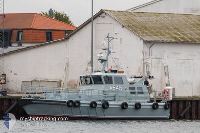
HDMS VIKAR
Military ops
Current Trip
Unknown
| Time Travelled | 22 h, 44 mins |
|---|---|
| Remaining Time | --- |
| Distance Travelled | 88.96 nm |
| Remaining Distance | --- |
| AVG Speed | 18.3 Knots |
| MAX Speed | 20.8 Knots |
| AVG Wind | 12.1 knots |
| MAX Wind | 13.5 knots |
| MIN Temp | 22.4°C / 72.32°F |
| MAX Temp | 23.7°C / 74.66°F |
| Draught | 2.5 m |
| Position Received | 17 h, 31 m ago |
Current Position
| Longitude | 12.83878° |
|---|---|
| Latitude | 35.54027° |
| Status | Under way using engine |
| Speed | 20.2 Knots |
| Course | 248.8° |
| Area | Mediterranean Sea - Eastern Basin |
| Station | T-AIS |
| Position Received | 17 h, 31 m ago |
Info
Information
The current position of HDMS VIKAR is in Mediterranean Sea - Eastern Basin with coordinates 35.54027° / 12.83878° as reported on 2024-06-24 12:32 by AIS to our vessel tracker app. The vessel's current speed is 20.2 Knots
The vessel HDMS VIKAR (MMSI: 219000546) is a Military ops It's sailing under the flag of [DK] Denmark.
In this page you can find informations about the vessels current position, last detected port calls, and current voyage information. If the vessels is not in coverage by AIS you will find the latest position.
The current position of HDMS VIKAR is detected by our AIS receivers and we are not responsible for the reliability of the data. The last position was recorded while the vessel was in Coverage by the Ais receivers of our vessel tracking app.
The current draught of HDMS VIKAR as reported by AIS is 2.5 meters
Weather
| Temperature | 22.6°C / 72.68°F |
|---|---|
| Wind Speed | 10 knots |
| Direction | 66° ENE |
| Pressure | 1011.7 hPa |
| Humidity | 81.9 % |
| Cloud Coverage | 96 % |
Featured Company
Last Port Calls
| Port | Arrival | Departure | Time In Port |
|---|---|---|---|
| 2024-06-22 14:56 | 2024-06-24 07:19 | 1 d | |
| 2024-06-21 14:42 | 2024-06-22 07:30 | 16 h | |
| 2024-06-18 17:23 | |||
| 2024-06-17 14:42 | 2024-06-18 11:39 | 20 h | |
| 2024-06-16 13:13 | 2024-06-17 05:54 | 16 h | |
| 2024-06-15 15:56 | 2024-06-16 05:54 | 13 h | |
| 2024-06-14 15:20 | 2024-06-15 09:48 | 18 h |
Last Trips
| Origin | Departure | Destination | Arrival | Distance | |
|---|---|---|---|---|---|
| 2024-06-22 09:30 | 2024-06-22 16:56 | 83.88 nm | |||
| 2024-06-18 14:39 | 2024-06-18 19:23 | 94.04 nm | |||
| 2024-06-17 08:54 | 2024-06-17 17:42 | 138.03 nm | |||
| 2024-06-16 08:54 | 2024-06-16 16:13 | 92.80 nm | |||
| 2024-06-15 12:48 | 2024-06-15 18:56 | 104.76 nm |
Events
| Time | Event | Details | Position / Dest | Info |
|---|---|---|---|---|
| 2024-06-24 12:32 | OUT of Coverage |
35.54027 / 12.83878
Mediterranean Sea - Eastern Basin
|
Speed: 20.2 kn Course: 248.8° |
|
| 2024-06-24 12:31 | Change Sea Area | Italian part of the Mediterranean Sea - Eastern Basin Tunisian part of the Mediterranean Sea - Eastern Basin |
35.54154 / 12.84329
Mediterranean Sea - Eastern Basin
|
Speed: 20.7 kn Course: 256.1° |
| 2024-06-24 11:37 | Change Sea Area | Tunisian part of the Mediterranean Sea - Eastern Basin Italian part of the Mediterranean Sea - Eastern Basin |
35.61395 / 13.18682
Mediterranean Sea - Eastern Basin
|
Speed: 20.7 kn Course: 250.6° |
| 2024-06-24 11:00 | Detected in Sea | Italian part of the Mediterranean Sea - Eastern Basin |
35.66574 / 13.43648
Mediterranean Sea - Eastern Basin
|
Speed: 20 kn Course: 255.3° |
| 2024-06-24 11:00 | IN Coverage |
35.66574 / 13.43648
Mediterranean Sea - Eastern Basin
|
Speed: 20 kn Course: 255.3° |
|
| 2024-06-24 09:58 | OUT of Coverage |
35.75114 / 13.84487
Mediterranean Sea - Eastern Basin
|
Speed: 19.9 kn Course: 254.9° |
|
| 2024-06-24 07:31 | IN Coverage |
35.88083 / 14.58176
Mediterranean Sea - Eastern Basin
|
Speed: 16.7 kn Course: 152.8° |
|
| 2024-06-24 07:19 | PORT DEPARTURE |
|
35.88502 / 14.57855
|
Speed: 5.7 kn Course: 221° |
| 2024-06-22 15:05 | OUT of Coverage |
35.88938 / 14.51050
Mediterranean Sea - Eastern Basin
[MT] VALLETTA
|
Speed: 5.7 kn Course: 220° |
|
| 2024-06-22 14:56 | PORT ARRIVAL |
|
35.90174 / 14.52573
[MT] VALLETTA
|
Speed: 9.9 kn Course: 227.6° |