
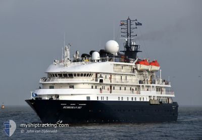
HEBRIDEAN SKY
Passengers Ship
Current Trip
| Time Travelled | 1 h, 50 mins |
|---|---|
| Remaining Time | --- |
| Distance Travelled | 12.45 nm |
| Remaining Distance | --- |
| AVG Speed | 8.2 Knots |
| MAX Speed | 8.6 Knots |
| AVG Wind | 18.1 knots |
| MAX Wind | 19.1 knots |
| MIN Temp | 12.9°C / 55.22°F |
| MAX Temp | 13.4°C / 56.12°F |
| Draught | 4.3 m |
| Position Received | 22 h, 0 m ago |
Current Position
| Longitude | -6.07731° |
|---|---|
| Latitude | 51.03383° |
| Status | Under way using engine |
| Speed | 8.4 Knots |
| Course | 9.3° |
| Area | Celtic Sea |
| Station | T-AIS |
| Position Received | 22 h, 0 m ago |
Info
Information
The current position of HEBRIDEAN SKY is in Celtic Sea with coordinates 51.03383° / -6.07731° as reported on 2024-05-27 21:29 by AIS to our vessel tracker app. The vessel's current speed is 8.4 Knots and is heading at the port of ISLES OF SCILLY. The estimated time of arrival as calculated by vessel tracking app is 2024-05-27 06:30 LT
The vessel HEBRIDEAN SKY (IMO: 8802882, MMSI: 311000253) is a Passengers Ship that was built in 1991 ( 33 years old ). It's sailing under the flag of [BS] Bahamas.
In this page you can find informations about the vessels current position, last detected port calls, and current voyage information. If the vessels is not in coverage by AIS you will find the latest position.
The current position of HEBRIDEAN SKY is detected by our AIS receivers and we are not responsible for the reliability of the data. The last position was recorded while the vessel was in Coverage by the Ais receivers of our vessel tracking app.
The current draught of HEBRIDEAN SKY as reported by AIS is 4.3 meters
Weather
| Temperature | 13°C / 55.4°F |
|---|---|
| Wind Speed | 19 knots |
| Direction | 241° WSW |
| Pressure | 1007.8 hPa |
| Humidity | 89.9 % |
| Cloud Coverage | --- |
Featured Company
Last Port Calls
| Port | Arrival | Departure | Time In Port |
|---|---|---|---|
| 2024-05-28 06:13 | 2024-05-28 17:40 | 11 h | |
| 2024-05-25 06:30 | 2024-05-25 17:17 | 10 h | |
| 2024-05-24 05:59 | 2024-05-24 13:12 | 7 h | |
| 2024-05-22 07:52 | 2024-05-22 18:33 | 10 h | |
| 2024-05-21 10:46 | 2024-05-21 22:14 | 11 h | |
| 2024-05-18 06:32 | 2024-05-18 12:42 | 6 h | |
| 2024-05-15 06:26 | 2024-05-15 20:14 | 13 h | |
| 2024-05-11 06:04 | 2024-05-11 18:13 | 12 h | |
| 2024-05-07 05:04 | 2024-05-07 16:33 | 11 h | |
| 2024-05-06 05:29 | 2024-05-06 16:10 | 10 h |
Most Visited Ports (Last year)
| Port | Arrivals | |
|---|---|---|
| 5 | ||
| 4 | ||
| 4 | ||
| 4 | ||
| 3 | ||
| 3 |
Last Trips
| Origin | Departure | Destination | Arrival | Distance | |
|---|---|---|---|---|---|
| 2024-05-25 18:17 | 2024-05-28 07:13 | 398.27 nm | |||
| 2024-05-24 14:12 | 2024-05-25 07:30 | 191.24 nm | |||
| 2024-05-22 19:33 | 2024-05-24 06:59 | 297.92 nm | |||
| 2024-05-21 23:14 | 2024-05-22 08:52 | 134.12 nm | |||
| 2024-05-18 13:42 | 2024-05-21 11:46 | 413.52 nm | |||
| 2024-05-15 21:14 | 2024-05-18 07:32 | 458.69 nm | |||
| 2024-05-11 19:13 | 2024-05-15 07:26 | 561.51 nm | |||
| 2024-05-07 18:33 | 2024-05-11 07:04 | 659.98 nm | |||
| 2024-05-06 18:10 | 2024-05-07 07:04 | 147.35 nm | |||
| 2024-05-05 19:17 | 2024-05-06 07:29 | 105.80 nm |
Events
| Time | Event | Details | Position / Dest | Info |
|---|---|---|---|---|
| 2024-05-28 17:47 | START Moving | 0.9 nm, North East of FISHGUARD |
52.01848 / -4.95844
GB ISC
|
Speed: 8.1 kn Course: 329° |
| 2024-05-28 17:40 | PORT DEPARTURE |
|
52.01848 / -4.95844
GB ISC
|
Speed: 0.6 kn Course: 206° |
| 2024-05-28 06:13 | PORT ARRIVAL |
|
52.01235 / -4.98443
[GB] FISHGUARD
|
Speed: 10.6 kn Course: 68° |
| 2024-05-27 21:35 | Status Changed | Default Under way using engine |
51.05093 / -6.07215
GB ISC
|
Speed: 8.4 kn Course: 9.3° |
| 2024-05-27 21:29 | OUT of Coverage |
51.03383 / -6.07731
Celtic Sea
|
Speed: 8.4 kn Course: 9.3° |
|
| 2024-05-27 21:28 | Status Changed | Under way using engine Default |
51.03293 / -6.07756
GB ISC
|
Speed: 11.3 kn Course: 11° |
| 2024-05-27 21:26 | Status Changed | Default Under way using engine |
51.02860 / -6.07918
GB ISC
|
Speed: 12.9 kn Course: 9.9° |
| 2024-05-27 21:09 | Status Changed | Under way using engine Default |
50.96719 / -6.09691
GB ISC
|
Speed: 12.7 kn Course: 11° |
| 2024-05-27 20:50 | Status Changed | Default Under way using engine |
50.90165 / -6.11841
GB ISC
|
Speed: 12.8 kn Course: 13.5° |
| 2024-05-27 20:11 | Status Changed | Under way using engine Default |
50.76694 / -6.17296
GB ISC
|
Speed: 12.8 kn Course: 15° |