
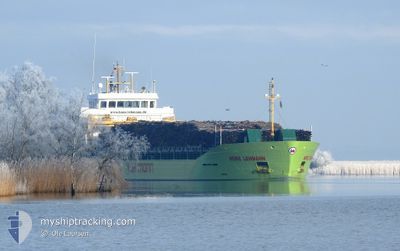
HEIKE LEHMANN
Cargo
Current Trip
| Time Travelled | 21 h, 39 mins |
|---|---|
| Remaining Time | 11 h, 28 mins |
| Distance Travelled | 231.89 nm |
| Remaining Distance | 123.14 nm |
| AVG Speed | 10.8 Knots |
| MAX Speed | 11.6 Knots |
| AVG Wind | 8.6 knots |
| MAX Wind | 15.5 knots |
| MIN Temp | 11°C / 51.8°F |
| MAX Temp | 20.6°C / 69.08°F |
| Draught | 5.7 m |
| Position Received | 1 m ago |
Current Position
| Longitude | 23.58212° |
|---|---|
| Latitude | 59.44085° |
| Status | Under way using engine |
| Speed | 10.7 Knots |
| Course | 64.3° |
| Area | Gulf of Finland |
| Station | T-AIS |
| Position Received | 1 m ago |
Info
Information
The current position of HEIKE LEHMANN is in Gulf of Finland with coordinates 59.44085° / 23.58212° as reported on 2024-06-01 04:11 by AIS to our vessel tracker app. The vessel's current speed is 10.7 Knots and is heading at the port of KOTKA. The estimated time of arrival as calculated by vessel tracking app is 2024-06-01 15:41 LT
The vessel HEIKE LEHMANN (IMO: 9805439, MMSI: 305050000) is a Cargo It's sailing under the flag of [AG] Antigua Barbuda.
In this page you can find informations about the vessels current position, last detected port calls, and current voyage information. If the vessels is not in coverage by AIS you will find the latest position.
The current position of HEIKE LEHMANN is detected by our AIS receivers and we are not responsible for the reliability of the data. The last position was recorded while the vessel was in Coverage by the Ais receivers of our vessel tracking app.
The current draught of HEIKE LEHMANN as reported by AIS is 5.7 meters
Weather
| Temperature | 11°C / 51.8°F |
|---|---|
| Wind Speed | 11 knots |
| Direction | 70° ENE |
| Pressure | 1014.7 hPa |
| Humidity | 96.2 % |
| Cloud Coverage | 28 % |
Featured Company
Last Port Calls
| Port | Arrival | Departure | Time In Port |
|---|---|---|---|
| 2024-05-30 01:02 | 2024-05-31 06:34 | 1 d | |
| 2024-05-28 17:09 | 2024-05-28 17:49 | 39 m | |
| 2024-05-25 14:16 | 2024-05-28 12:20 | 2 d | |
| 2024-05-25 09:02 | 2024-05-25 09:29 | 26 m | |
| 2024-05-18 11:28 | 2024-05-20 13:34 | 2 d | |
| 2024-05-18 00:04 | 2024-05-18 01:37 | 1 h | |
| 2024-05-16 12:54 | 2024-05-17 22:44 | 1 d | |
| 2024-05-16 09:39 | 2024-05-16 12:28 | 2 h | |
| 2024-05-14 18:35 | 2024-05-14 20:47 | 2 h | |
| 2024-05-11 09:16 | 2024-05-12 05:36 | 20 h |
Last Trips
| Origin | Departure | Destination | Arrival | Distance | |
|---|---|---|---|---|---|
| 2024-05-28 19:49 | 2024-05-30 04:02 | 270.00 nm | |||
| 2024-05-28 14:20 | 2024-05-28 19:09 | 48.71 nm | |||
| 2024-05-25 11:29 | 2024-05-25 16:16 | 48.45 nm | |||
| 2024-05-20 14:34 | 2024-05-25 11:02 | 903.22 nm | |||
| 2024-05-18 03:37 | 2024-05-18 12:28 | 110.04 nm | |||
| 2024-05-18 00:44 | 2024-05-18 02:04 | 6.02 nm | |||
| 2024-05-16 14:28 | 2024-05-16 14:54 | 2.47 nm | |||
| 2024-05-14 22:47 | 2024-05-16 11:39 | 349.48 nm | |||
| 2024-05-12 08:36 | 2024-05-14 20:35 | 604.87 nm | |||
| 2024-05-09 16:05 | 2024-05-11 12:16 | 463.71 nm |
Events
| Time | Event | Details | Position / Dest | Info |
|---|---|---|---|---|
| 2024-06-01 03:19 | Detected in Sea | Estonian part of the Gulf of Finland |
59.37232 / 23.31228
Gulf of Finland
KOTKA
|
Speed: 10.6 kn Course: 64.6° |
| 2024-06-01 02:40 | Draught Changed | 5.7 4.3 |
59.31916 / 23.10608
KOTKA
|
Speed: 10.5 kn Course: 63.2° |
| 2024-06-01 02:40 | Destination Changed | KOTKA RIGA |
59.31916 / 23.10608
KOTKA
|
Speed: 10.5 kn Course: 63.2° |
| 2024-06-01 02:40 | ETA Changed | 2024/06/01 16:00 2024/05/29 17:00 |
59.31916 / 23.10608
KOTKA
|
Speed: 10.5 kn Course: 63.2° |
| 2024-06-01 02:24 | Status Changed | Under way using engine Default |
59.30055 / 23.02979
RIGA
|
Speed: 10.4 kn Course: 63° |
| 2024-06-01 02:09 | Status Changed | Default Under way using engine |
59.28142 / 22.95418
RIGA
|
Speed: 10.5 kn Course: 62.6° |
| 2024-06-01 02:05 | Status Changed | Under way using engine Default |
59.27619 / 22.93388
RIGA
|
Speed: 10.6 kn Course: 64° |
| 2024-06-01 01:52 | IN Coverage |
59.27619 / 22.93388
Baltic Sea
|
Speed: 10.5 kn Course: 62.6° |
|
| 2024-06-01 00:33 | Status Changed | Default Under way using engine |
59.15471 / 22.46022
RIGA
|
Speed: 10.6 kn Course: 62.8° |
| 2024-06-01 00:23 | OUT of Coverage |
59.14225 / 22.41038
Baltic Sea
|
Speed: 10.6 kn Course: 62.8° |